In July 2020, five months into the coronavirus global pandemic, Dale and I packed up my car and set out on a 10-day cross country road trip to Seattle. We planned to do the trip as safely as possible, camping each night, cooking on our camp stove and sanitizing after every gas station stop. We’d never traveled together before, let alone during a time when most of the world was shutdown, so this was going to a huge test of our friendship.
Day 1: Wisconsin
We started Day 1 with unplanned matching outfits.
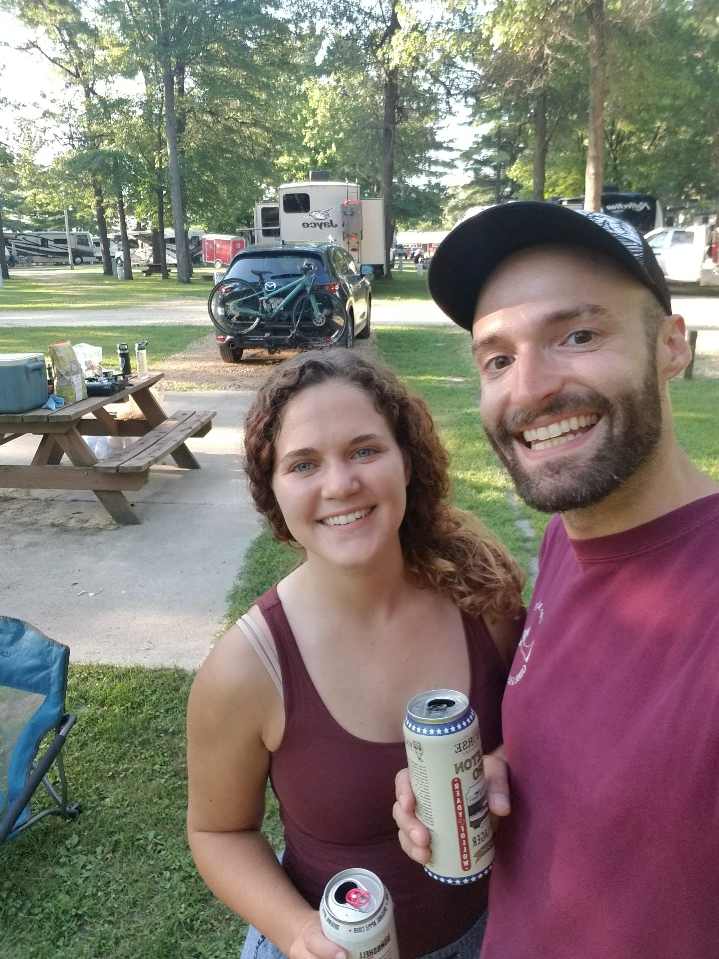
This was our longest driving day – nearly 13 hours of driving to get from New York to Wisconsin. Despite many podcast recommendations, we learned very quickly that I can’t handle educational podcasts while driving. So 13 hours of my “Roadtrip” playlist later (a playlist that only had about 5 hours of songs), we arrived at the Oakdale KOA Journey. Our first night wasn’t too eventful, we cooked veggie burgers, sat by a fire and began to figure out each other’s travel styles.
Days 2-4: North Dakota
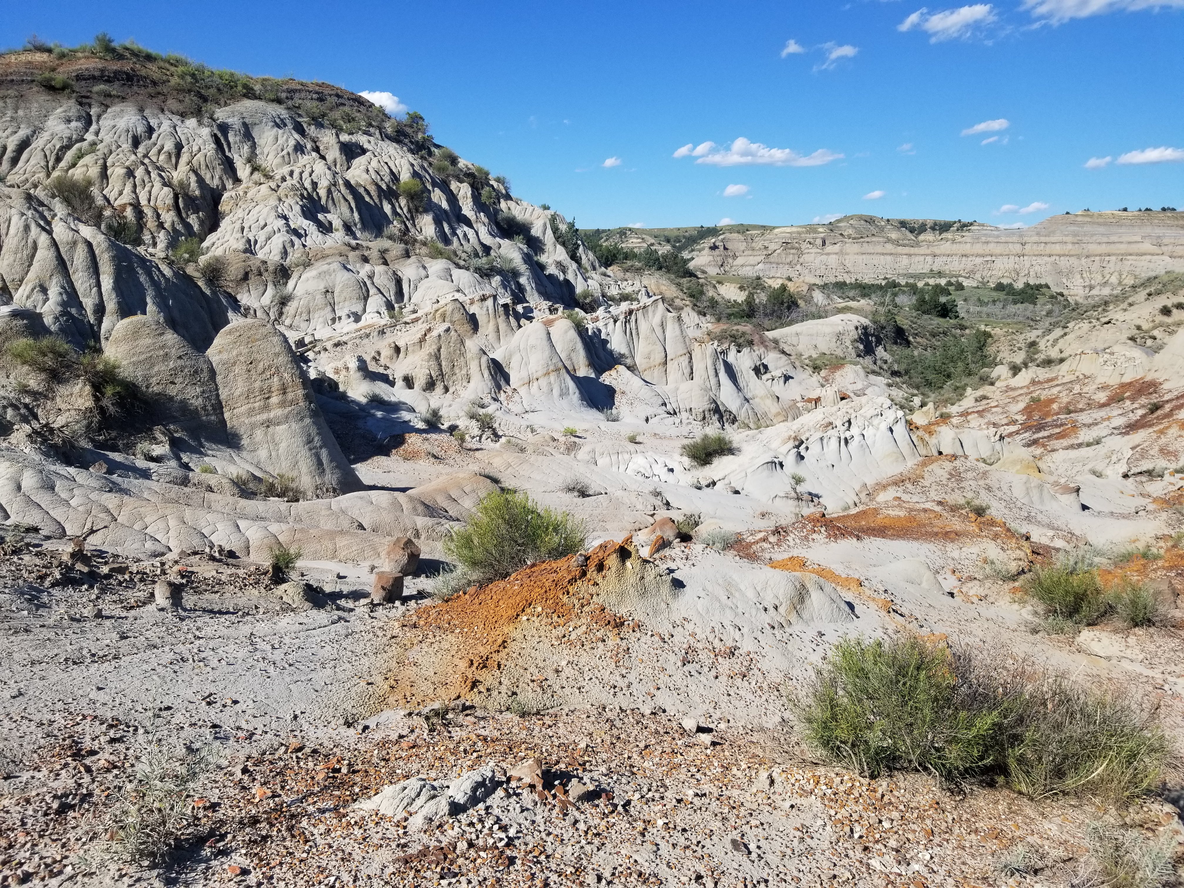
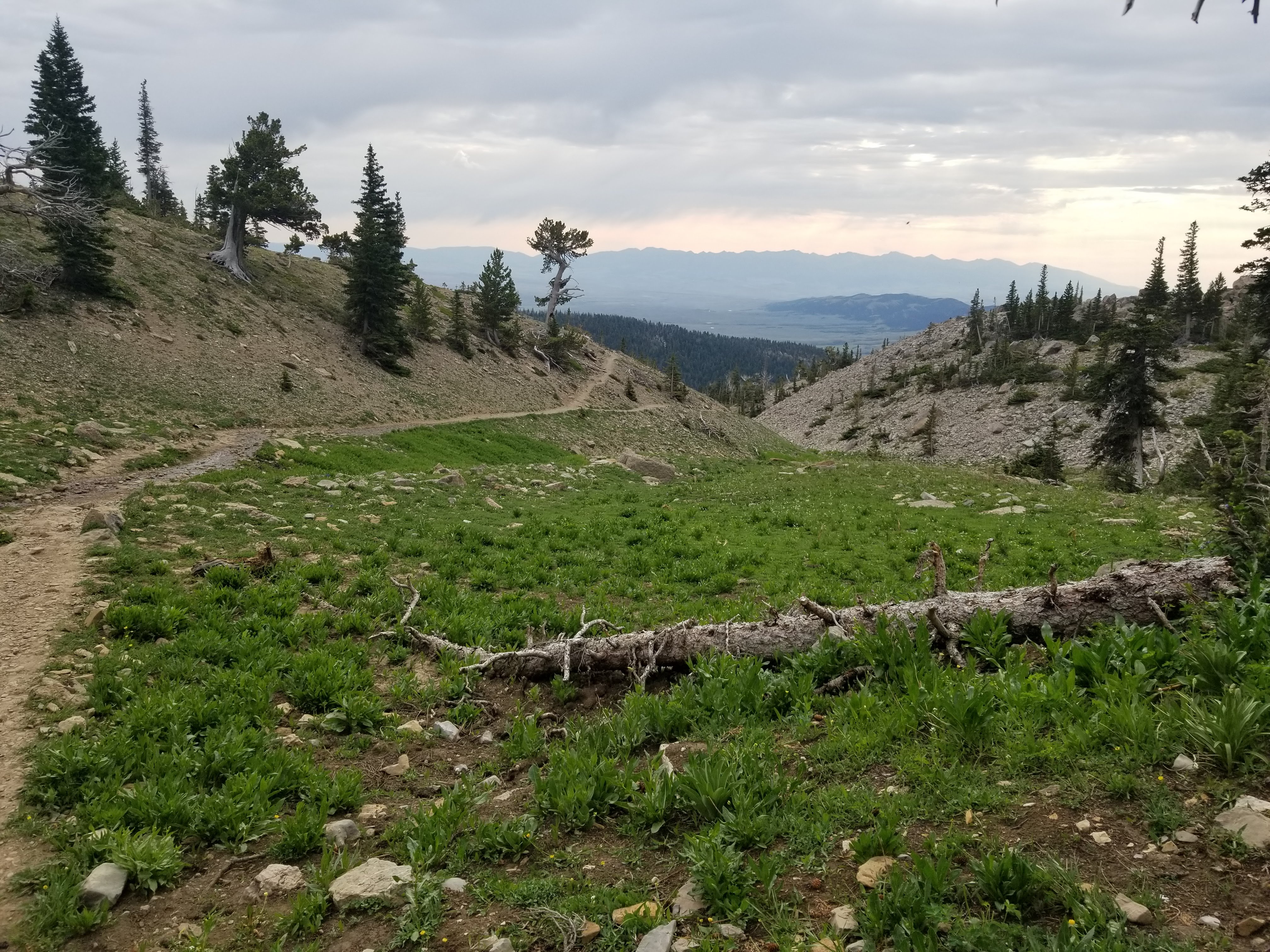
Day 2 began with another 11 hours of driving, but at the end of the day we arrived at one of the most unique places I’ve ever been, Theodore Roosevelt National Park. I learned about this park from a Reddit post and was excited to start our trip somewhere that both Dale and I had never seen, let alone heard of.
Most people go to the South Unit of the park, but I read about a hike in the North Unit. I had called the park rangers a few days before and was told about the Achenbach Loop trail. “There should be trail markers within sight of each other along the whole trail”, the ranger said, “but sometimes the bison knock them down. So be careful not to get lost.” Alright, fair warning.
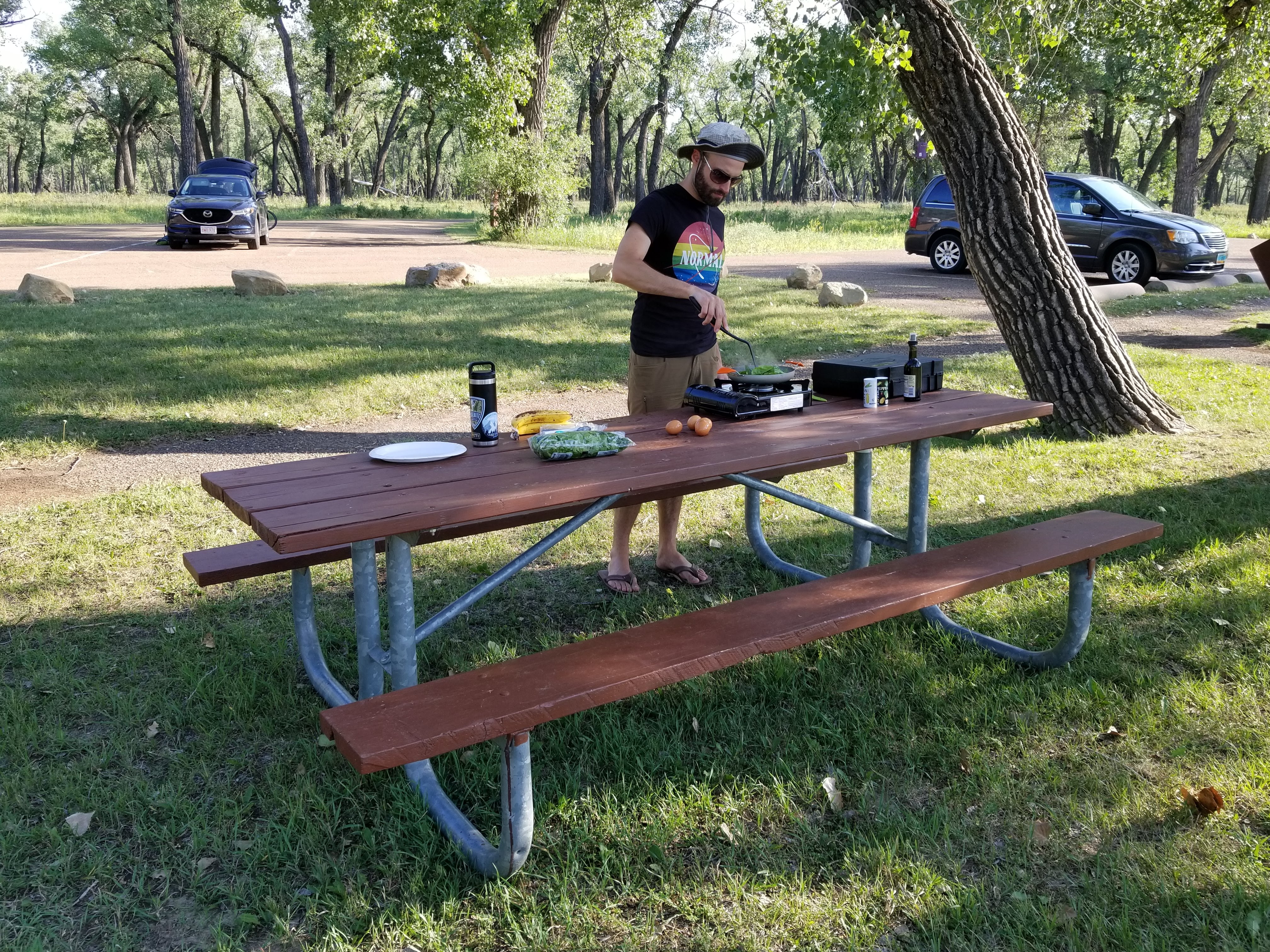
We arrived at the South Achenbach Trailhead around 7pm, but still had plenty of light. We cooked a quick dinner on a picnic table while enjoying our first views, packed our bags and began the trail.

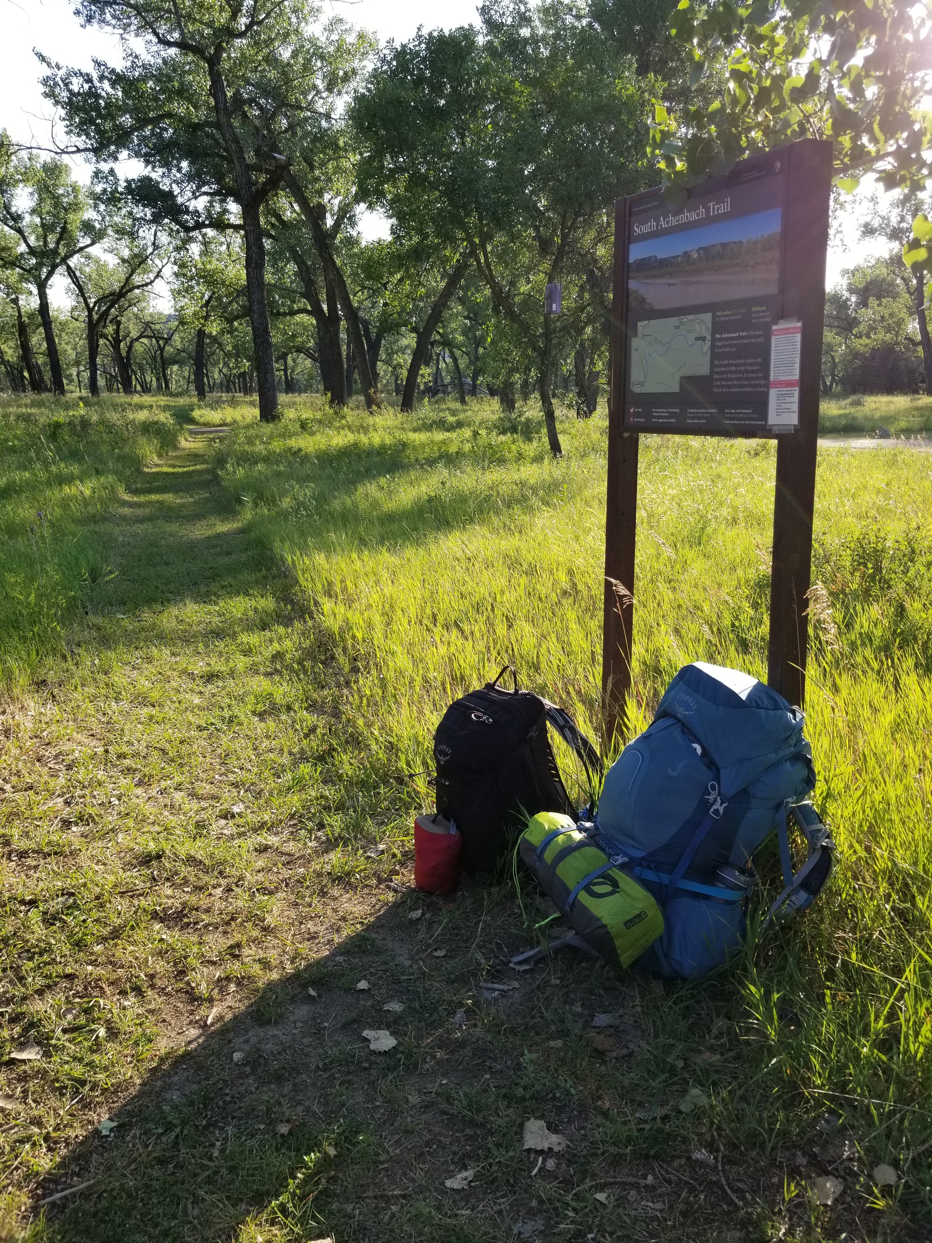
Within 400 yards we were lost.
Just a quarter-mile into the trail, we had our first river crossing. On the other side of the river there was… no trail. Fortunately, the Little Missouri River marks the edge of the Central and Mountain time zones, so while it was already getting close to 8pm, we still had plenty of daylight to figure out where to go.
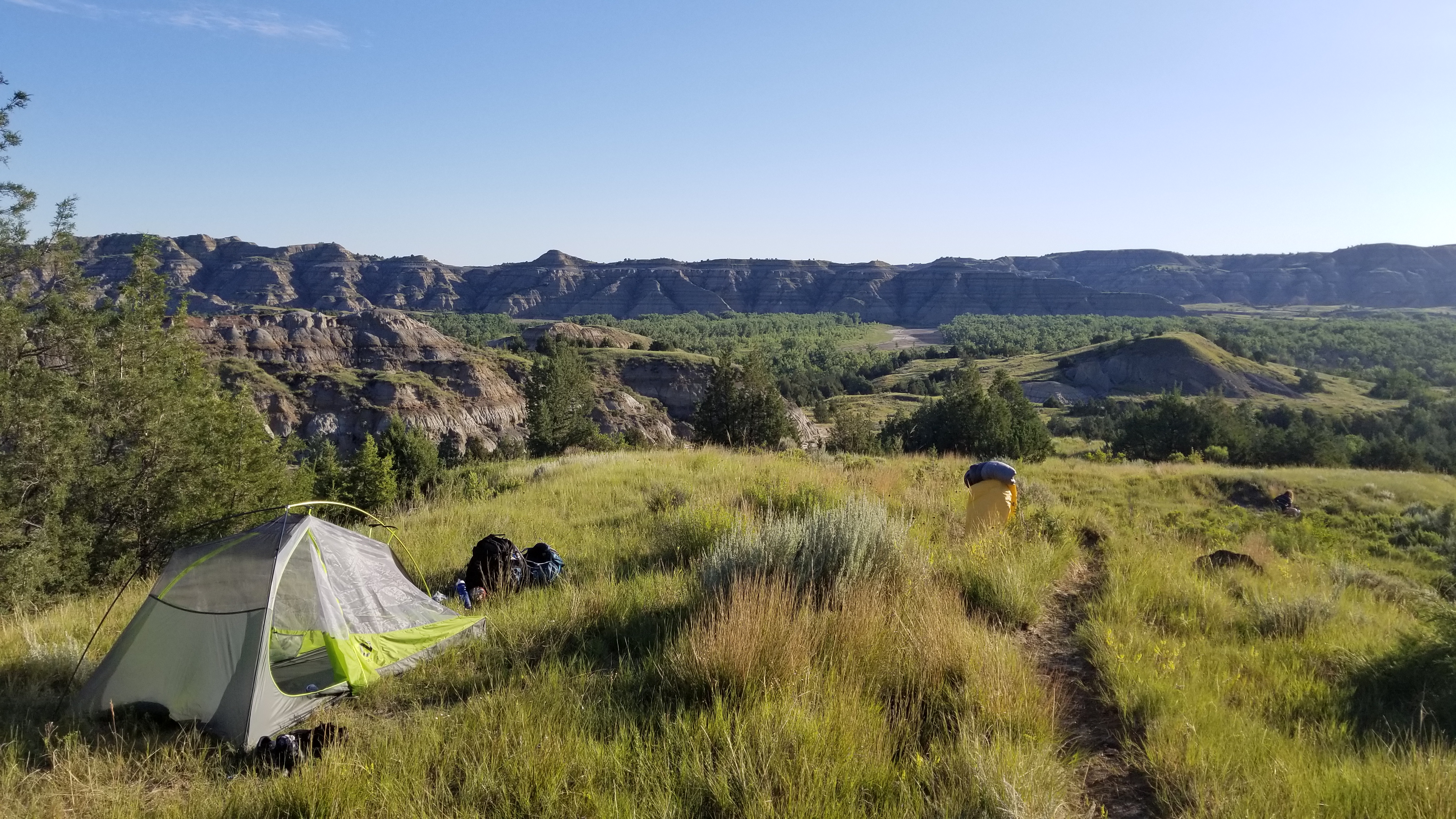
After about 20 minutes of us walking back and forth, trying to follow AllTrails, and retracing steps, Dale eventually found the trail. We only walked about a mile that night, but we were already seeing some amazing views. We set up camp on an exposed ridge and shared a dehydrated meal for dinner while watching a beautiful sunset.
We woke up the next day with minimal plan, but both excited to be on the trail. We packed up camp early and began climbing. We went up over a ridge, detoured slightly to see a “spring” that turned out to be a puddle, and arrived at the opposite ridge of the canyon.
The entire hike we tried to follow the wooden posts that served as trail markers, but just as the ranger had warned, several had been knocked down from bison. We had to retrace our steps more than a few times.
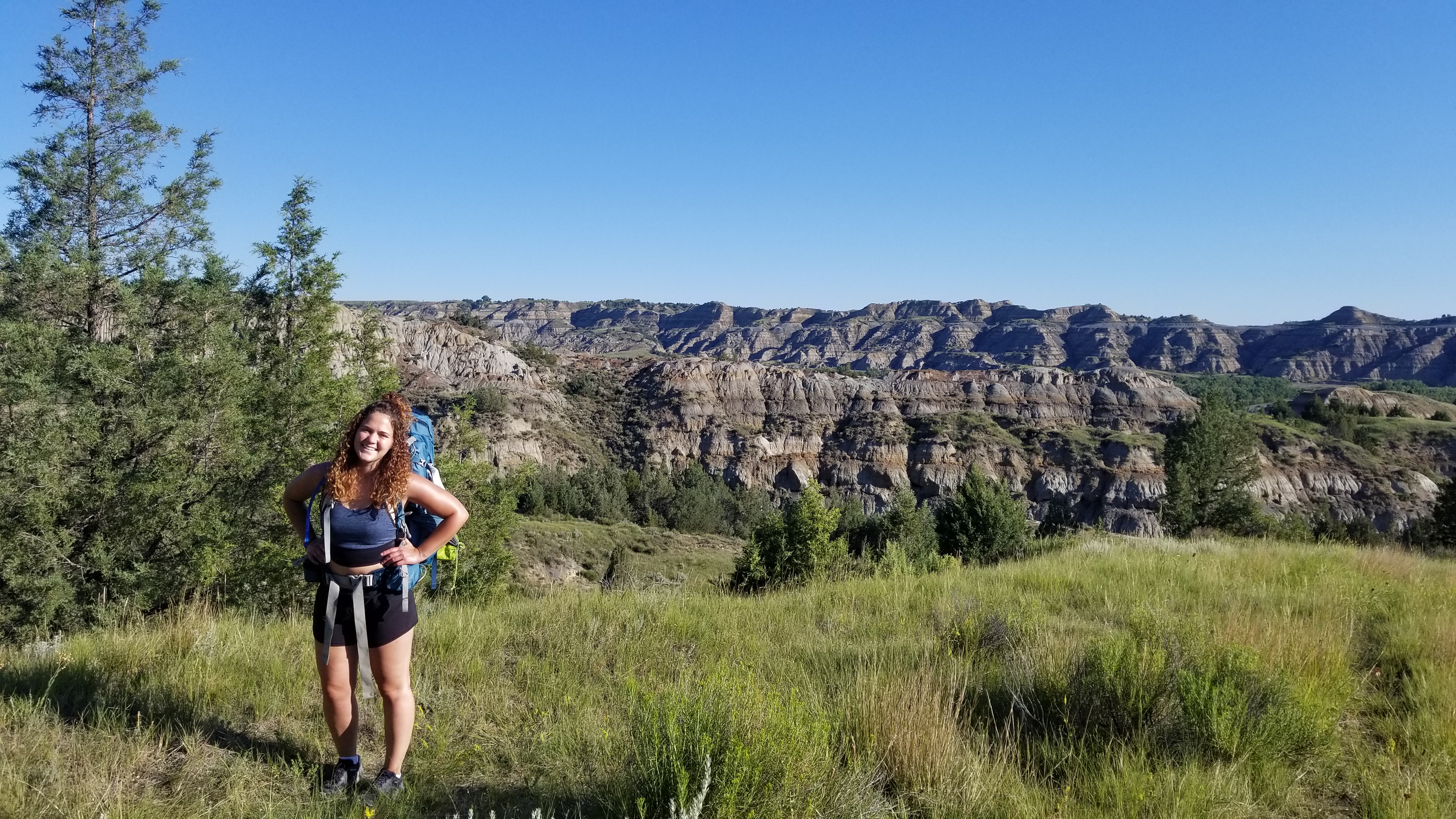
Dale and I covered a lot of topics during that 15-mile day, from childhood memories to undergraduate and graduate school events through to current day. It was fun to have so much uninterrupted time to talk, our only distraction being the beautiful views.
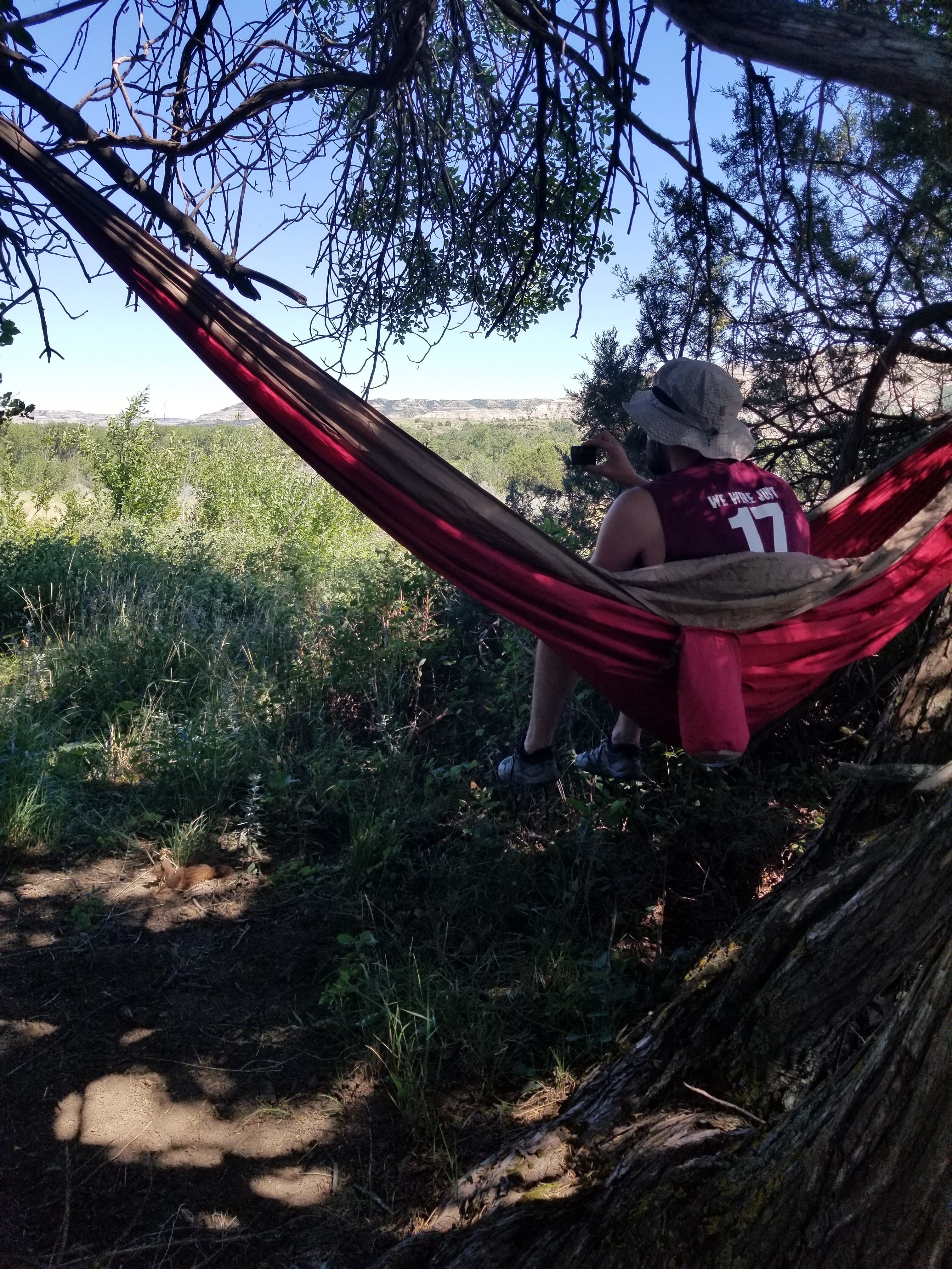
About 7 miles in, just past another river crossing, we found ourselves very lost. After not being able to find a trail marker for almost a mile, Dale said we should take a break and regroup. So we went into what was likely a bison’s home and hung our hammock for an hour. As soon as we packed back up, we were able to find the trail just a little ways away.
About that time, we started climbing to the top of the canyon ridge again. We had not seen a single person the entire day, but as soon we got to the top we realized there was a road at this end. There were a few tourists taking pictures, but these were the only people we saw the entire time on the trail. It was really special to have the entire trail to ourselves.
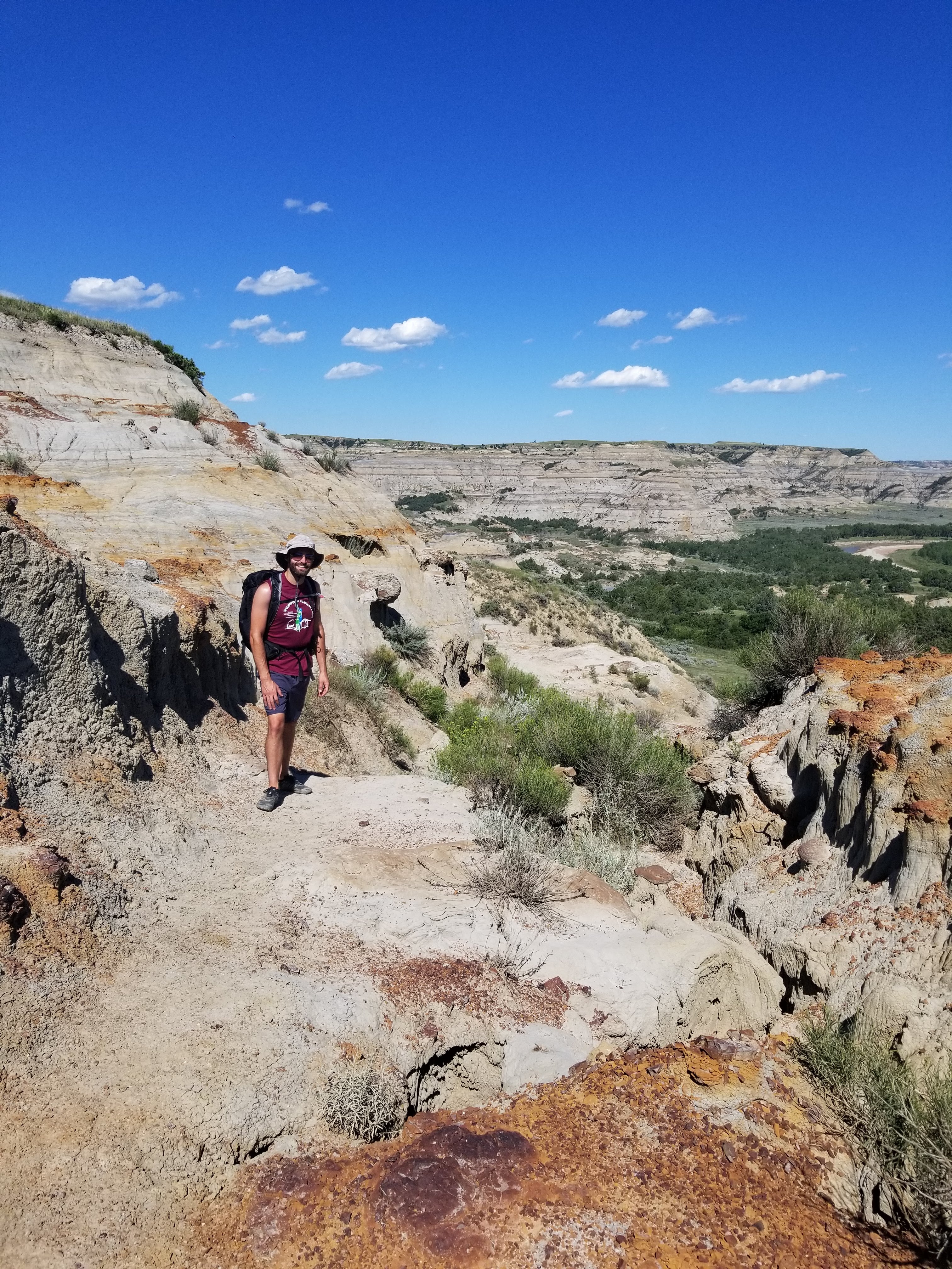
Over the course of the day, we saw such a diverse landscape. From grassy fields, to canyon overlooks, river crossings and sand-like structures that felt like we were on the moon, I was in awe of this place. By the time the evening was rolling around, I couldn’t believe we had hiked so far.
Around 8pm, we realized that we were only about 3 miles away from the car. The sun was starting to set and we had to find a spot to camp. We came out of the trees to find an open grassy field, but just as soon as we thought we found a nice camp spot, Dale turns around and sees our first bison just 200 yards away. We quickly decided we couldn’t setup camp here and kept moving.
Another half-mile later and we were starting to get desperate to find a spot. We finally found a mediocre spot, with some clear signs that bison had been there, but no bison around at the time. After setting up the tent, and with it starting to get dark, we began to cook dinner a few yards away from camp.
We brought our Jetboil, food and headlamps away from our tent and began to boil some water. We had just finished boiling two cups of water, when Dale looked up and saw a bison just 50 yards away staring right at us. We quickly packed our food back into the bear canister and hustled towards camp. With Dale keeping an eye on the bison, and me trying to figure out if I had the energy to run two miles back to the car if that’s what it came to, we circled around our camp watching the bison check out our things. Within a few minutes, the bison had moved on.
Thankfully, our food was left untouched, and Dale and I ate dinner sitting back-to-back that night.
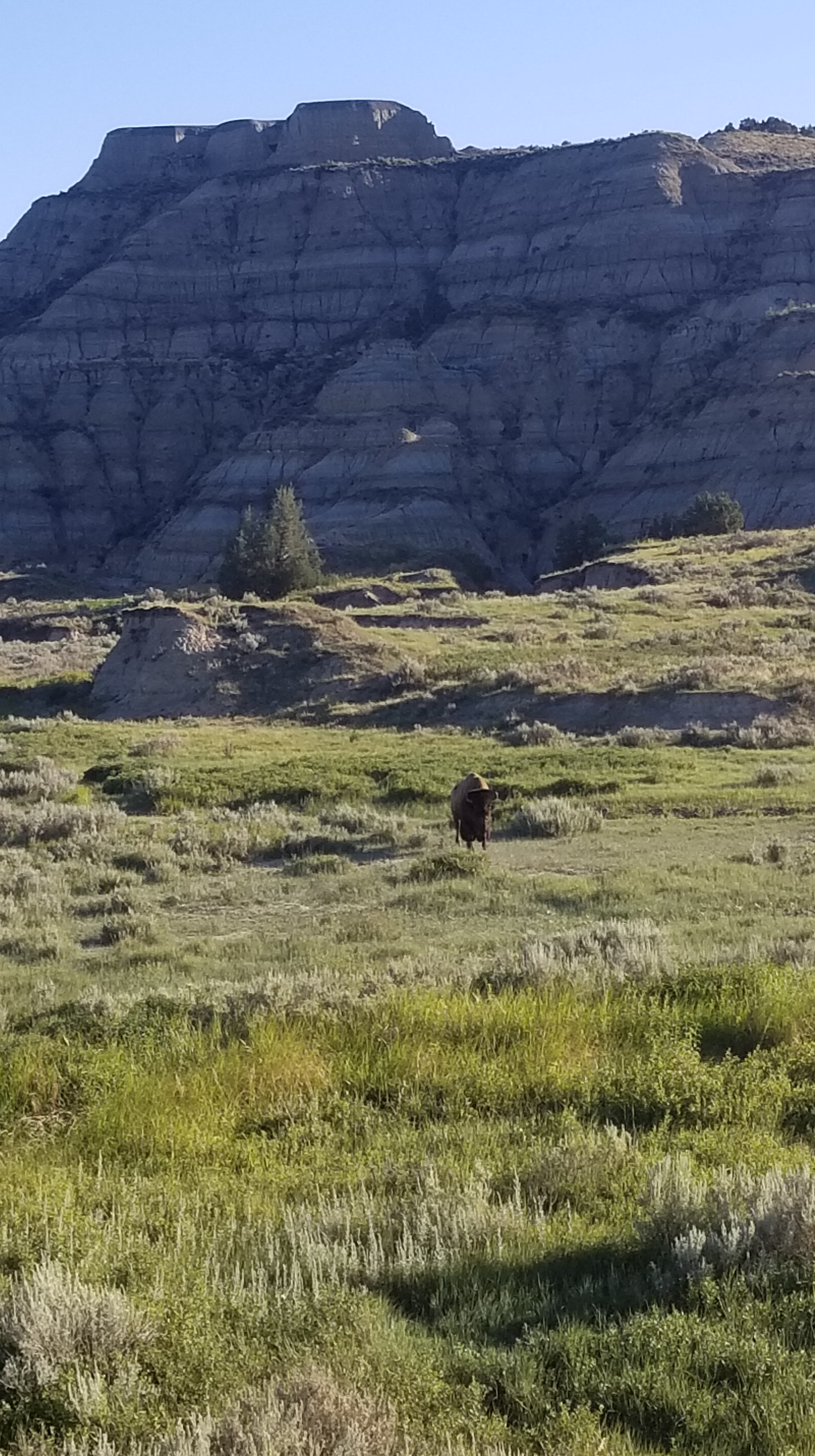
When packing up the next morning, we again saw a few bison grazing near our camp so Dale went to higher ground to take a few pictures. As he panned his GoPro over the area, there in the corner you can see a bison sneaking up on me and me running away as soon as I realized. I took that as a sign that it was time to hustle it back to the car.
This trail was challenging for many reasons: unclear trail markers, lots of miles, the potential for bison and hiking with someone I was just getting to know. Regardless, we tackled each obstacle together and were ready for the next part of our journey.
Days 4-6: Montana
Driving into Montana we were met with captivating views of the Bridger Mountain Range. The mountains seemed to rise out of nowhere on the horizon and kept getting bigger and bigger as we got closer.
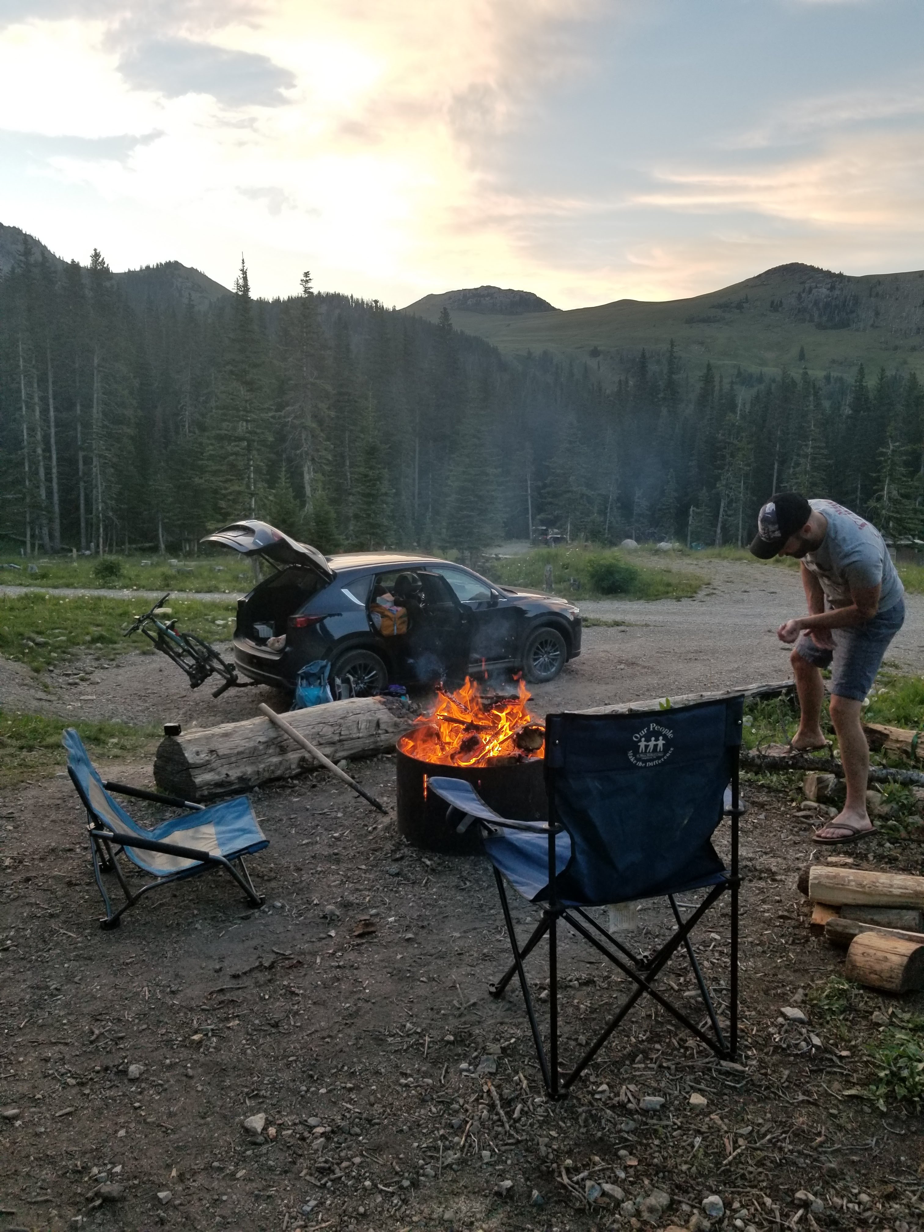
I had found a small, primitive campground located at an elevation of 7,500 feet at the base of Sacagawea Peak. It was a first-come, first-served campground, and we didn’t arrive at the base of the mountain until mid-afternoon. As we began driving the 7-mile ascent on the gnarliest dirt road, I began to get nervous that we were too late and started sorting through backup options in my head.
To our relief, there were plenty of sites still available, and we set up camp at a fairly secluded site, having 360 views of the mountains around us. The campground, Fairy Lake Campground, was adjacent to a beautiful alpine lake. That night, we walked down to the water and circled the lake before coming back to camp to make dinner.

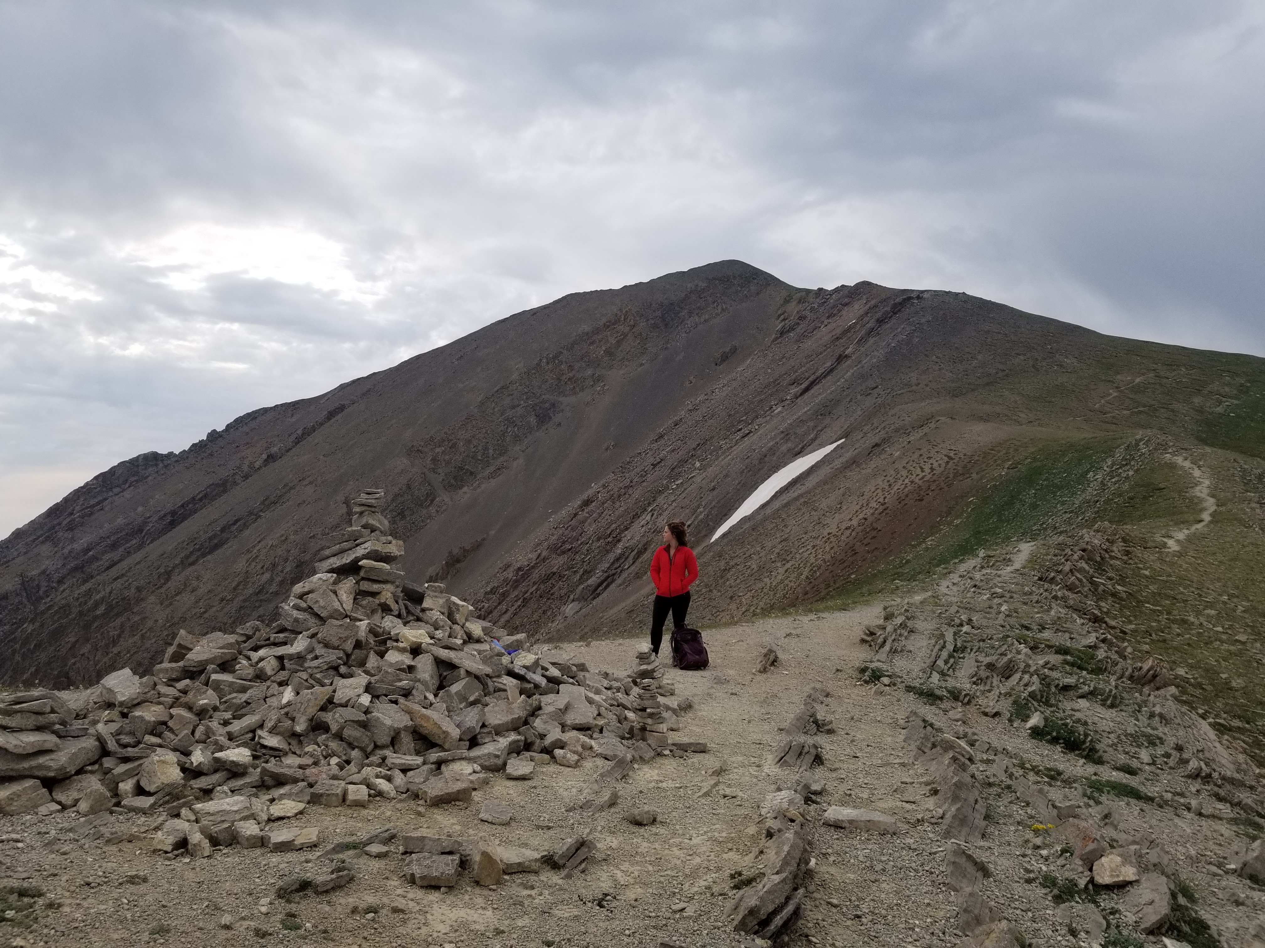
The next morning, we got up early to hike Sacagawea Peak. Rain was in the forecast in the afternoon and we had about 5 miles and 2,000 feet of elevation to climb. I made Dale carry the backpack the whole time.
The hike was filled with wildflowers, jagged rock faces and even snow. We emerged above the tree line about a mile in and had awesome views of the nearby mountains and valleys.
By the time we reached the top, we had the whole summit to ourselves, offering views of the entire ridgeline. The mountains dropped off on both sides into steep valleys below. I remember thinking this is the first time I’d seen mountains like that. It was so unlike the vast Adirondack or White Mountain Ranges.
One of the most memorable parts of the hike was running down the mountain. It was fun that Dale and I had similar hiking styles, and we both knew when it was okay to push each other on the uphill and when it was okay to run on the downhill.
By the time we got back to the campsite, the skies had greyed and the wind had picked up. We hung a hammock near the lake and made dehydrated meals while taking in the still beautiful views.
Day 7-9: Idaho
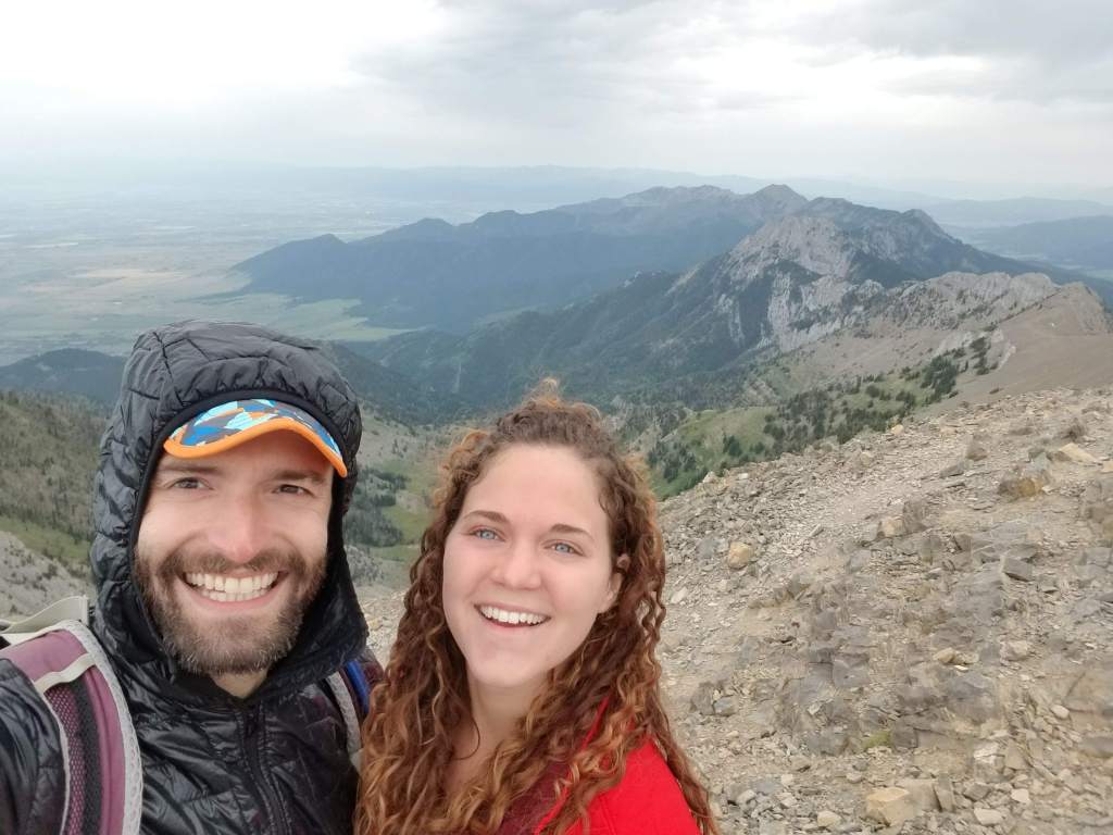
The drive into Idaho was our favorite leg of the trip. The Salmon River Scenic Byway was unlike anything we’d ever seen before and seemed to satisfy both my desire to be near mountains and Dale’s desire to be near water. We passed by million dollar cabins and began scheming about if we could afford anything.
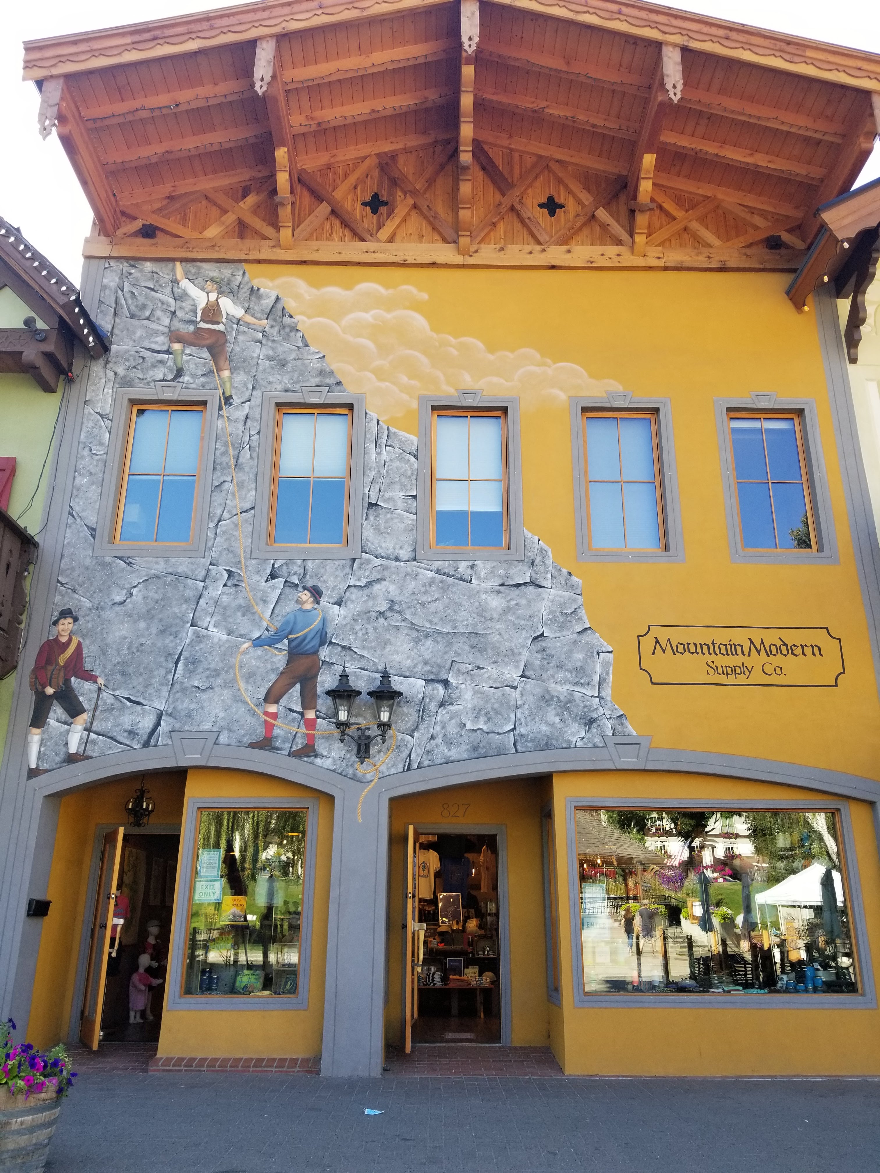
I had heard about Stanley and the Sawtooth Mountains from my sister, just a week before starting the trip. I did minimal research and had planned a day hike for Dale and I, thinking we would keep moving onto Oregon pretty quickly. But as soon as we got to our cabin in Stanley, we knew this was a pretty special place that we should spend more time in.
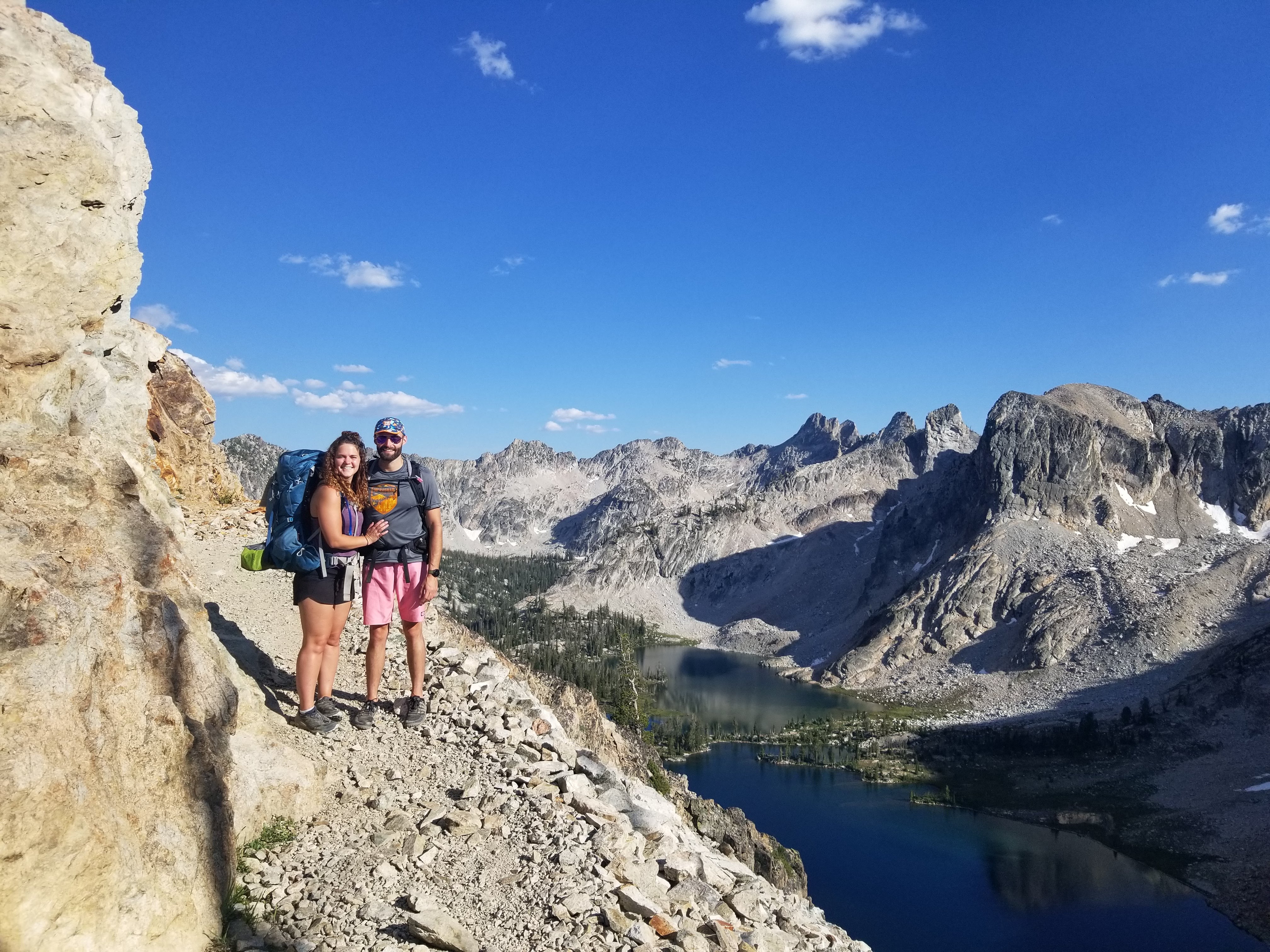
Dale befriended our neighbor, Tara, and she recommended the Alice and Toxaway Lake loop trail. It was 18 miles with about 3,000 feet of elevation and we figured we could do it in two days, spending one night in the backcountry. It was nice to be able to modify our plans to accommodate new adventures.
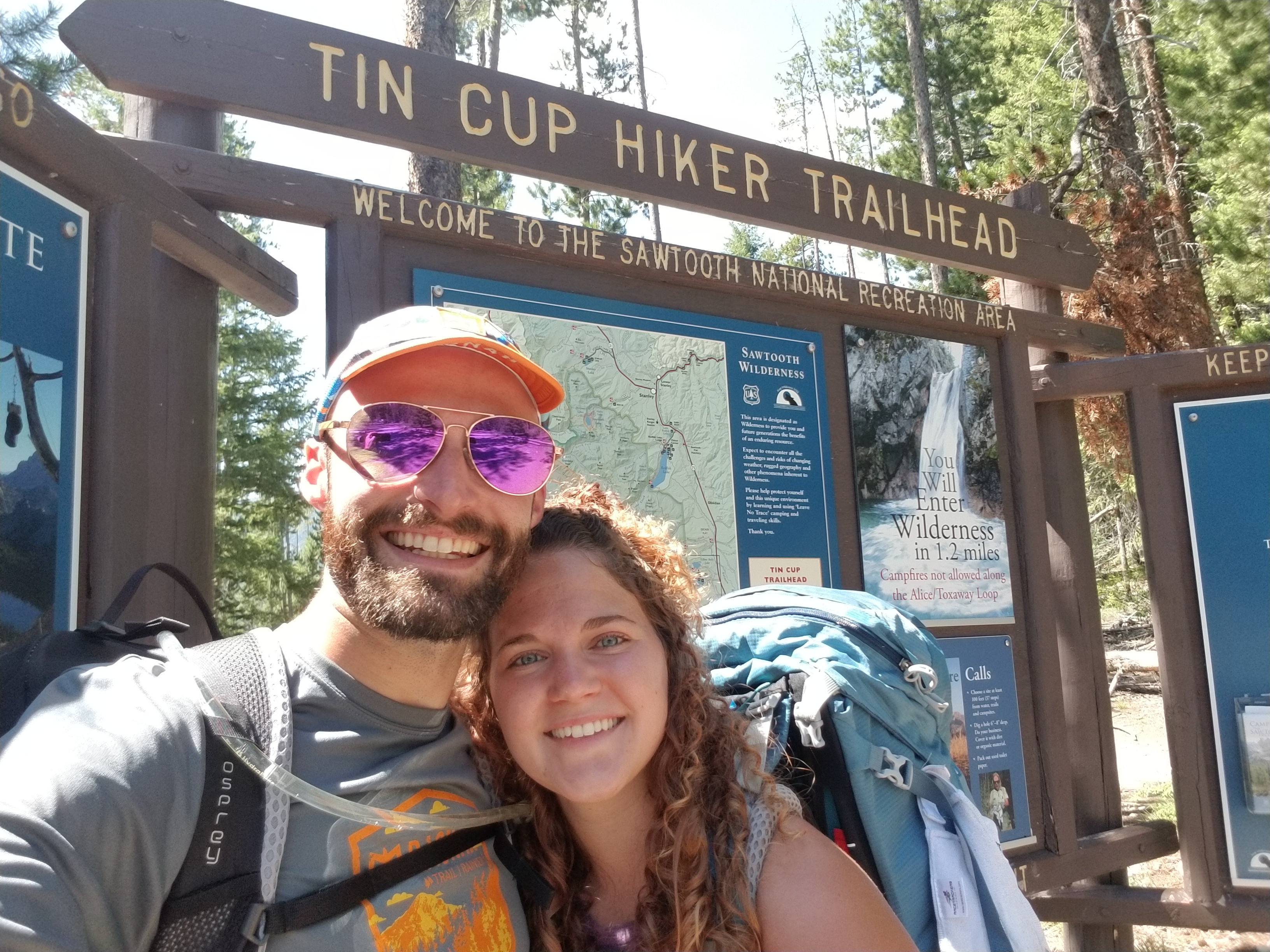
The next morning we woke up early to find a camp spot at Pettit Lake campground, located right at the trailhead. The plan was to spend one night on the trail and then spend one night at the campground before heading to Washington. Although it’s an extremely popular campground, we managed to snag the last first-come, first-serve spot. Another success of the trip.
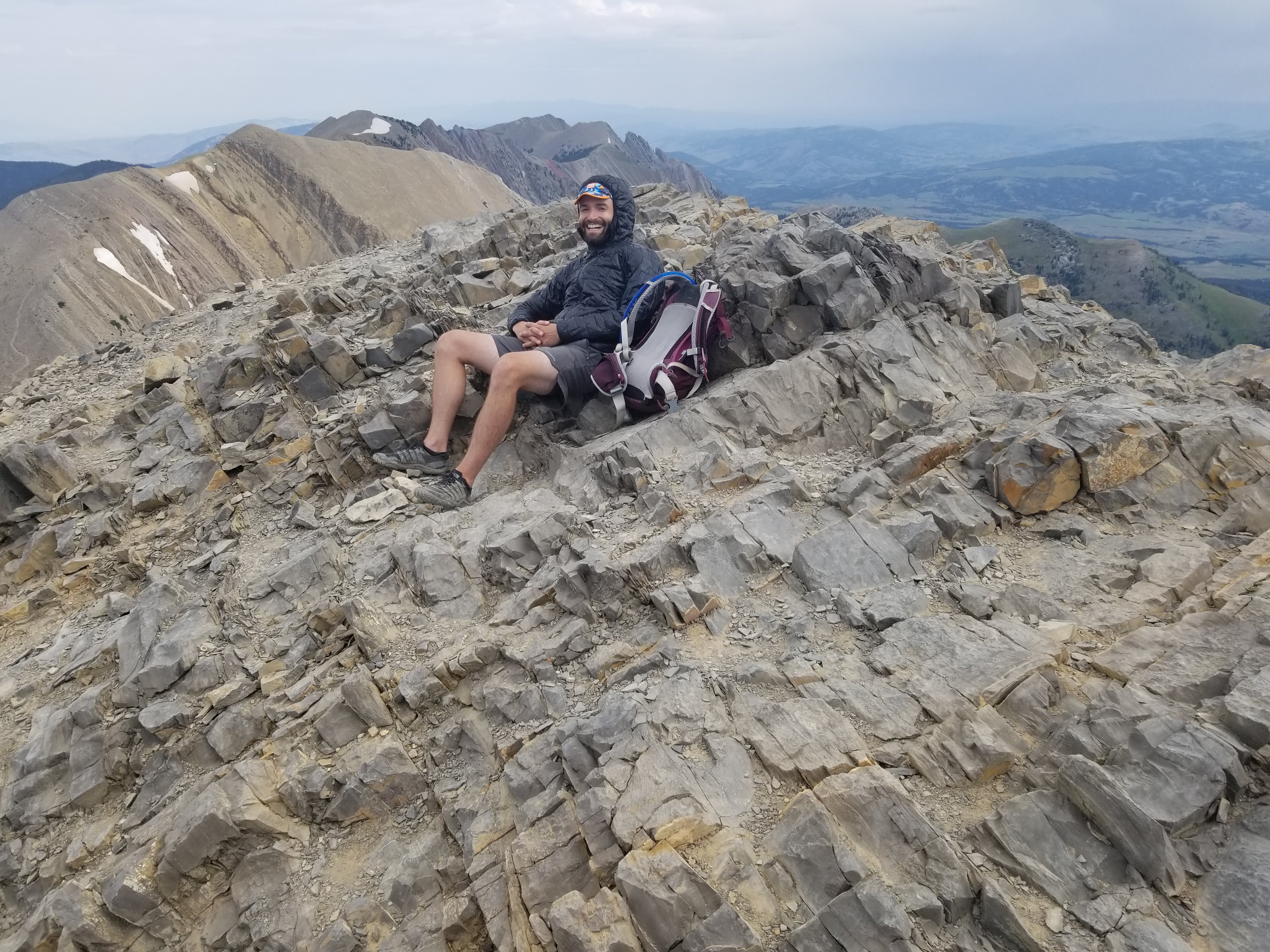
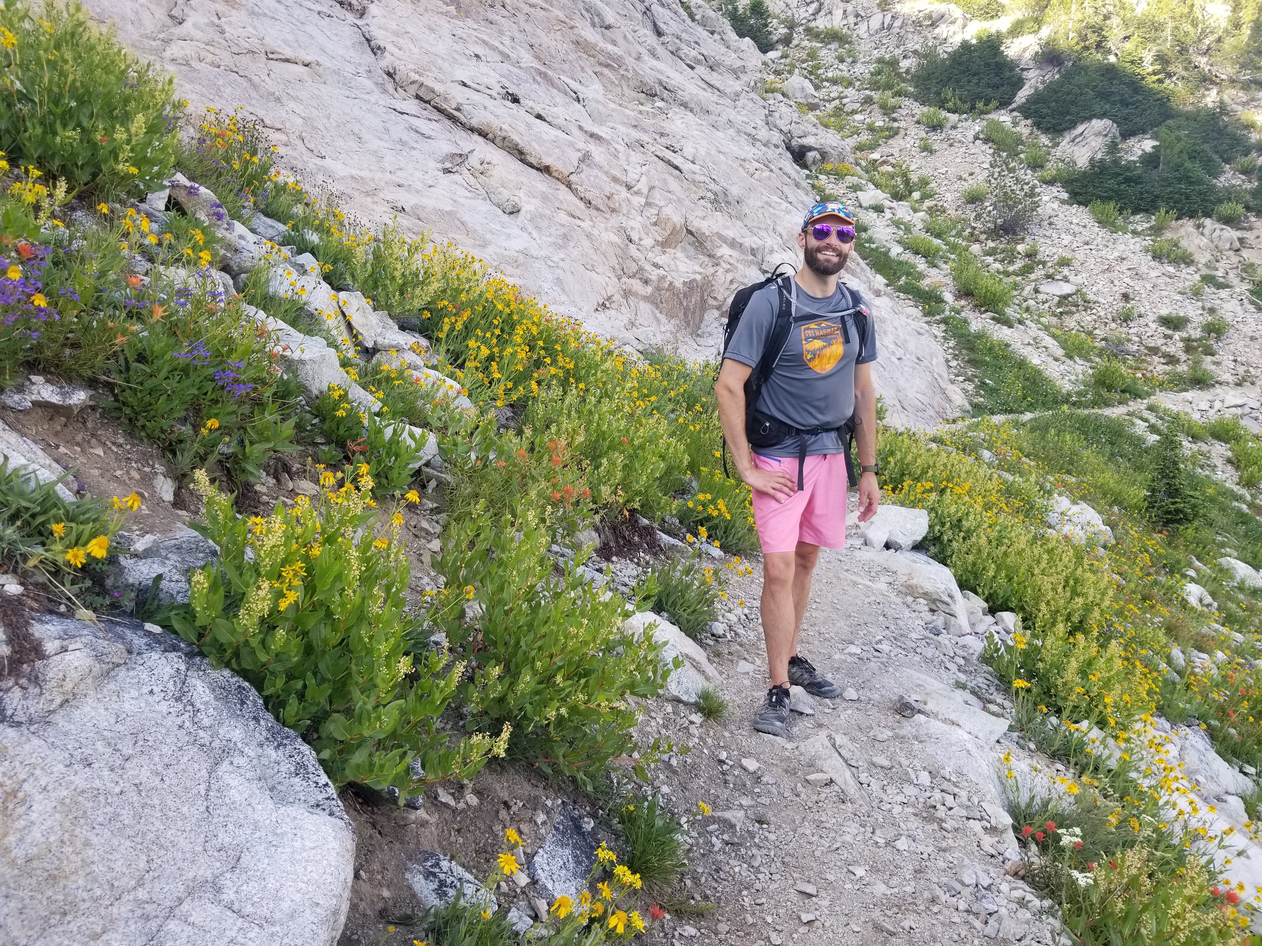
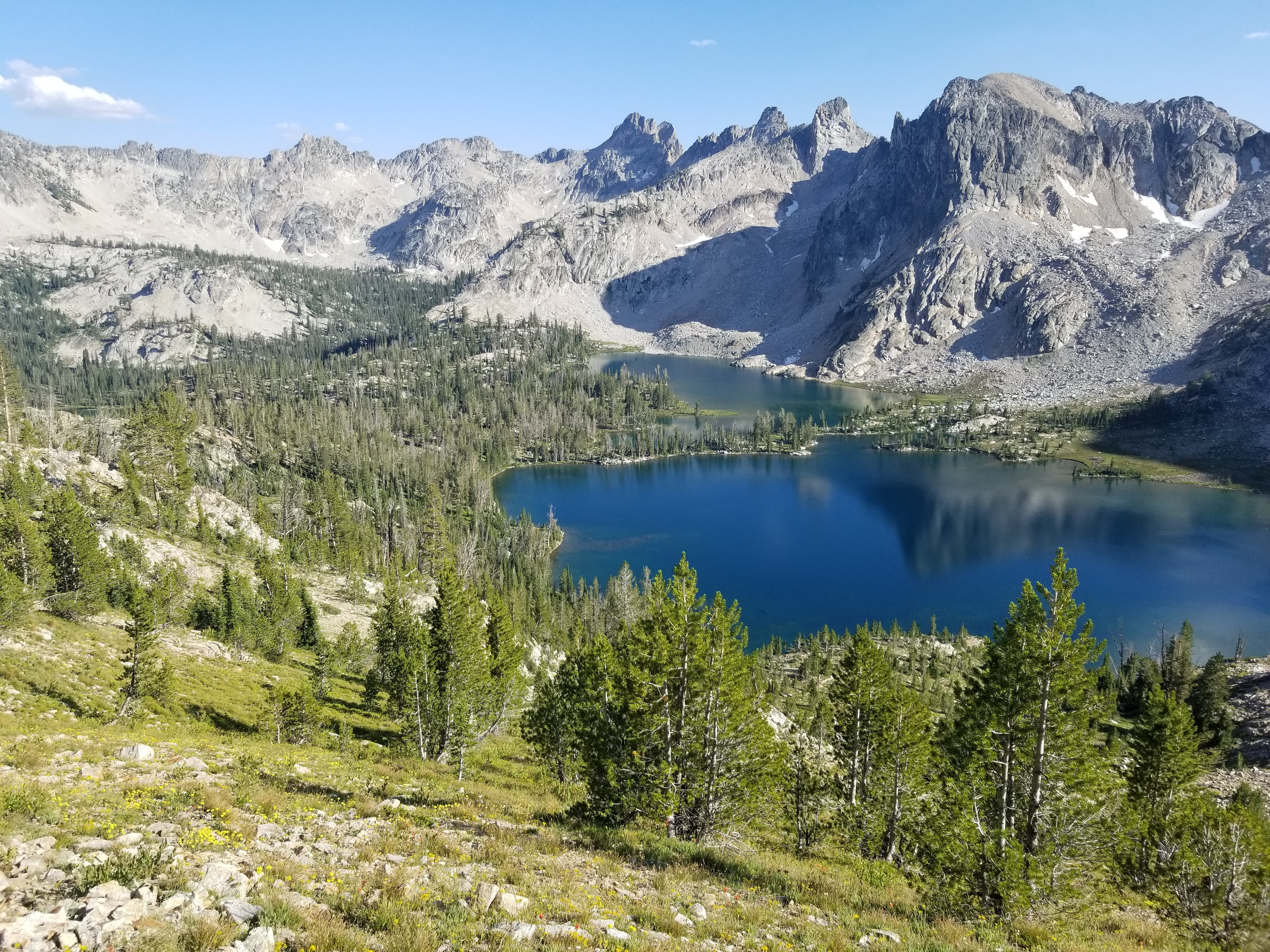
With our campsite secured, we started on the trail. We had done minimal research on this trail so neither of us were sure what to expect, but within two miles we were both thinking that we had made the right decision. After a short while in the forest, we emerged into a valley with breathtaking views in all directions. We continued climbing higher and deeper in the valley until we reached Alice Lake, an alpine lake located at 8,600 feet. We both changed into our bathing suits and took a very quick dip in the freezing lake before enjoying the afternoon in a hammock. The views of the surrounding mountains looked fake.

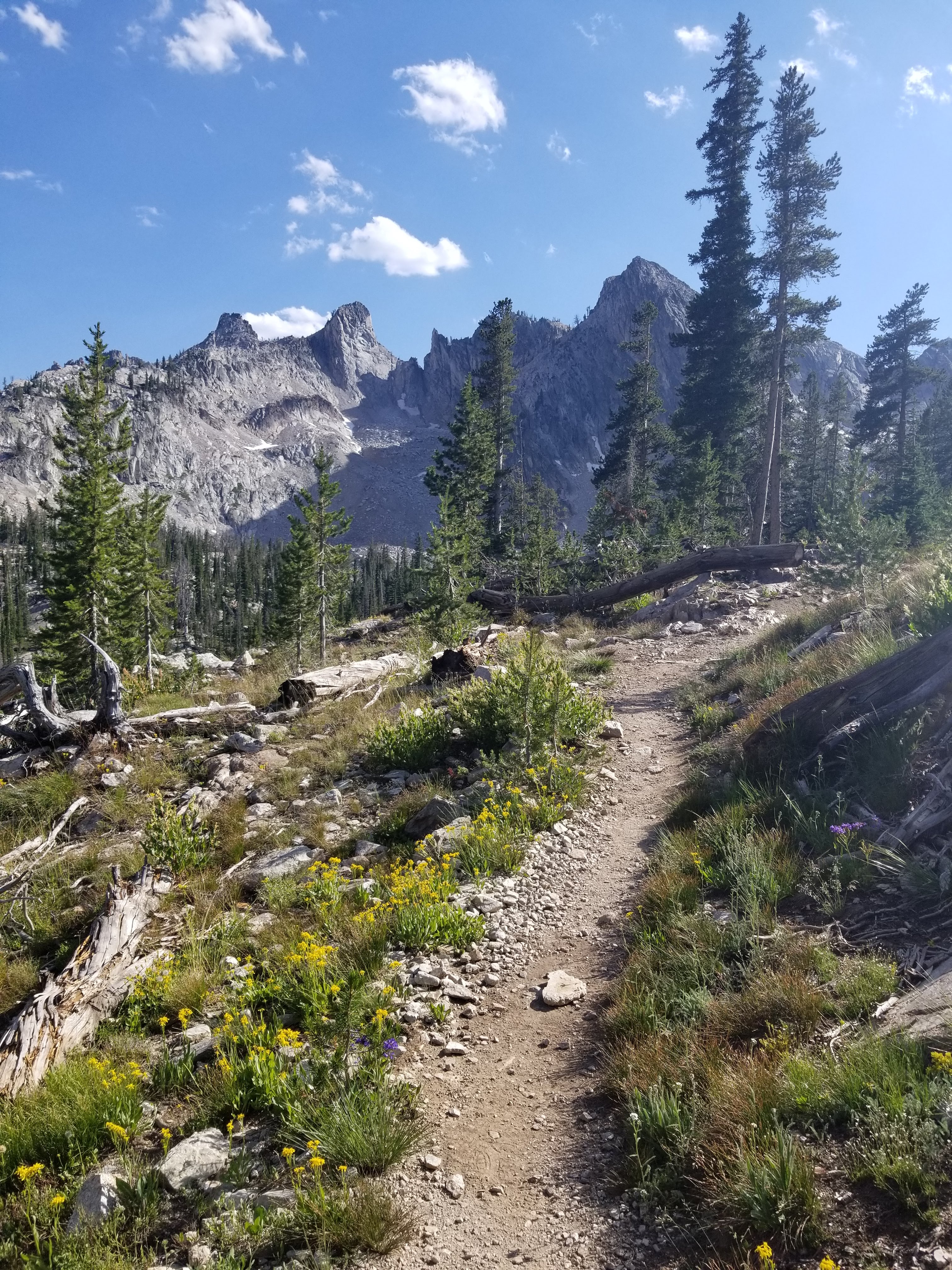
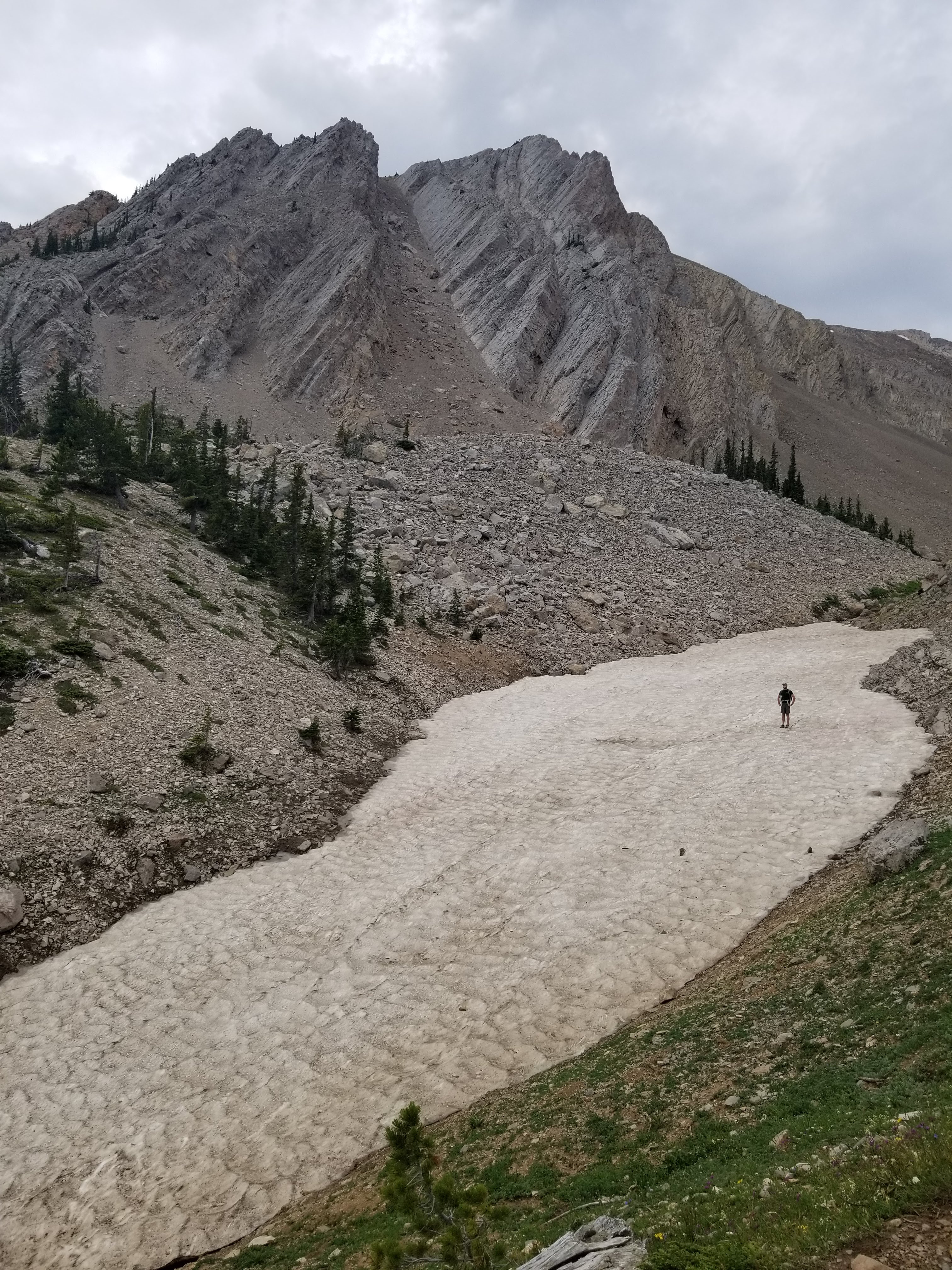
By midafternoon, we decided to continue on to Toxaway Lake where we would set up camp. But first we had to climb another 1,000 feet of elevation to get to the high point of the trail.
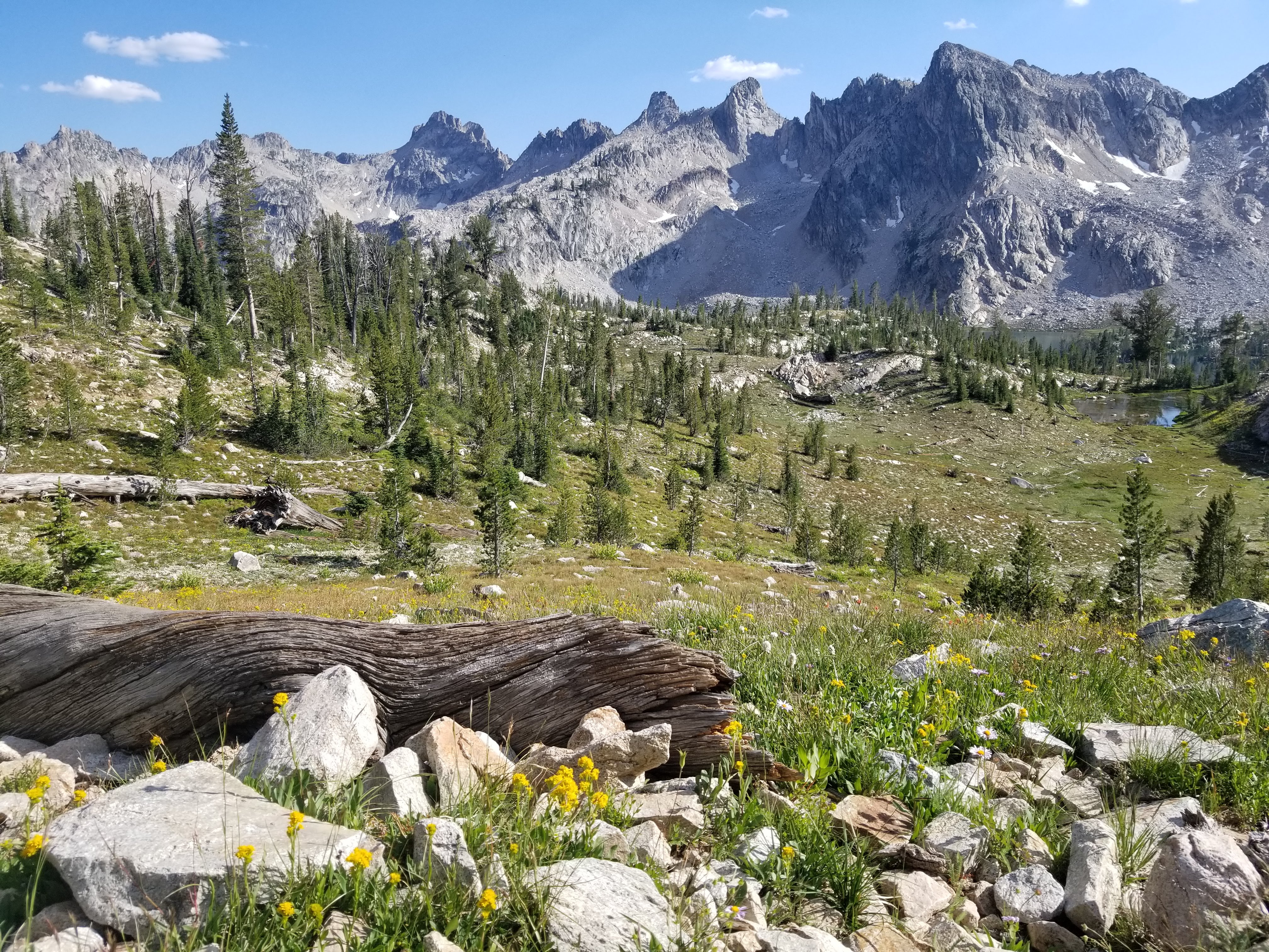
At 9,500 feet we found a small patch of snow and a beautiful view of Twin Lakes with wildflowers in the foreground.
We continued the hike to Toxaway Lake and found a secluded spot to setup camp. Unfortunately the bugs were out to get us that night, but we were still able to capture a sunset on the GoPro and enjoy the night in the tent.
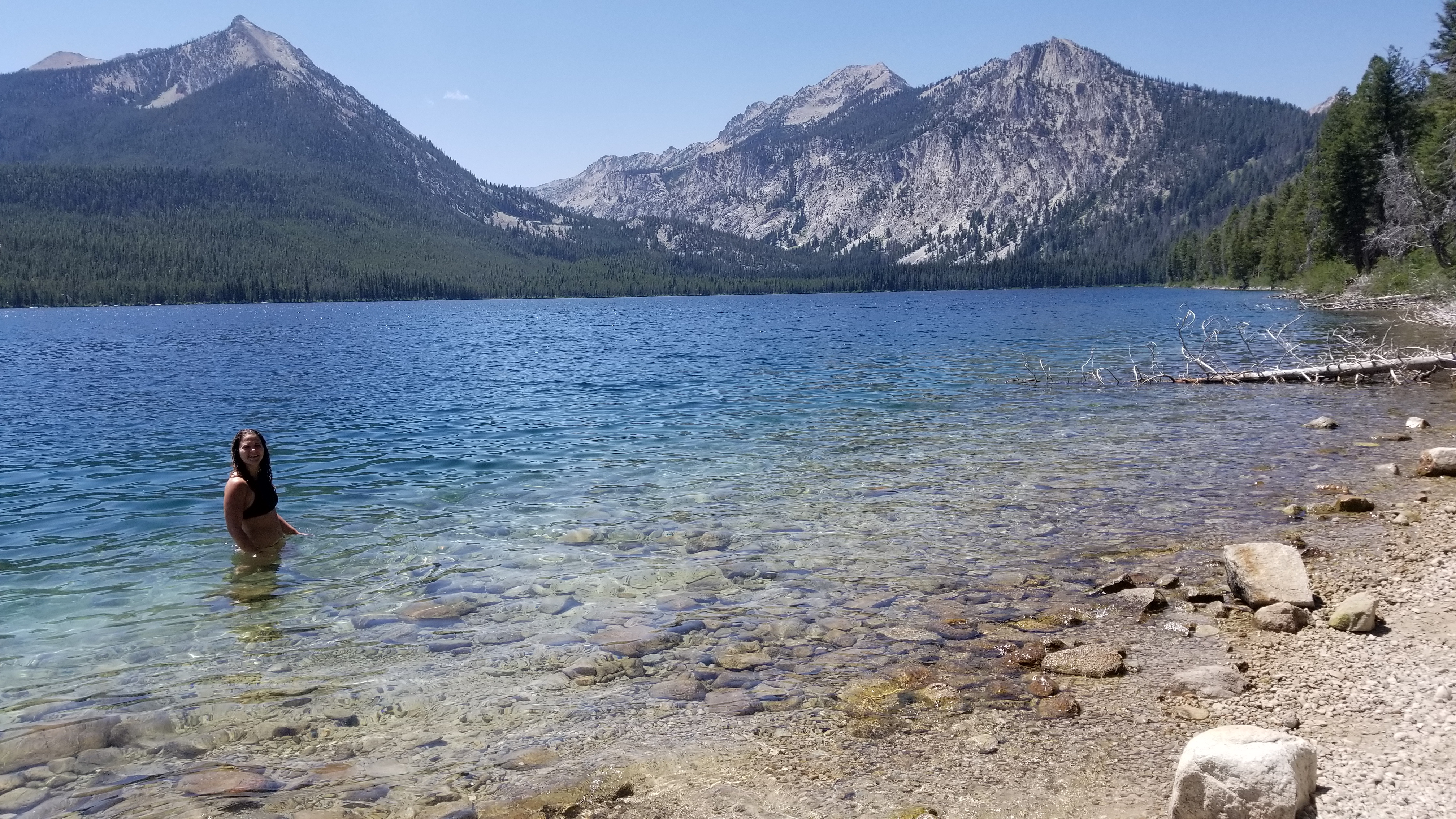
The next morning we finished the last 6 miles pretty quickly. Both exhausted, we were happy to have a campsite already reserved just steps from the trailhead. Even better, Pettit Lake was beautiful and slightly warmer than Alice Lake, warm enough for me to take a quick dip to wash off. We napped, made dinner and took tequila shots at night.
Days 10-11: Washington
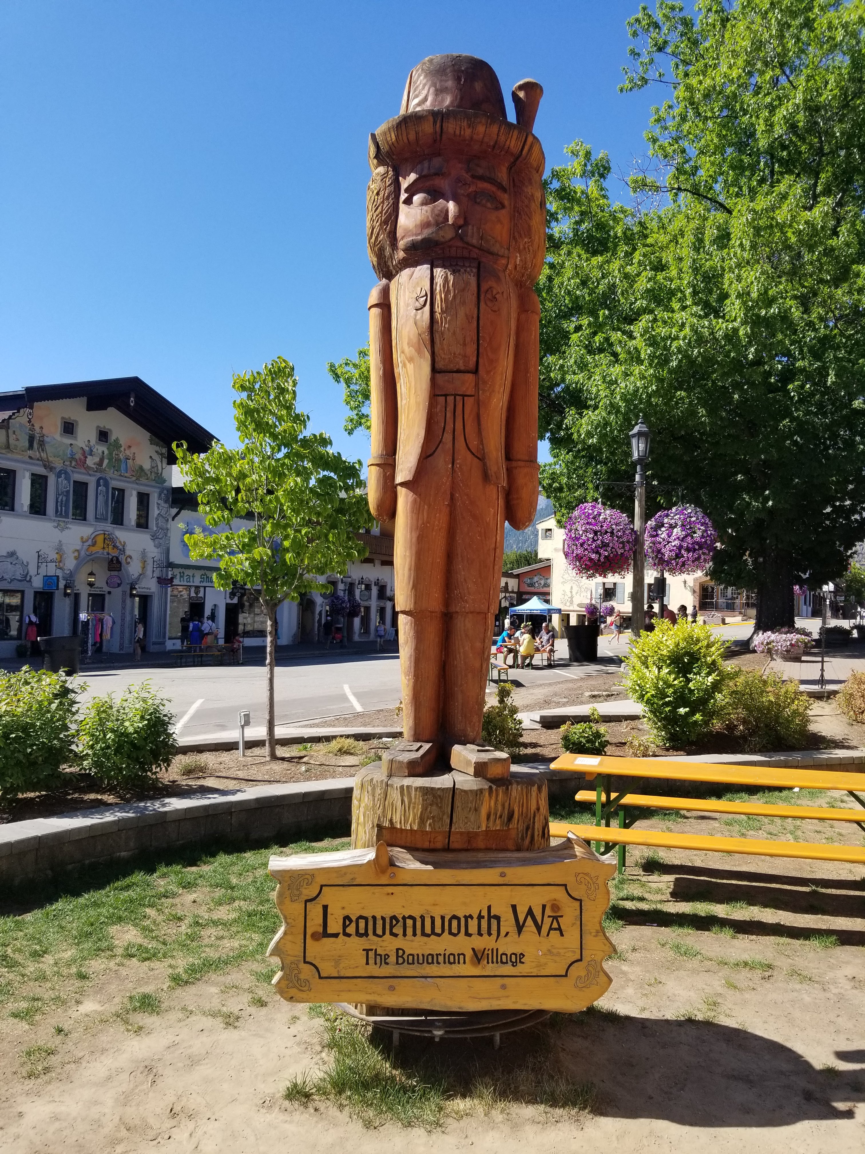
Idaho marked the end of the trip for just Dale and I. We had one more night scheduled in Leavenworth, WA, but we were meeting up with my sister. While our night in the Leavenworth KOA was fun, it was bittersweet to know that our time road tripping together was coming to an end.
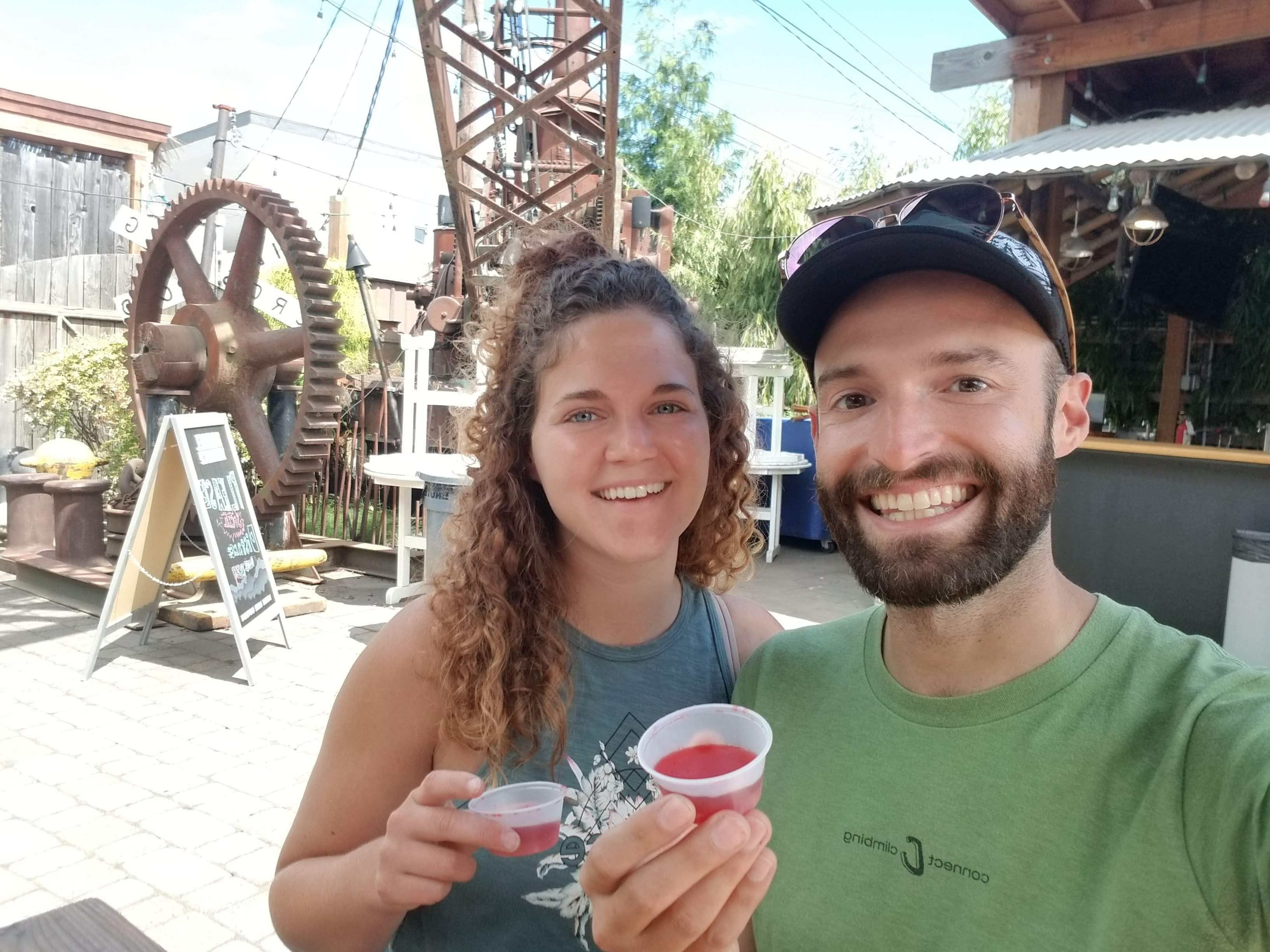
Upon arriving in Seattle, we headed straight to a Mexican restaurant that also served jello shots. Without question, we ordered a couple shots and cheers’d to making it from the Atlantic coast to the Pacific coast all in 10 days.