In November of 2020, Dale and I packed up my car to head West again. Our destination was Monticello, Utah, a small town 40 minutes south of Moab.
We completed the drive in just a few days, stopping in various KOAs along the way, and shotgunning a Press seltzer at the end of each long driving day. Having left Boston in a snowstorm on Friday, we arrived to sunshine in Moab on Monday afternoon.
First stop was Corona Arch, the same first hike that I did with Alberto when we came to Moab after graduation. It’s a short and flat hike, but a nice acclimation hike since Moab sits at 4,000 feet of elevation. Once complete, we continued the drive towards Monticello.
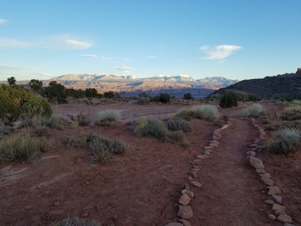
Since Moab is extremely expensive, even in the off-season, and we were staying for 5-weeks, we opted for a cheaper Airbnb in Monticello. From the listing, it showed a cute, 2-bedroom cabin with a full kitchen and living room, but we didn’t know much more than that. As we made our way south, we kept climbing in elevation until we were at 7,000 feet of elevation. There, we made a turnoff to the property which housed 4 other cabins on a big piece of land including our cabin, the Ranch Cabin.

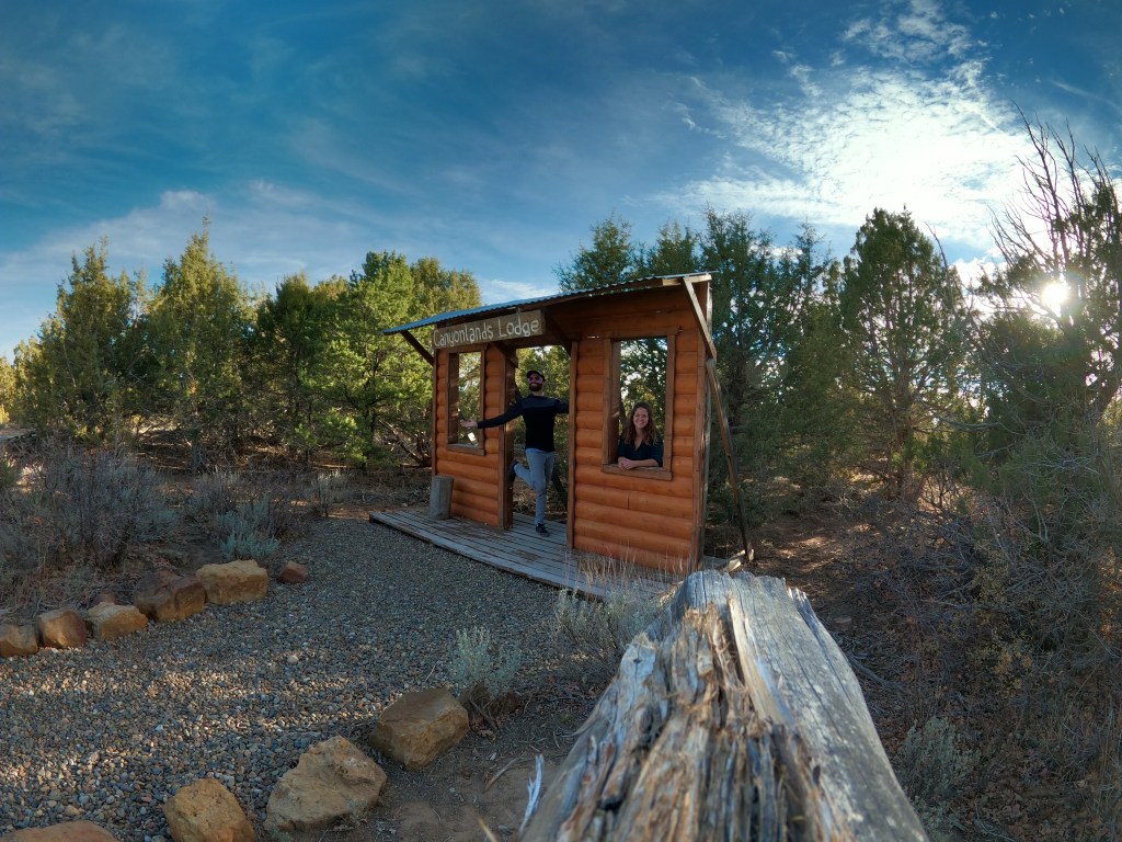
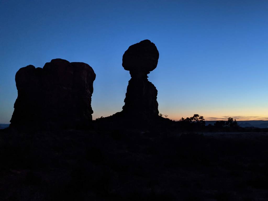
Upon arriving, we did a quick photoshoot out front, unpacked our car, and walked around the property. It was amazing to be up that high and be able to see the land in all directions. The La Sal Mountains and Moab were to the North, the Abajo Mountains were just to our West, the Rocky Mountains to the East, and Monument Valley to the South. That first night we watched the sunset with our heads on a swivel to see the different landscapes.
Abajo Peak
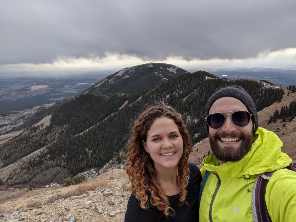
On Day 2 Dale stated that we were going to climb Abajo Peak, the 11,300 foot mountain that overlooked our cabin. This is the highest peak in the Abajo Mountains, a mountain range just southeast of Canyonlands. The trail wasn’t too far from our cabin; we just had a drive a narrow, winding road to the trailhead with no others cars or people in sight.
By the time we arrived at the trailhead, we had already covered a lot of the elevation. The hike itself was only about 1,200 feet of gain and 4 miles roundtrip, but having arrived to the area just one day prior, the default elevation was enough to have me breathing heavy and moving slowly.
You can’t make it all the way to summit of this trail since there’s power lines and cell towers at the mountain, but we were able to make it to 11,200 feet, the highest point I’ve ever hiked to date. The view towered over the town of Monticello, with Canyonlands and the La Sals to the North. It was a gray day, and the mountain itself was a little barren, but it was still amazing to look out and see all that we had to explore while we were there.
On the cross country drive to Utah, I had suggested we take a short video everyday of the trip. However, when Dale broke out his GoPro on the Abajo summit we quickly learned that I am extremely camera shy. Most of the videos ended up being of him or me being caught off guard.
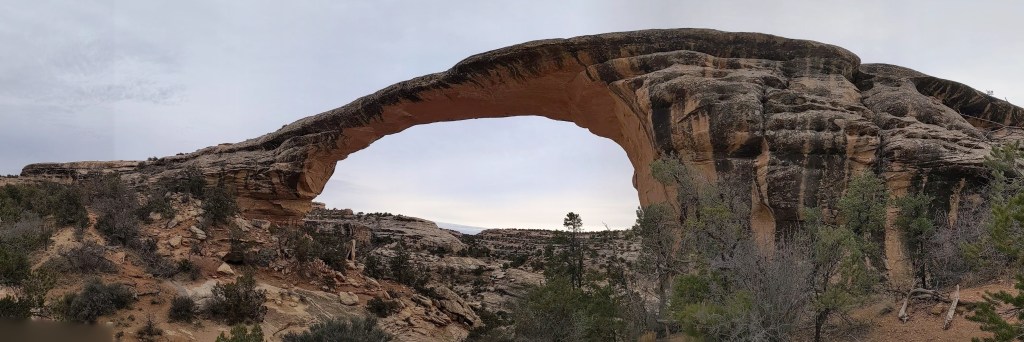
Natural Bridges National Monument
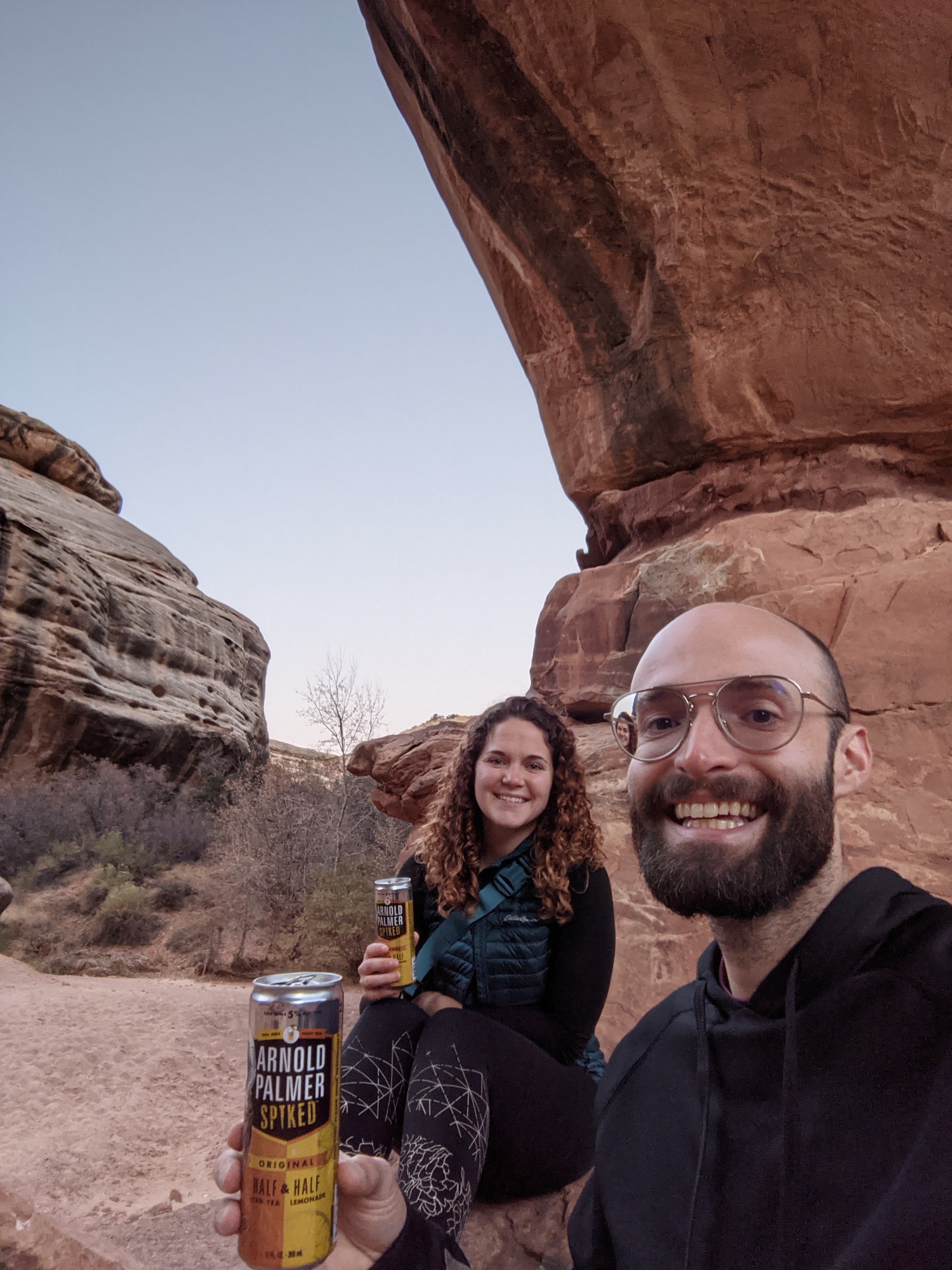
On Day 3 we made our way South to Natural Bridges National Monument. This was one of the coolest places we visited. The park is a 9 mile loop, with 3 major stops along the way. You can view the bridges from the road or hike down to the bottom to get a close up view. We hiked down to one of the areas (Kachina Bridge) bringing our signature Arnold Palmer seltzers, and watched the sunset.
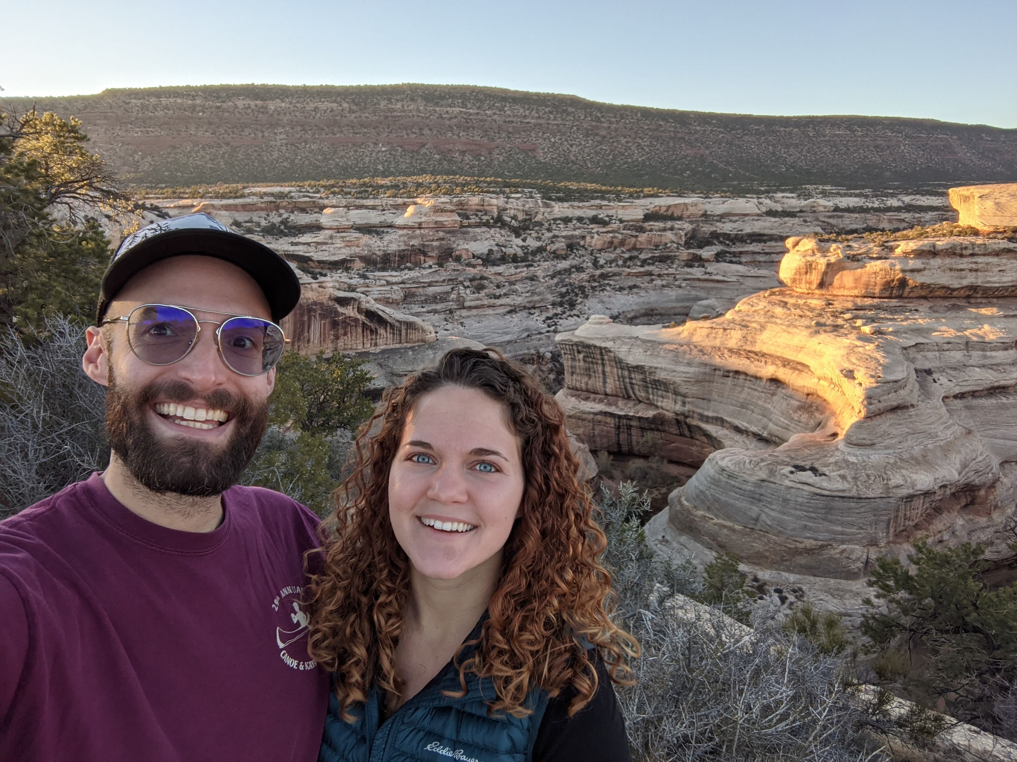

After the first time coming here, we knew we would want to come back to explore more. Later in the trip, we returned to hike down to another bridge, Owachomo Bridge, which was equally beautiful and secluded.
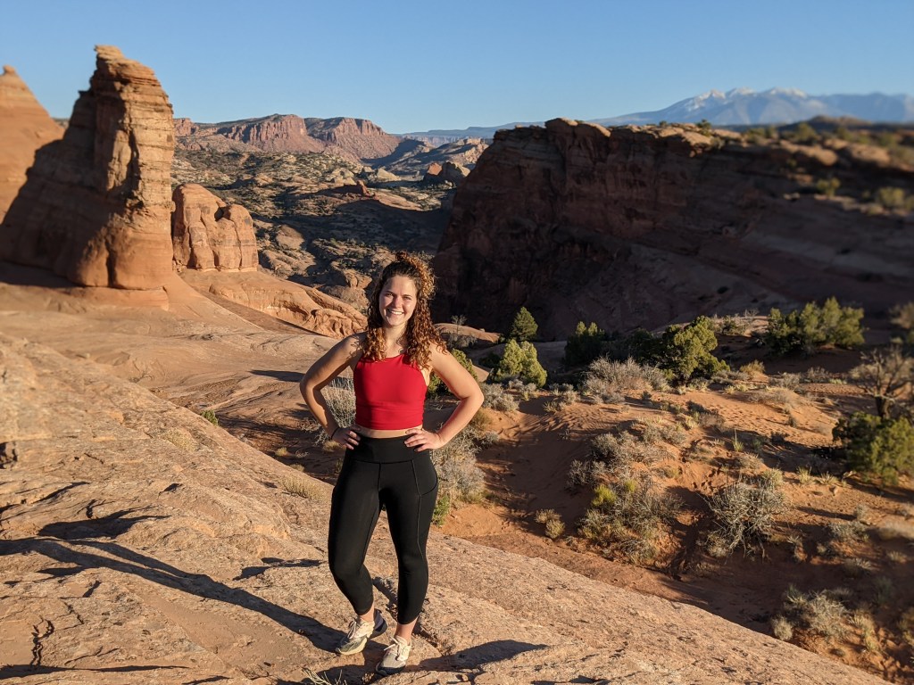
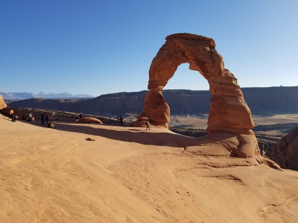
Delicate Arch
On Day 4 we explored Arches. We started the afternoon hiking to Delicate Arch. As expected, it was extremely busy, but neither of has been there before and the stoke from being in such a beautiful place was still pretty high. We didn’t get any pictures underneath the arch because of how busy it was, but we sat and took in the surroundings before hiking back down.
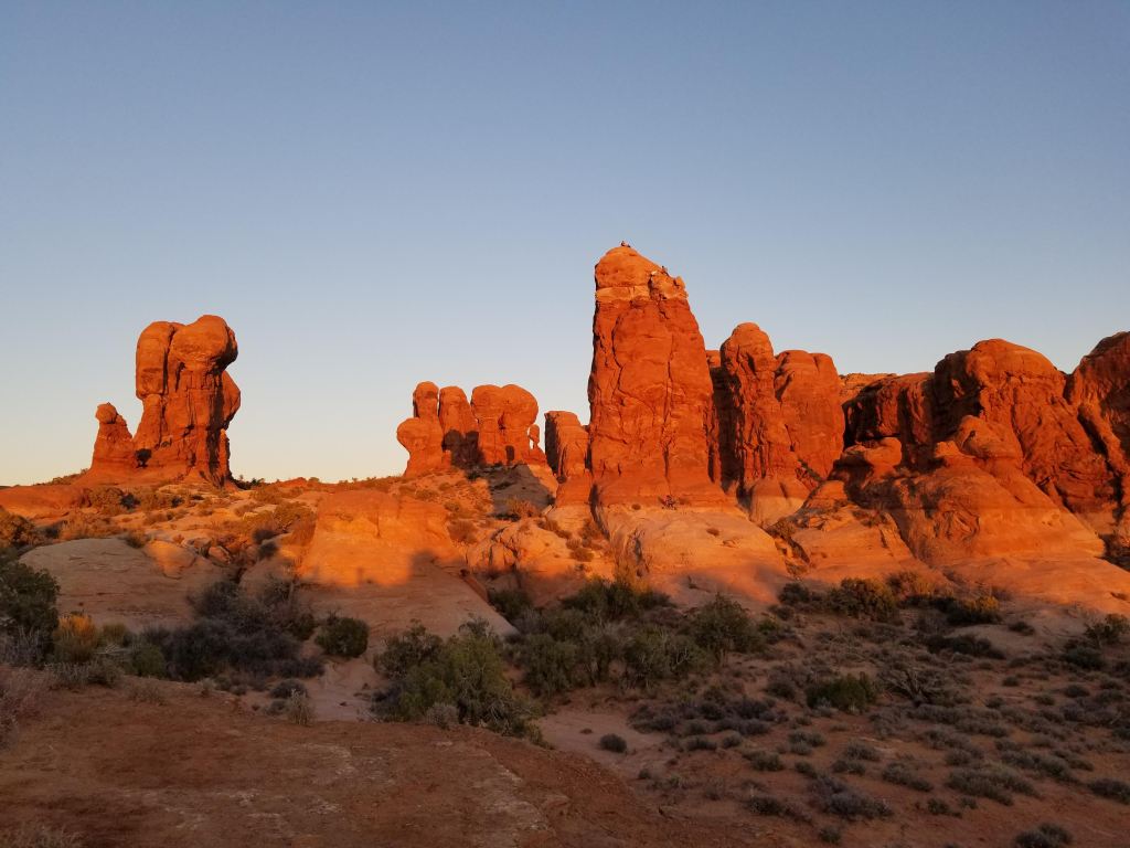
From there, we found a quiet spot in the Garden of Eden and watched some climbers finish their routes as the sun was setting.
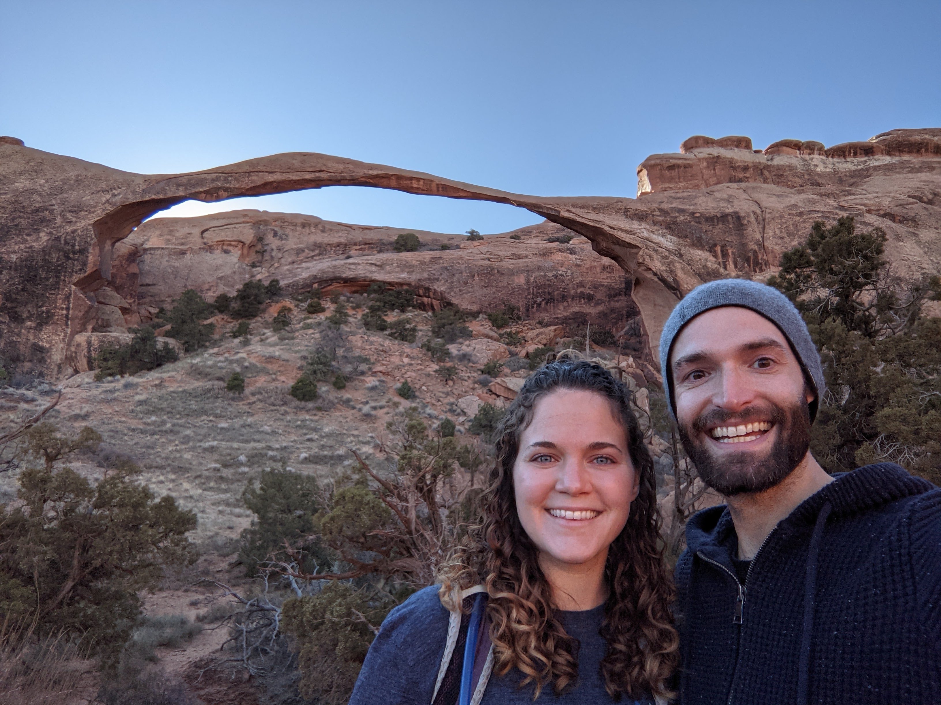
We returned to Arches a few weeks later to hike to Landscape and Double O Arch, a trail I had done previously with Alberto. Double O Arch is favorite since it’s much quieter than the rest of the park. On the way back out, we also stopped at Navajo, Partition, and Pine Tree arches.


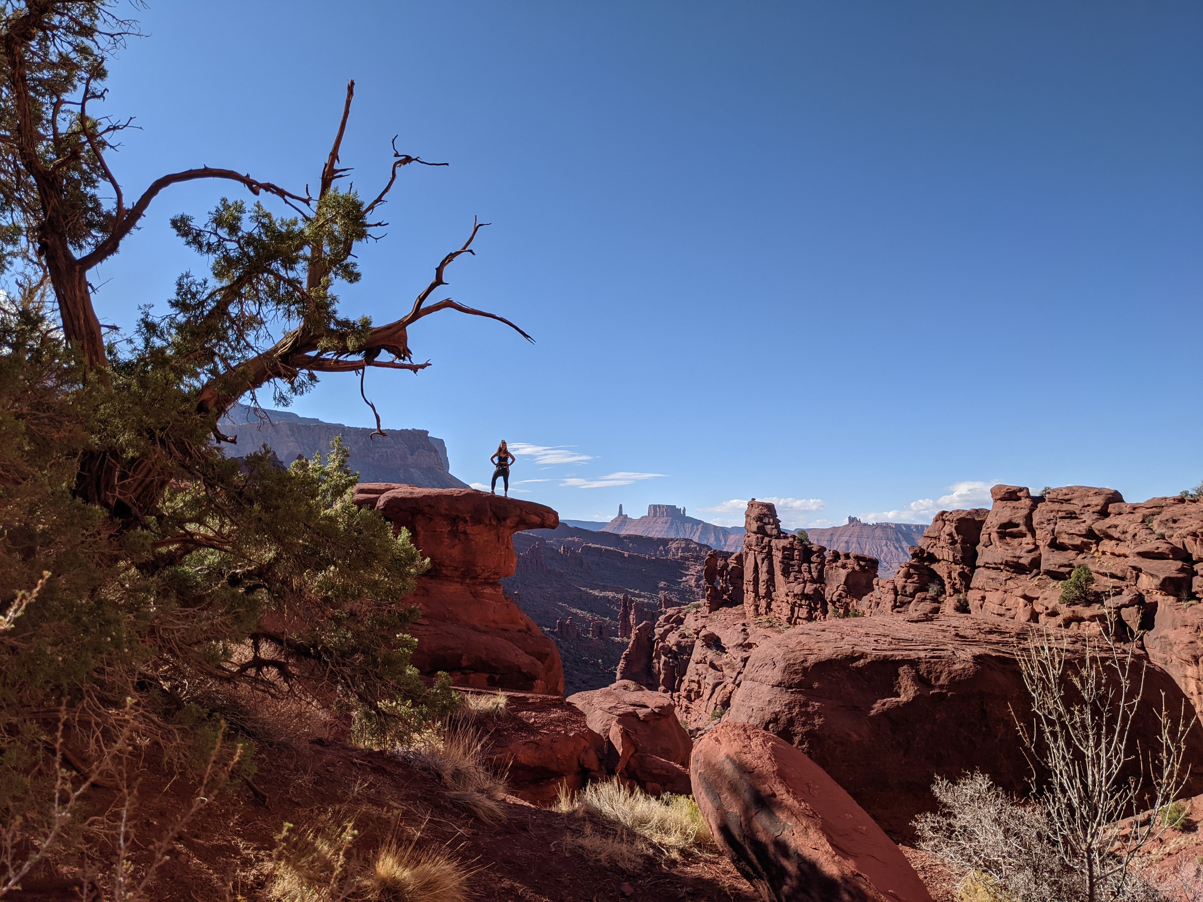
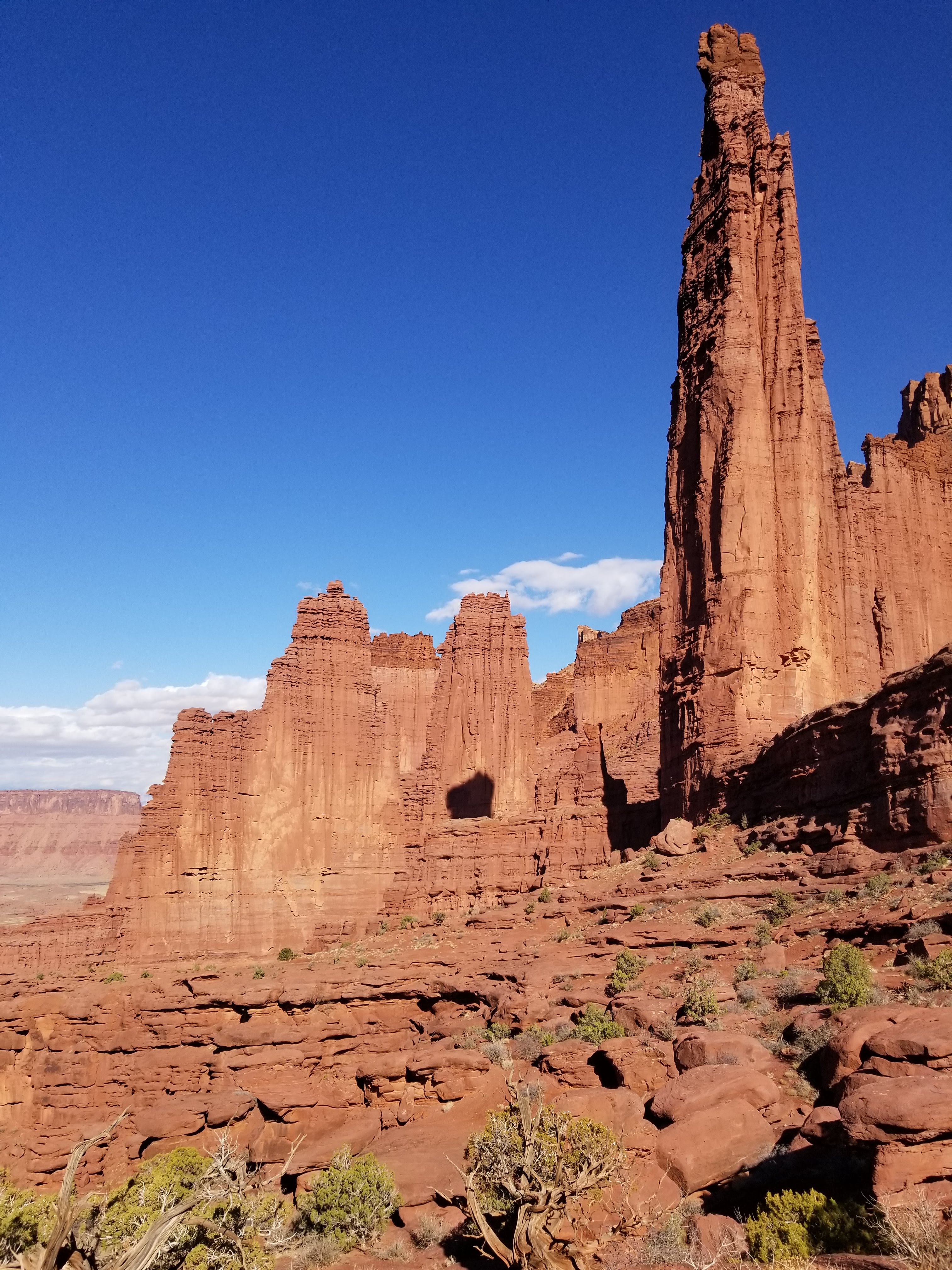
Fisher Towers
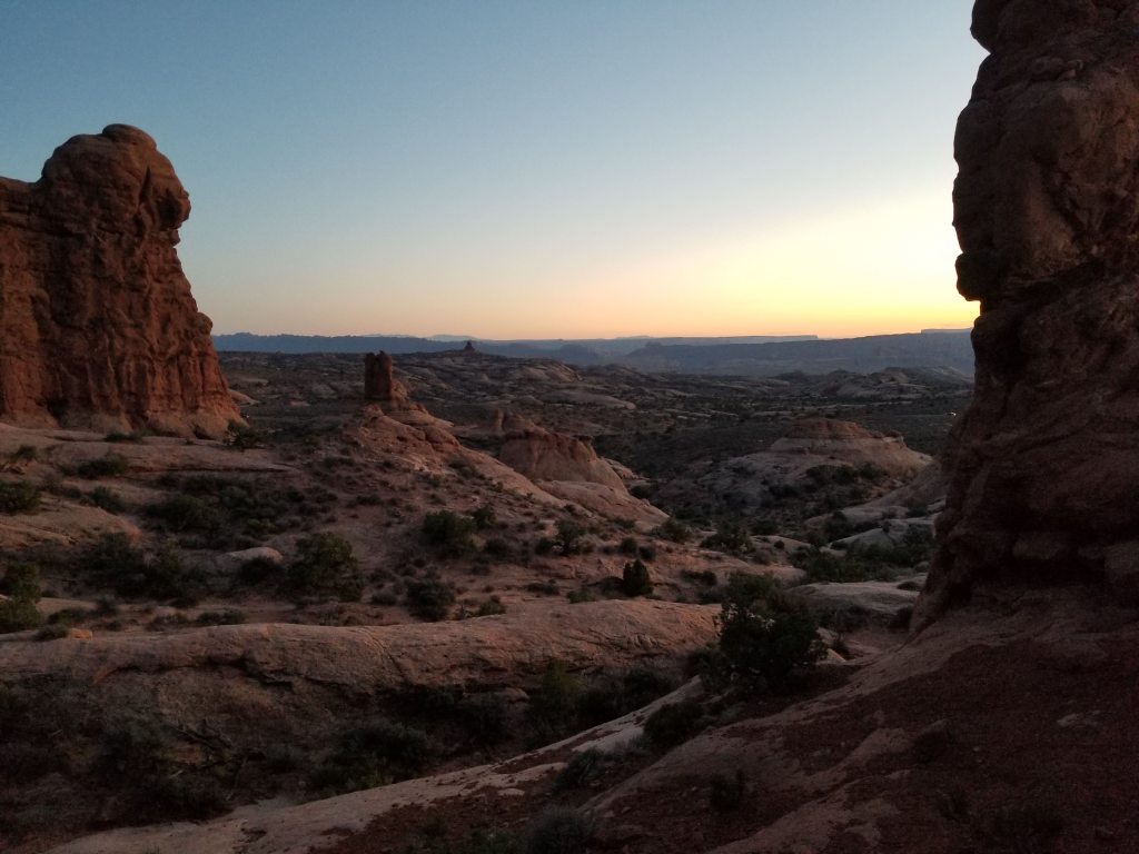
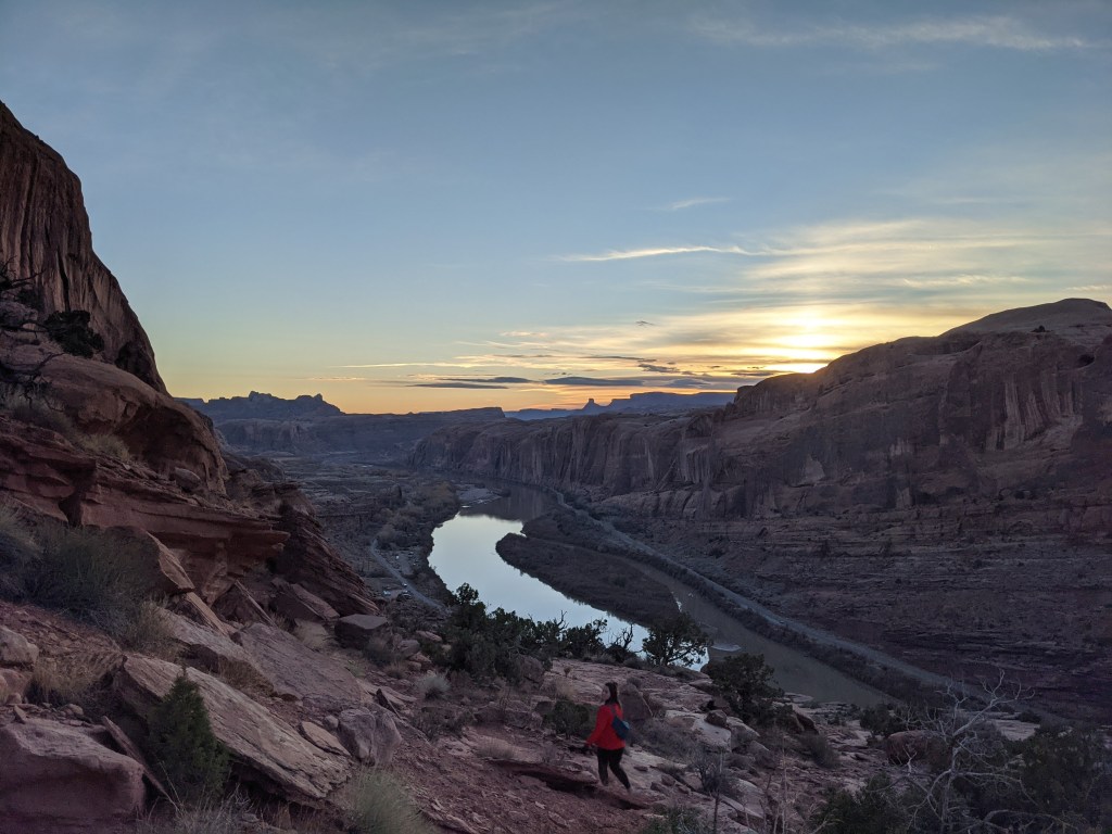
On Day 6 we drove north of Moab to the Fisher Towers trail. This has become one of my favorite short hikes in the Moab area. To get to the trailhead, you drive 20 miles north along the Colorado River before turning onto a 2 mile dirt road. You can see the towers from afar, but you can’t really appreciate the stature or intricacy of them until you’re up close. The trail winds in and out of the towers at a gradual incline, giving views of the valley and river the whole way. We got to the trail early, as the forecast was calling for rain and wind in the afternoon, which meant that there were hardly any people on the trail. However, there were a few times when the wind picked up and we were stuck getting blasted with sand.
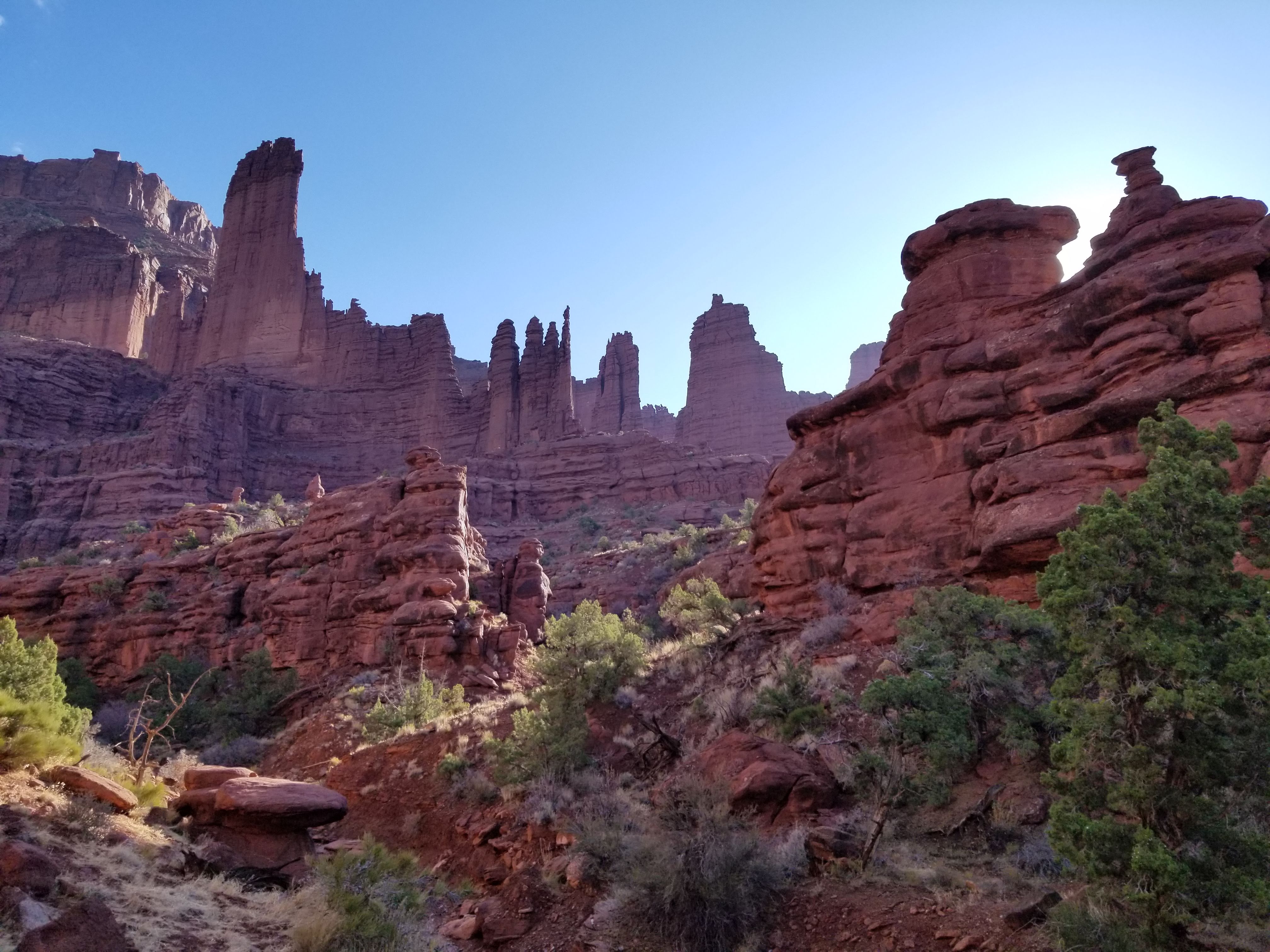
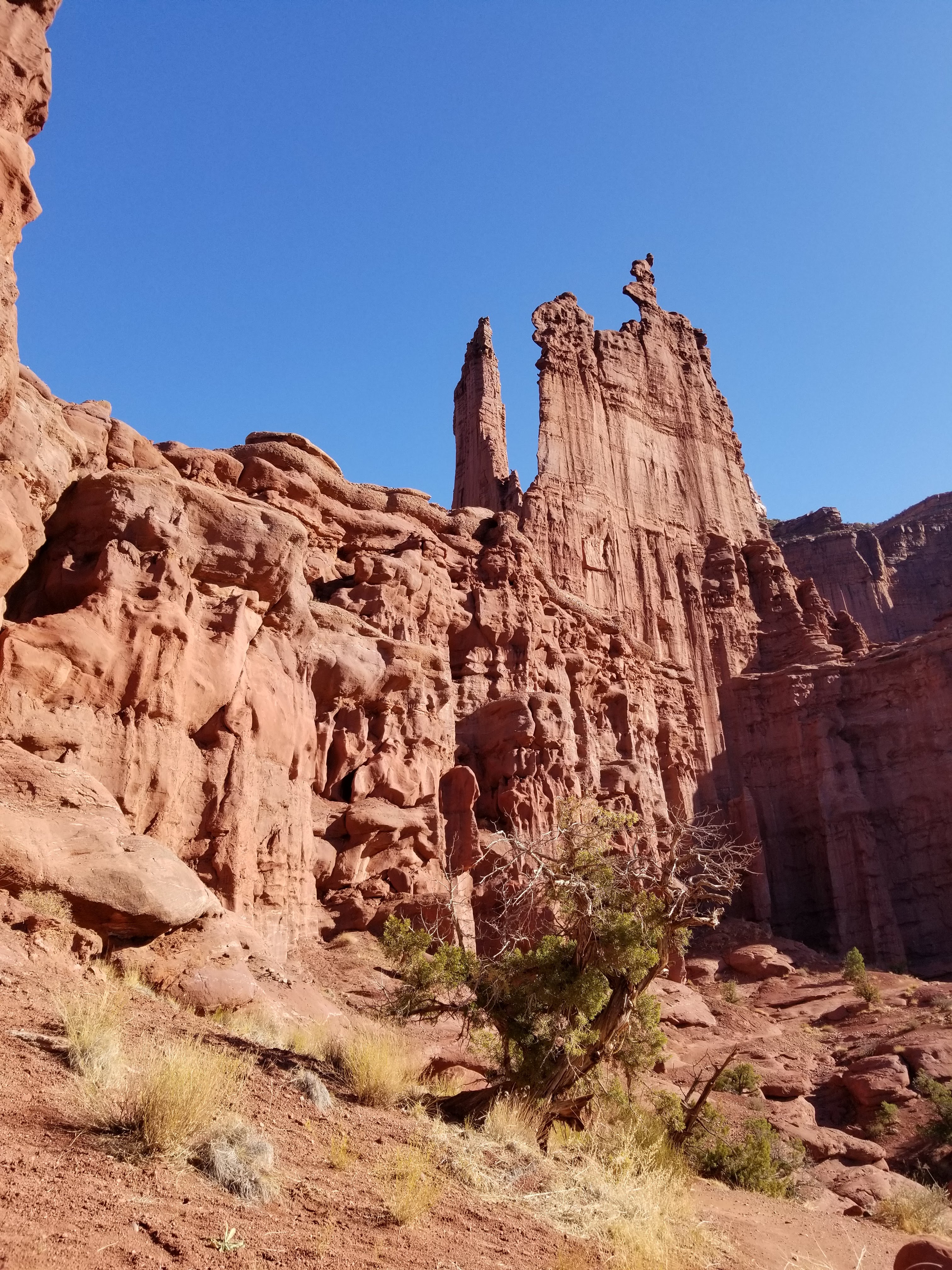

The end of the trail takes you a little away from the towers so that you can look back on where you came from and see the whole landscape. To the south, you can see Castleton Tower and it was during this hike that I decided I wanted to see Castleton up close too.
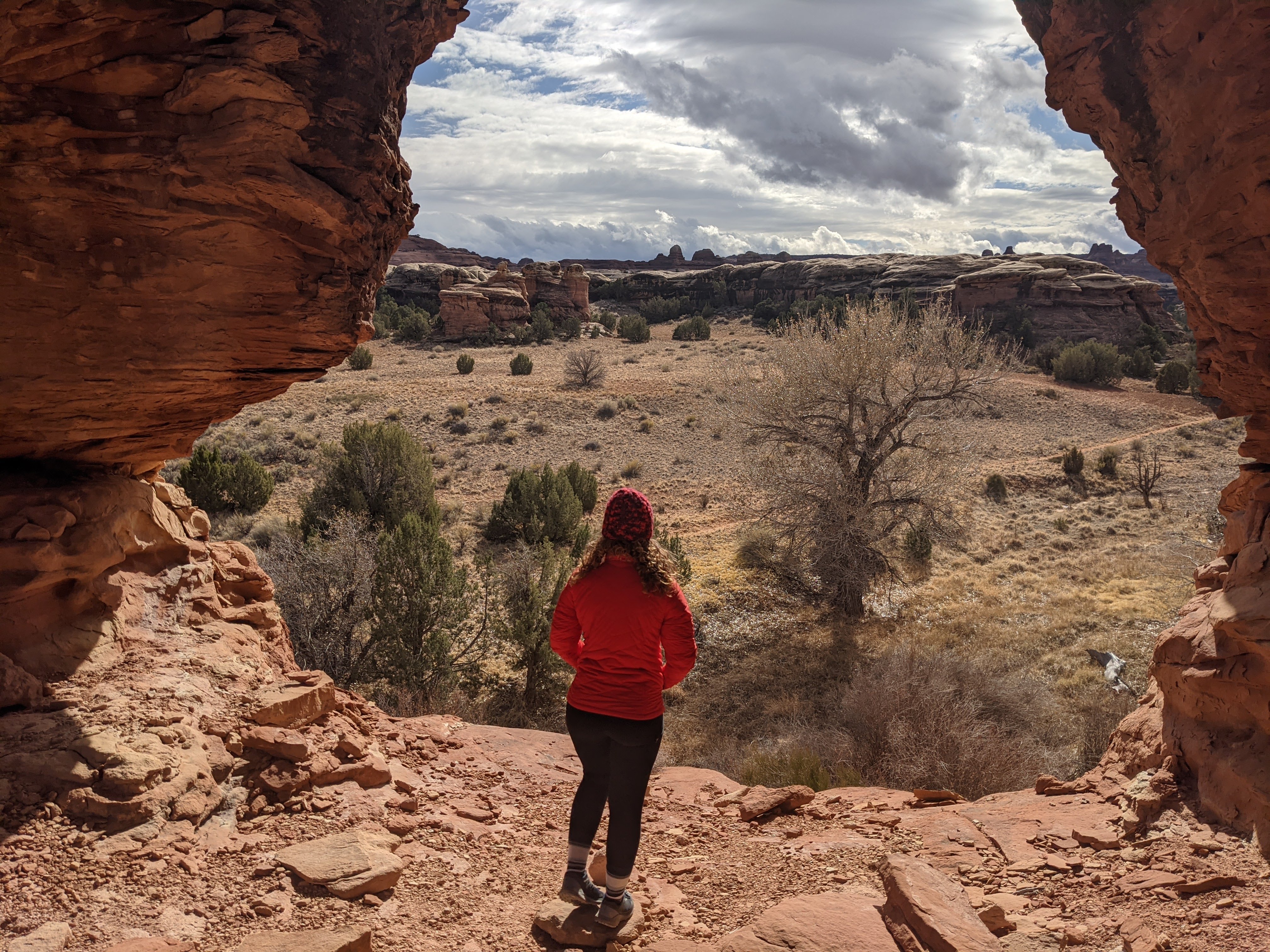
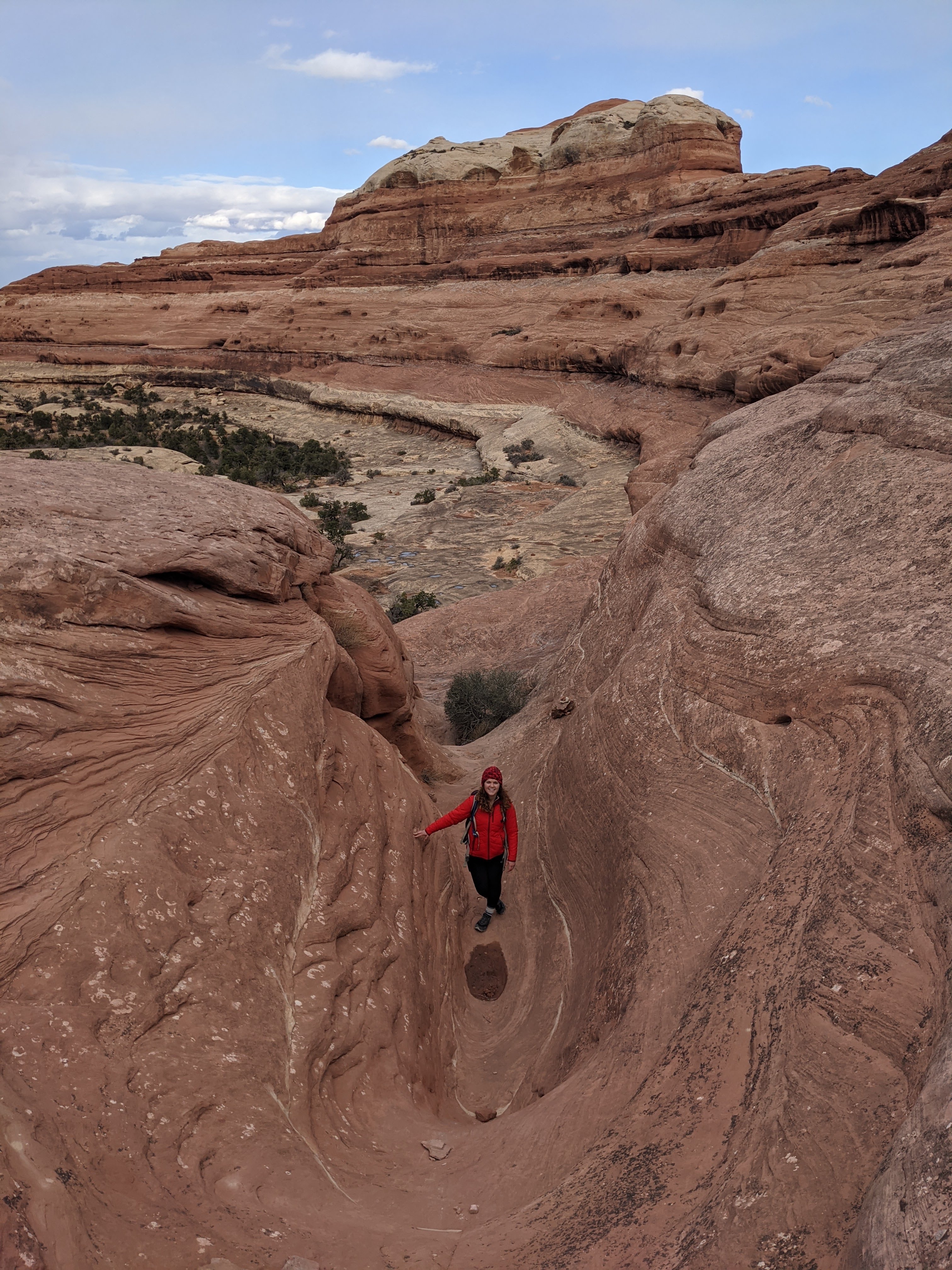
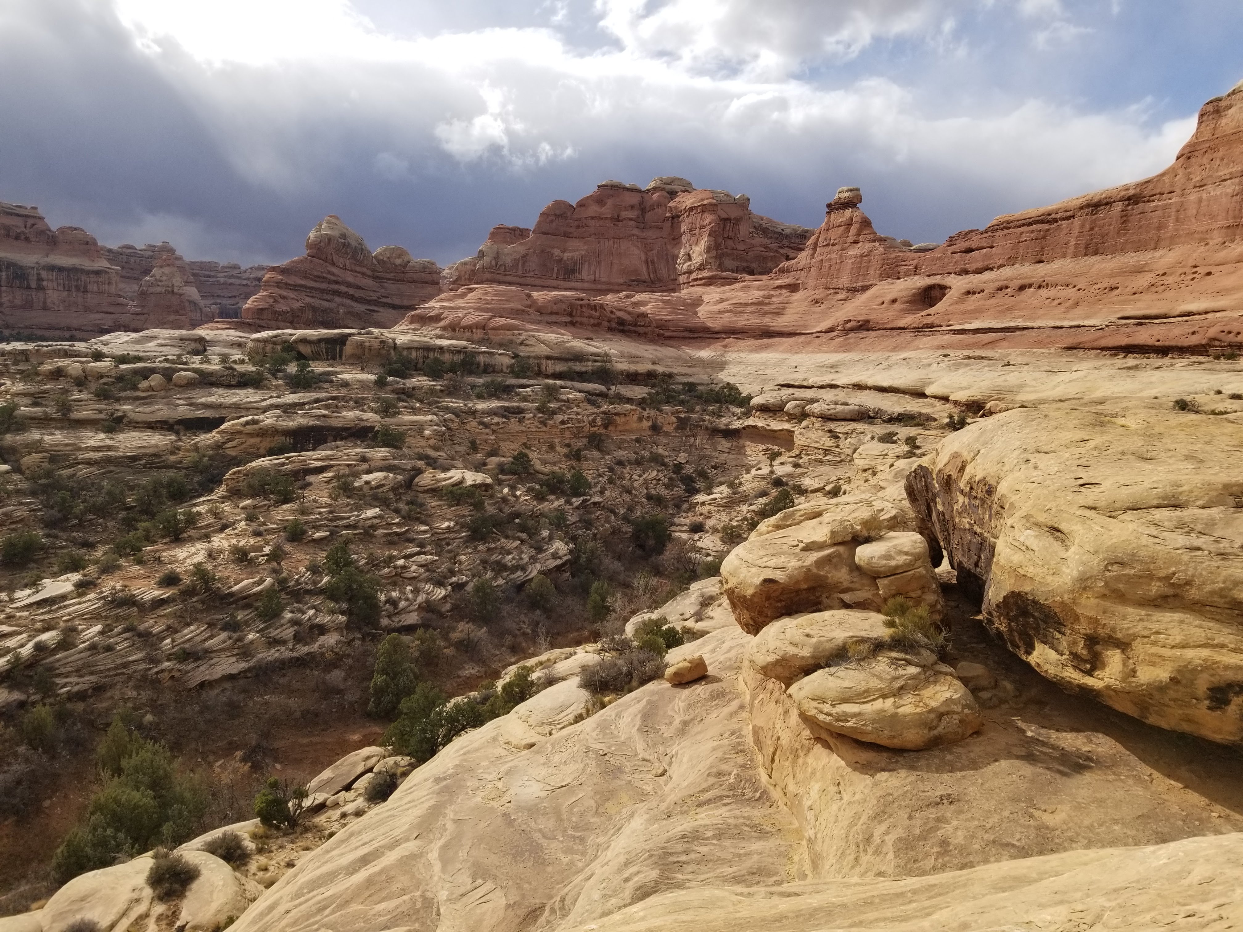
The Needles District, Canyonlands
On Day 7 we were exhausted, but it was a Sunday so we rallied and drove to the Needles District of Canyonlands. I had done a short hike through here previously, but I was excited to see more. We settled on a mostly flat, 7.5 mile loop through Big Spring and Squaw Canyons.
The hike took us through some of the most unique landscapes, weaving in and out of canyons, over and on top of rocks. Most tourists go to the Island in the Sky District so we were fortunate to have the trail mostly to ourselves. Despite the flat trail, we were exhausted by the end and ready to have a few rest days. We spent the rest of the week working, walking around the property, catching sunsets and making banana bread for my birthday.
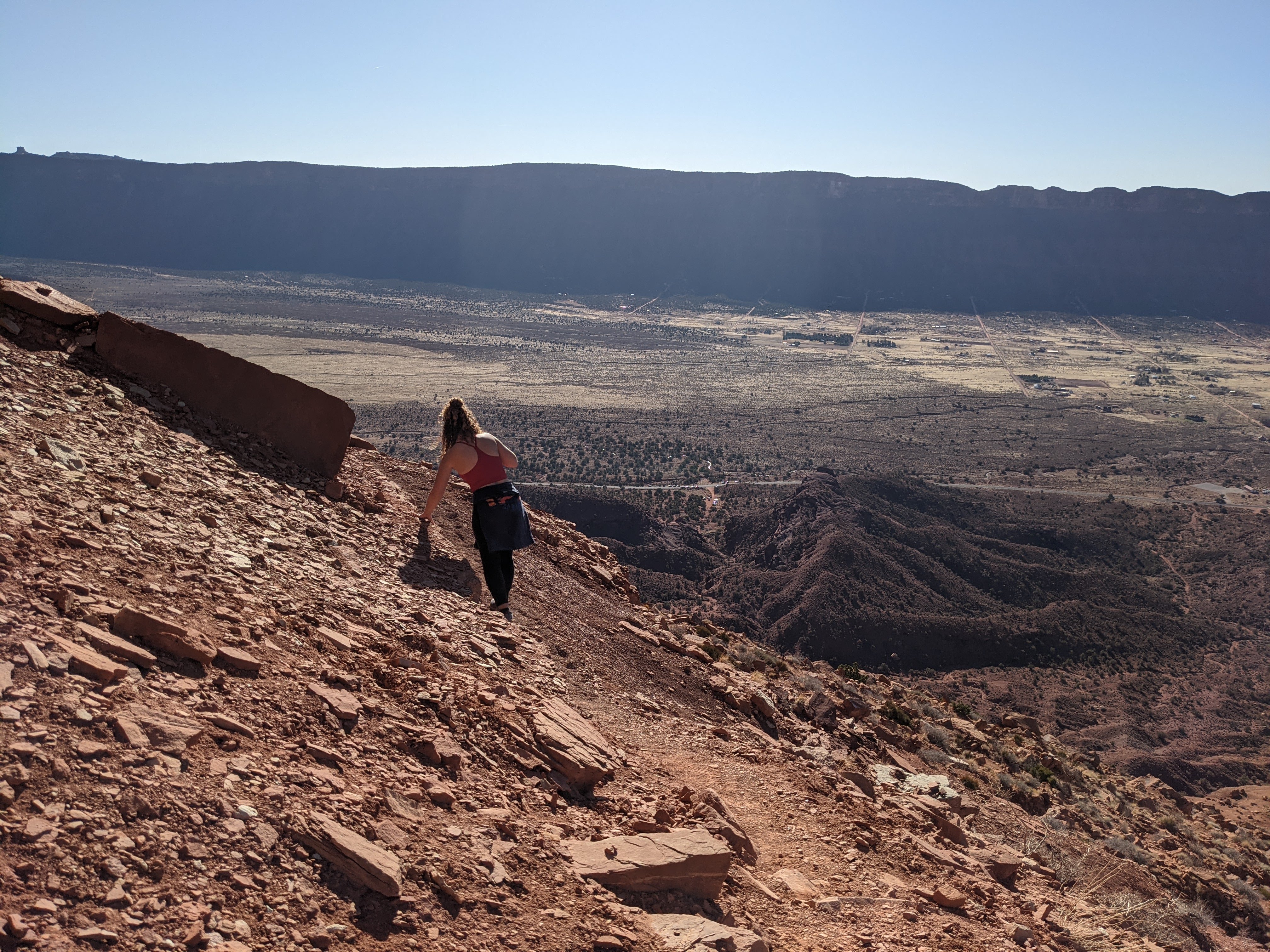
Moab Rim Trail
After 5 rest days, we were ready to hit the trail again. On Friday evening, we made the short and steep ascent up the Moab Rim trail. This is primarily an OHV/4×4 trail, so we saw many Jeeps slowly making their way up or down, often with the drivers having to get out and reassess their routes. Instead, Dale and I hiked it. On the way up, we had views of the Colorado River, but at the top we could lookout over the town of Moab and the La Sal Mountains beyond.
Capitol Reef National Park
For my birthday weekend, we decided to venture into Central Utah to explore Capitol Reef National Park and Goblin Valley State Park. We drove a few hours through vast and untouched land. For much of it, there wasn’t a gas station, establishment or person around. I remember thinking how surreal it was to be so secluded and alone in this area. We drove through parts of the Glen Canyon National Recreation Area and around the Henry Mountains, eventually arriving to our Airbnb in the small town of Huntsville. From there, we continued to Capitol Reef.
This park is unique from other national parks because not only does it contain rich geology, but there’s so much cultural history to the area as well. There used to a be a town in this area, now called the Fruita Rural Historic District, and the remnants of schoolhouses, blacksmiths and apple orchards still remain today. In addition, this used to be a big mining area, so you can find closed off mines throughout the park as well.
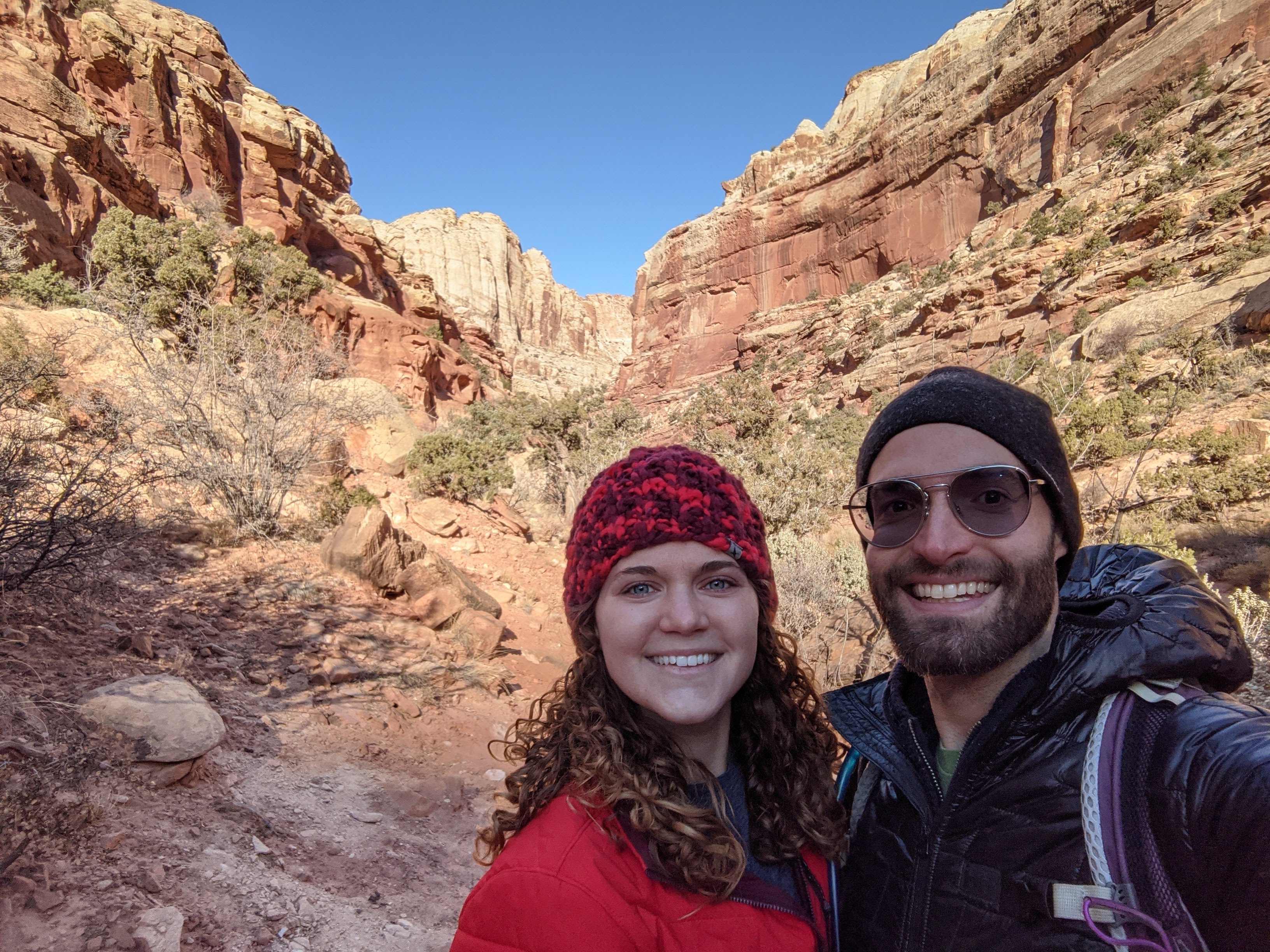

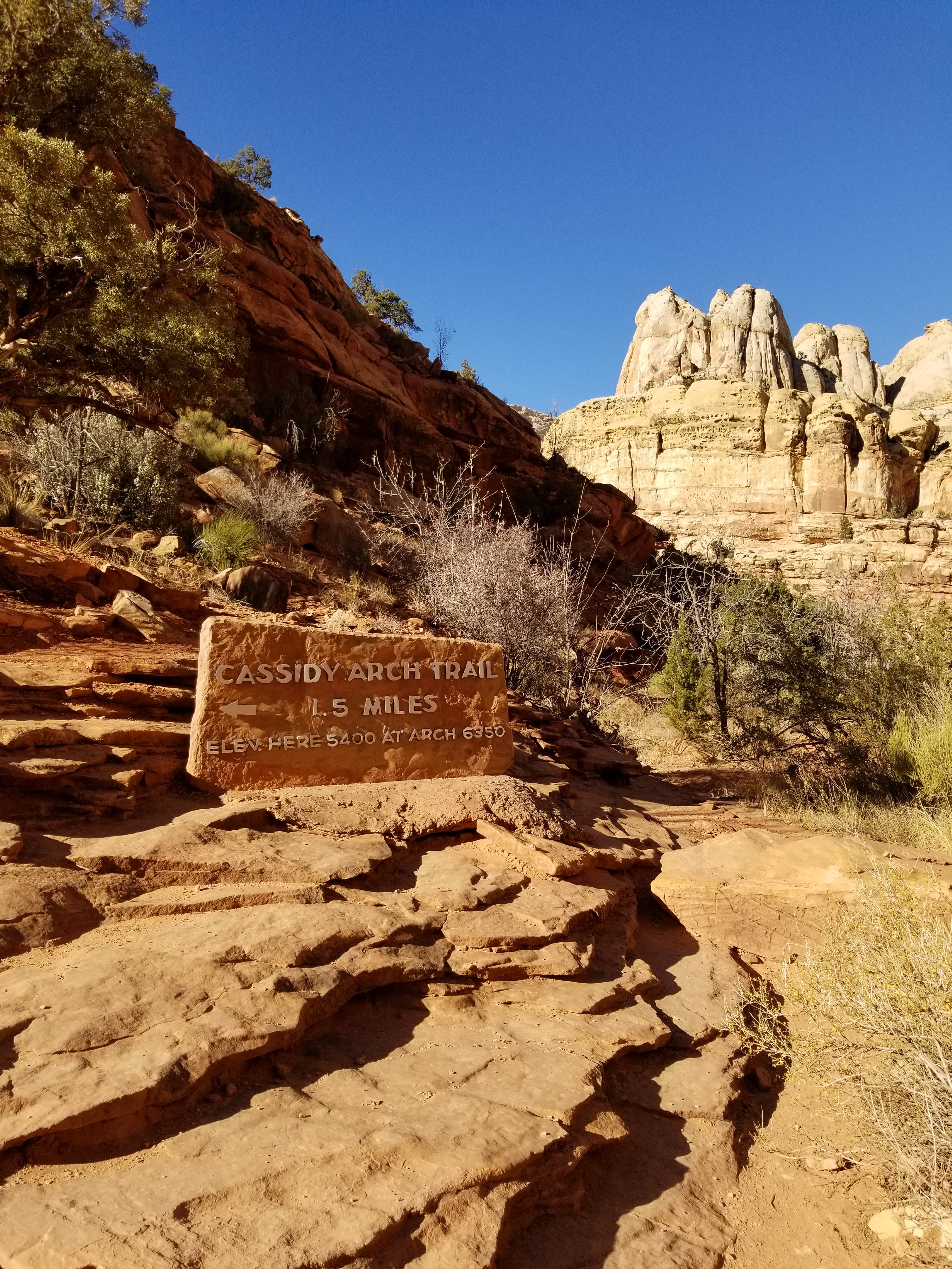
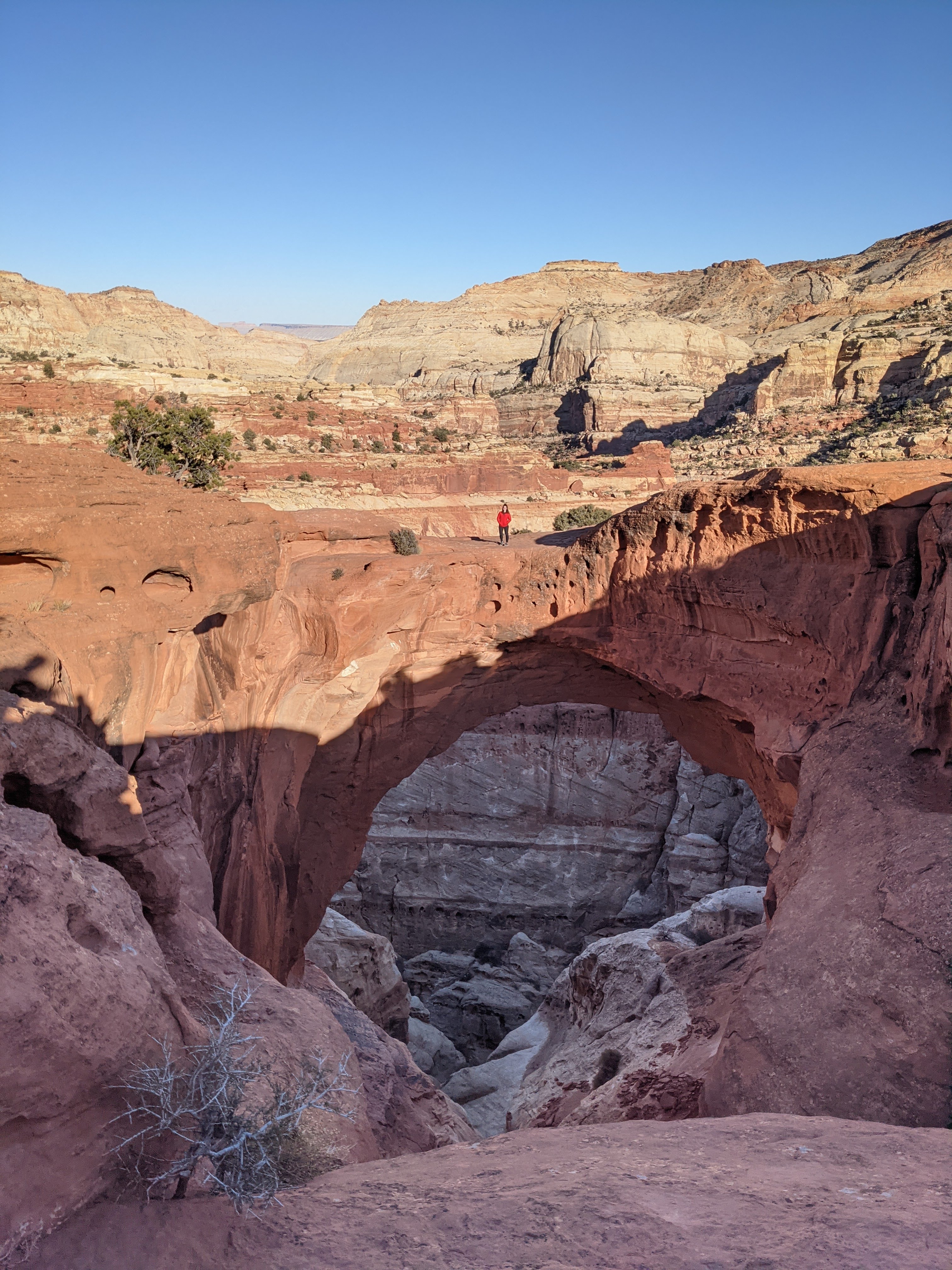
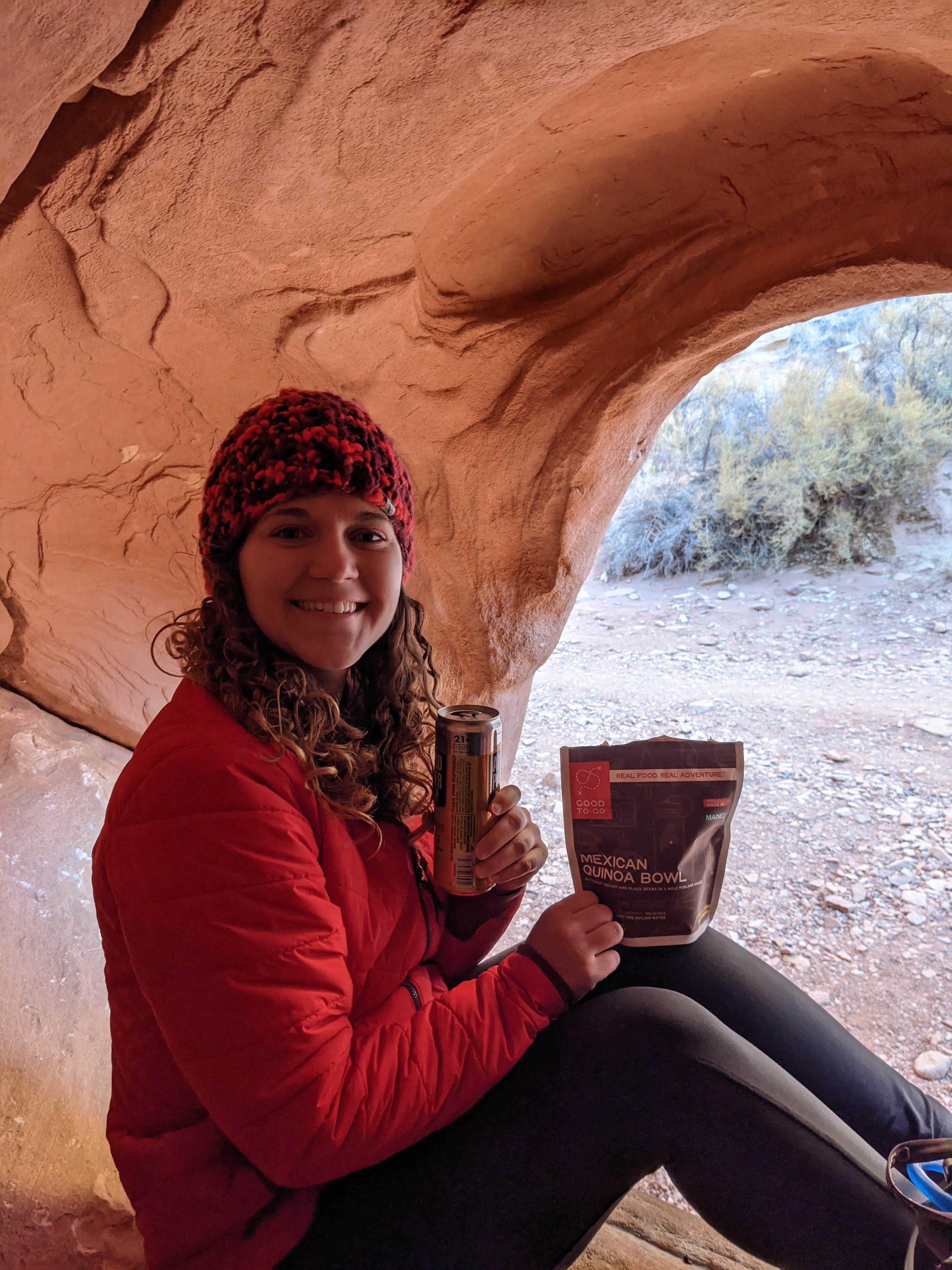
We did a couple small hikes, the most memorable being the Cassidy Arch trail. This trail takes you up high into a canyon where you can eventually stand on the arch itself. On the way back down, we prepped out dehydrated meals and ate in the car before heading back towards our Airbnb.
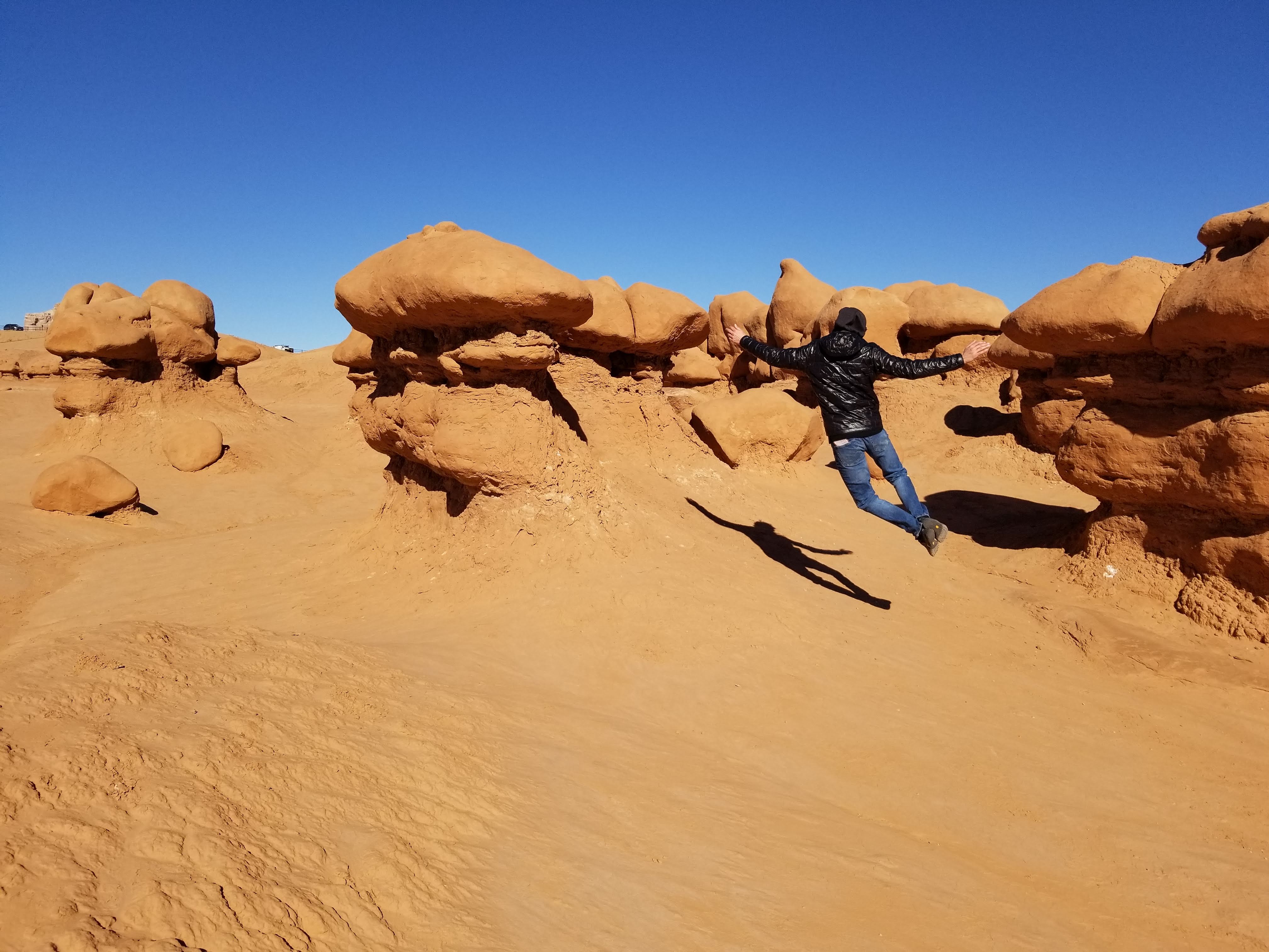
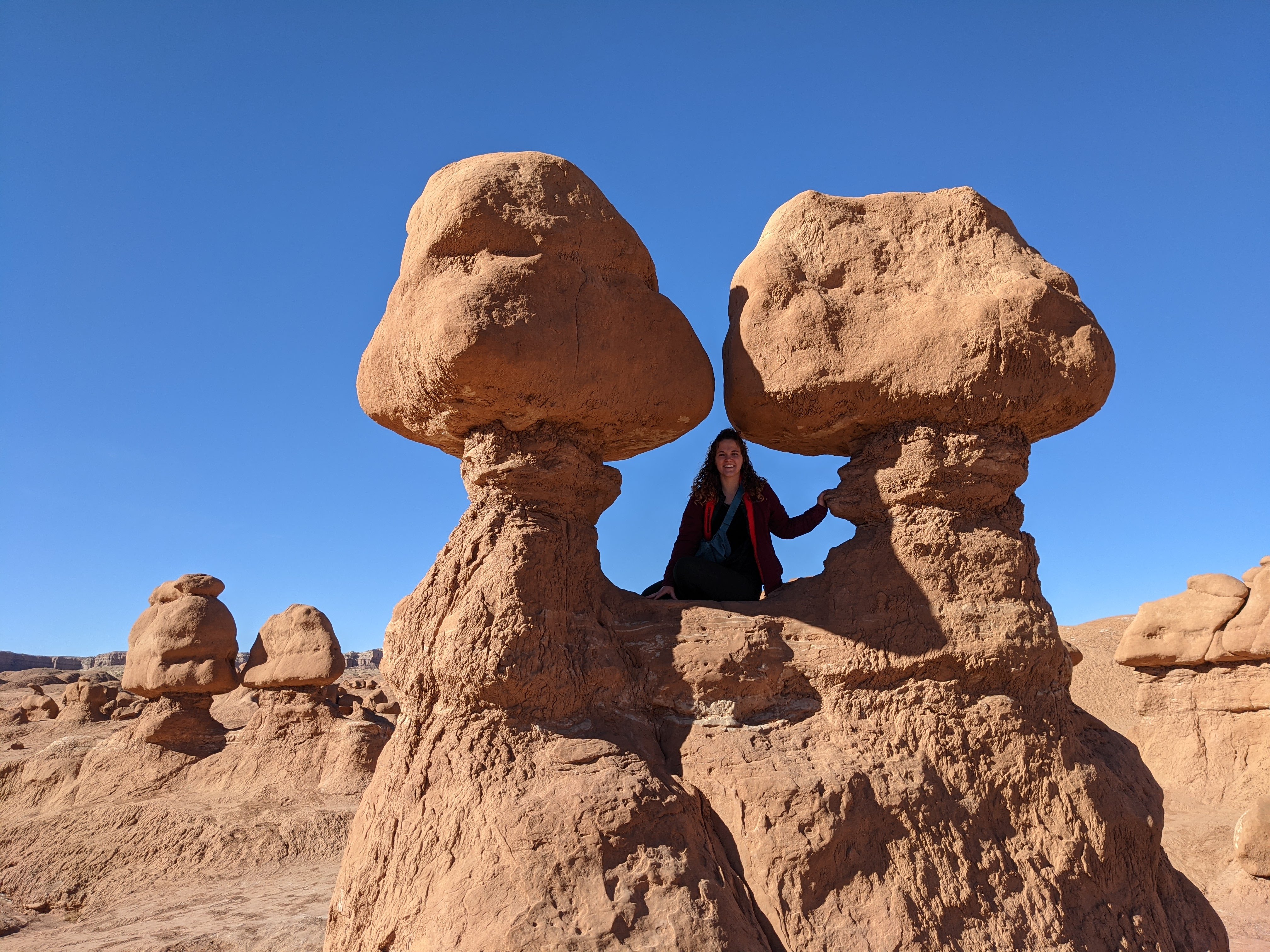
Goblin Valley State Park
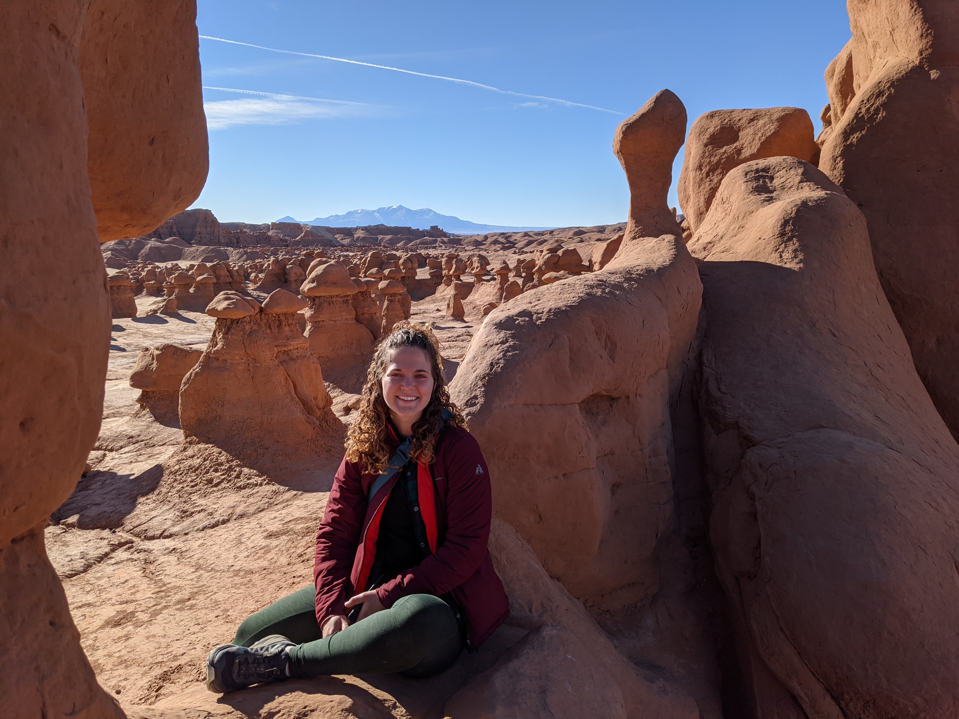
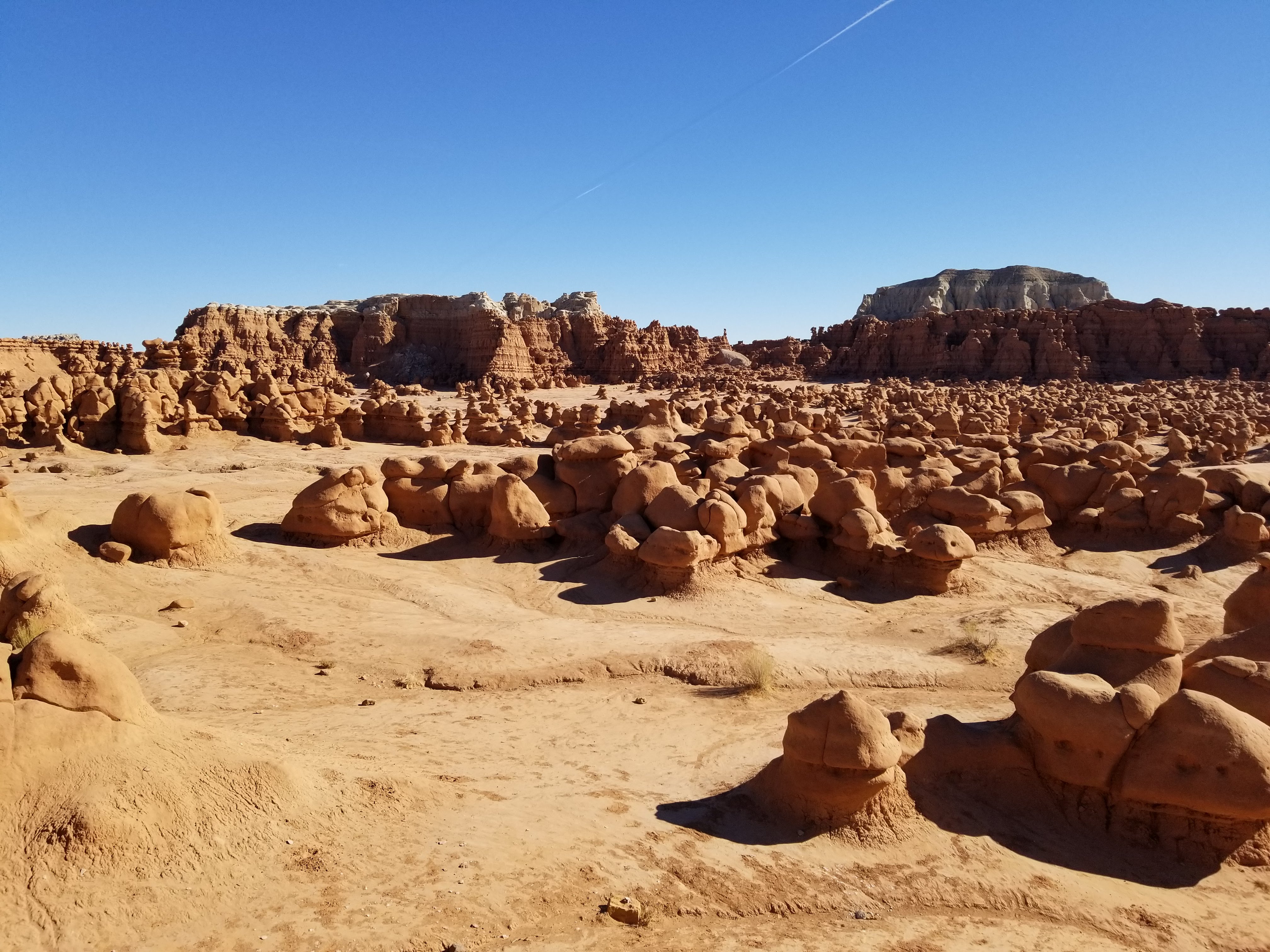
The next day we woke up early to get to Goblin Valley State Park. Since the national parks in Utah get so much hype, and therefore get a lot of visitors, the state parks are awesome to get off-the-beaten path a bit. To get to Goblin Valley you have to drive along a dirt road in the middle of a valley, until you arrive at the entrance pay station. It doesn’t look like much from here, but once you get to the parking area and look out, there’s a playground of hoodoos waiting for you. As opposed to Bryce Canyon where the hoodoos gradually appear, the landscape here seems to change out of nowhere. To the left is flat ground and to the right is hoodoos. This was such a unique experience as we climbed and scaled all the structures.

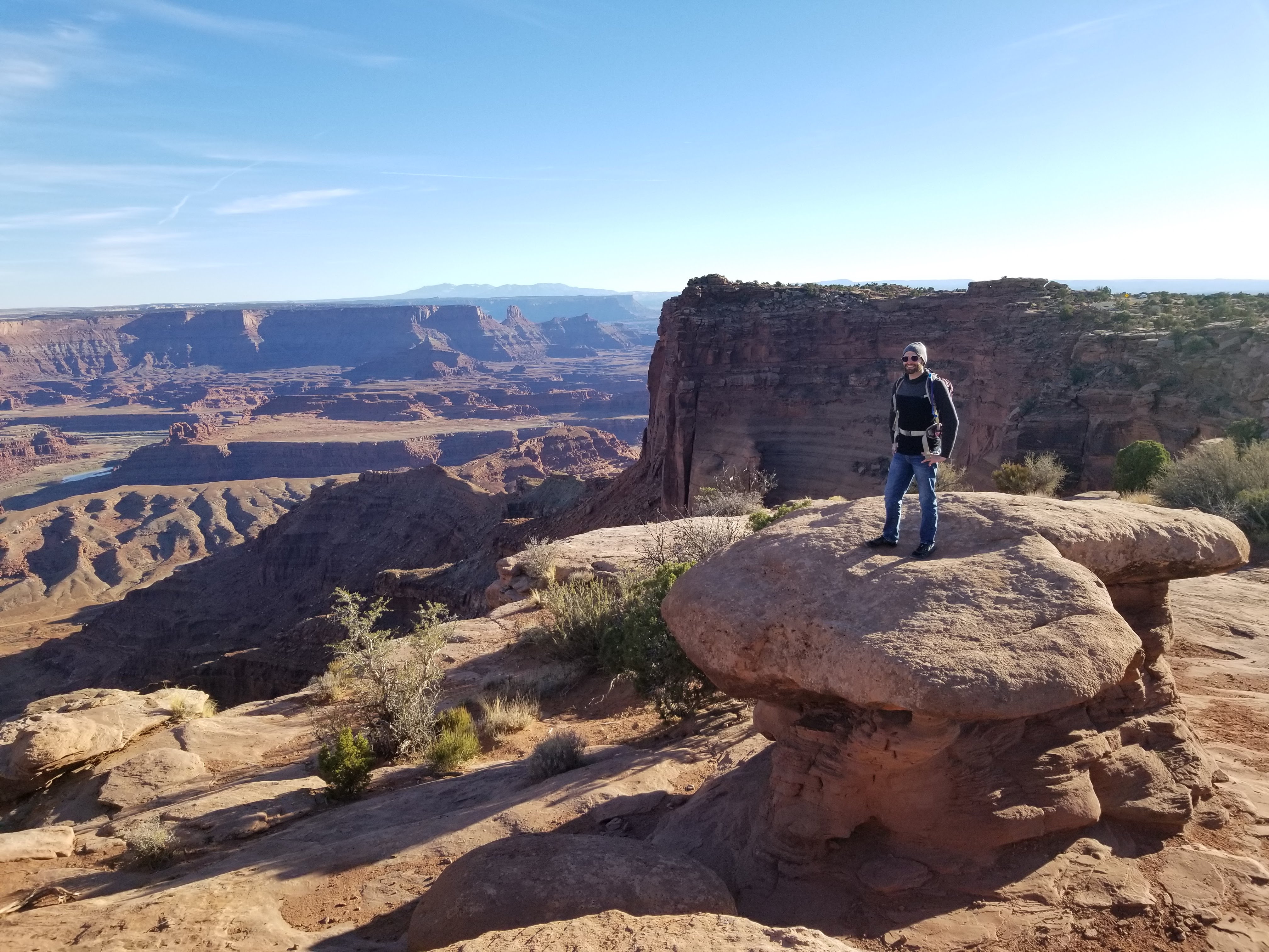
Dead Horse State Park
We took an alternate route back to Monticello so that we could stop at Dead Horse State Park along the way. Again, most tourists go to Canyonlands National Park, but Dead Horse State Park is just 4 miles away from Canyonlands, has many similar views and is not nearly as crowded! We got there in time to walk along the rim trail and find a spot for sunset. A great ending to my birthday weekend.


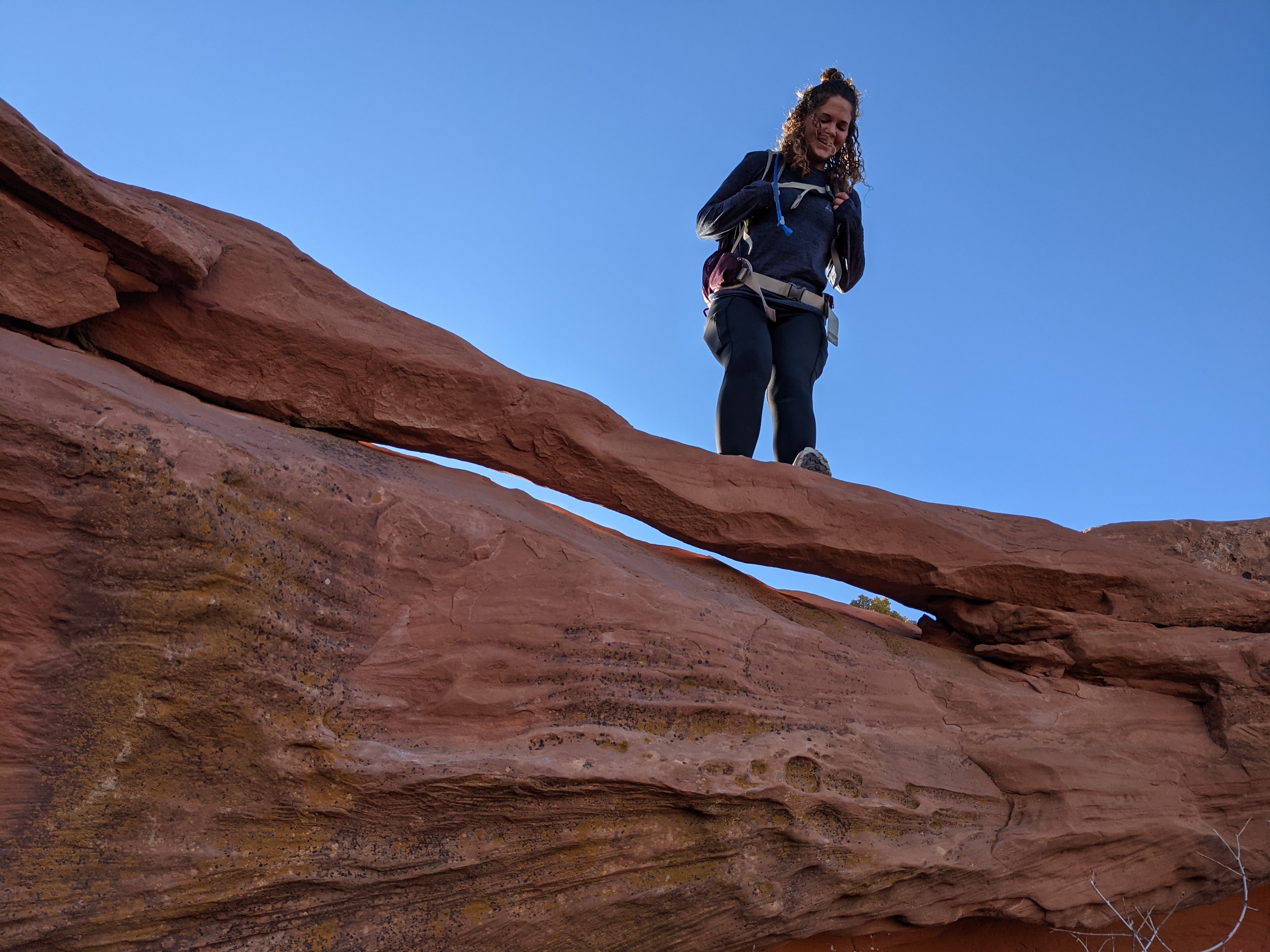
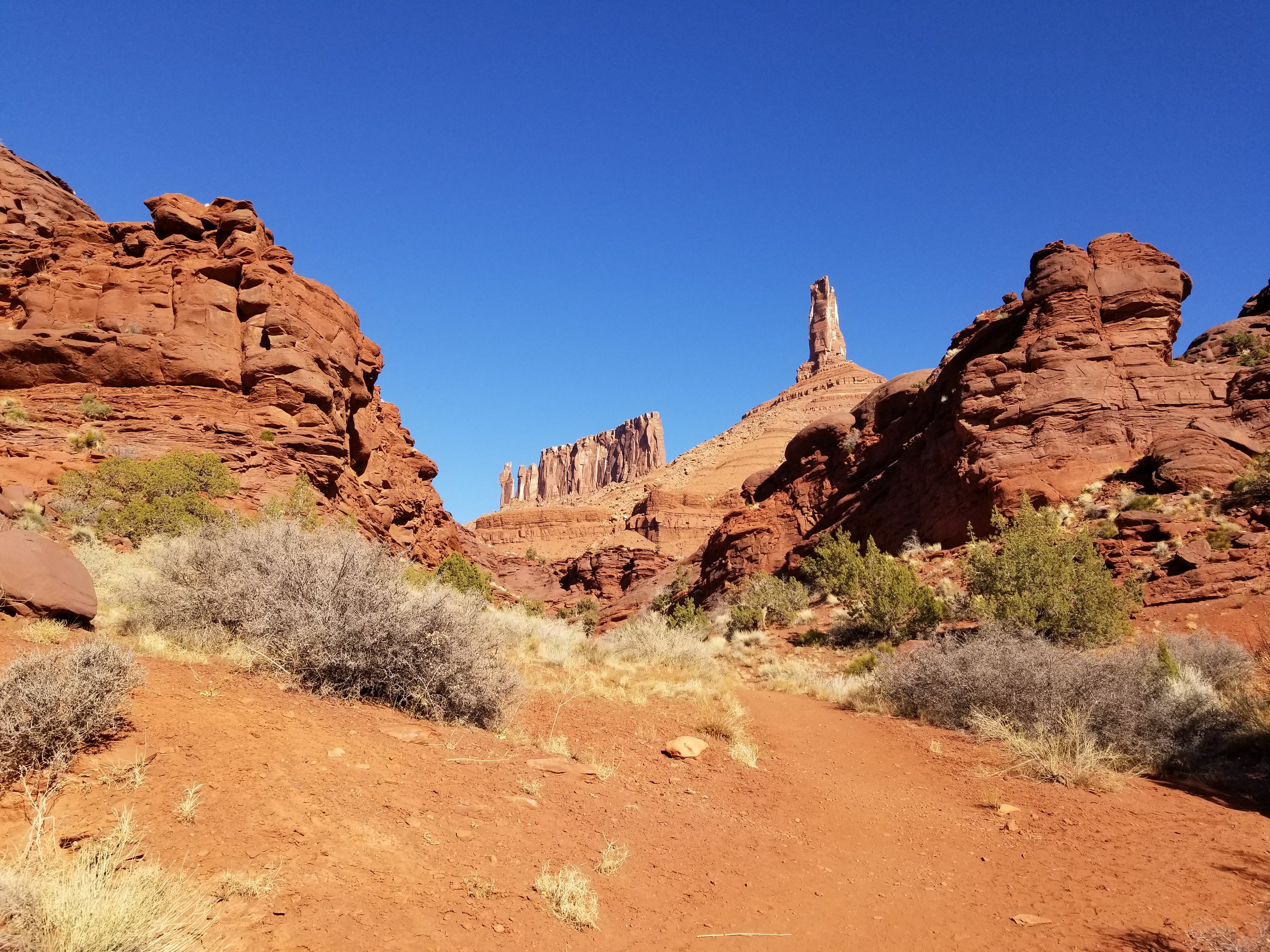
Castleton Tower
The following weekend we made it our mission to climb to the base of Castleton Tower. I had seen this tower several times, I knew it was a popular climbing spot, but didn’t know much more than that. I found the trail on AllTrails and we went on our way.
To get to the trail, we turned onto the La Sal Mountain Loop Road towards Castle Valley. You don’t have to drive too far down the road, but regardless you can still start to get some views of the La Sals as you’re still surrounded by red rock. At the trailhead, there’s a campground that many climbers stay in that was entirely full when we got there.
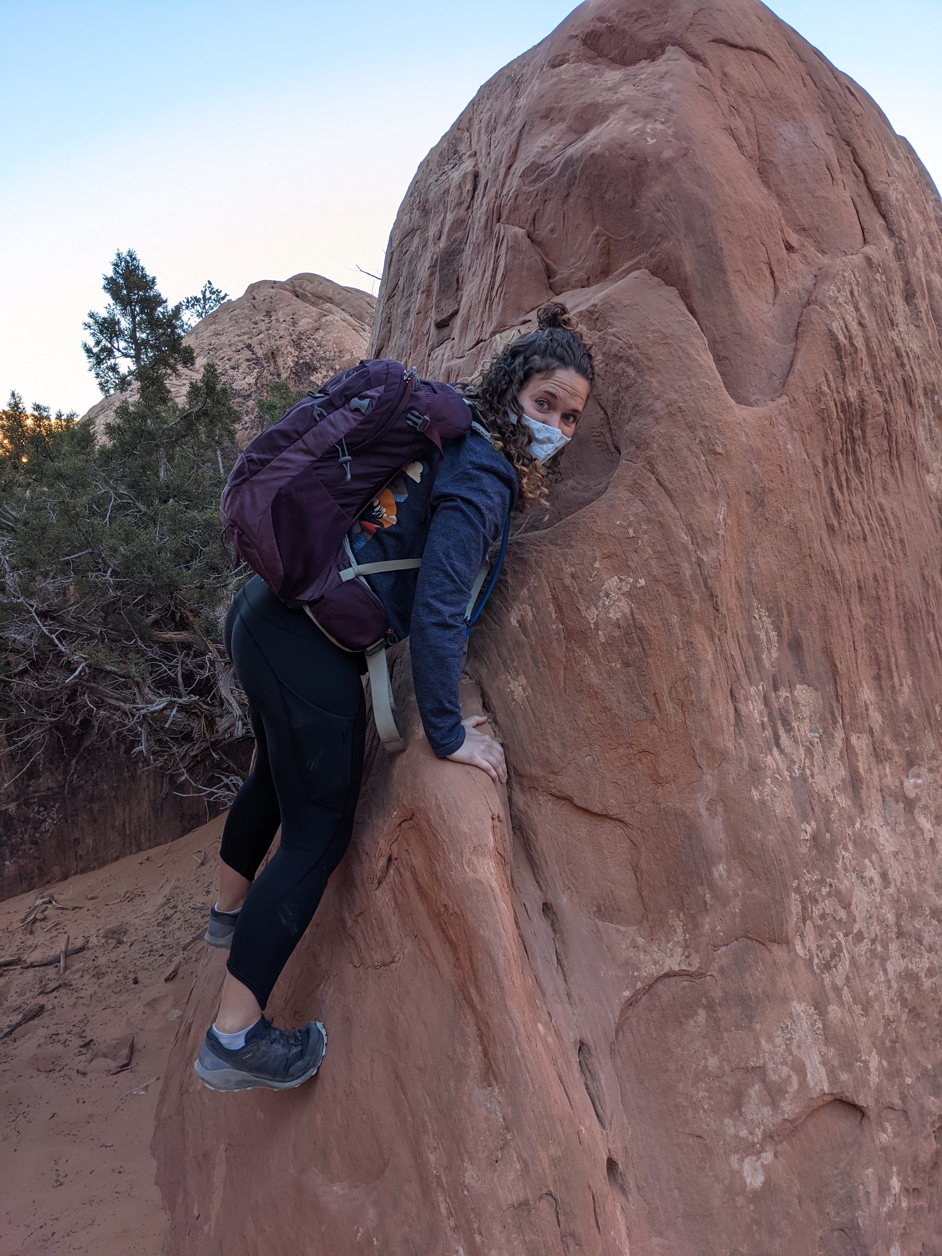
The climb started fairly easy, mostly walking through the valley to get to the base of the hike up. It wasn’t until we reached the base until we realized how much of a scramble it was going to be. We started up slowly taking in the view of the priest and nuns rock formations and Dale finding a couple boulders to climb. And then we reached the real challenge. Nearing the end, the trail turns from large boulders to slippery shale. Several times I was inching along on my butt and crab walking in order to feel secure. Eventually we made it to the base of the tower, looking up to see several climbers on the tower itself. Although relatively short, I was proud of us for completing this nerve racking hike, and excited to be able to say that I’d been up there next time we drove past!
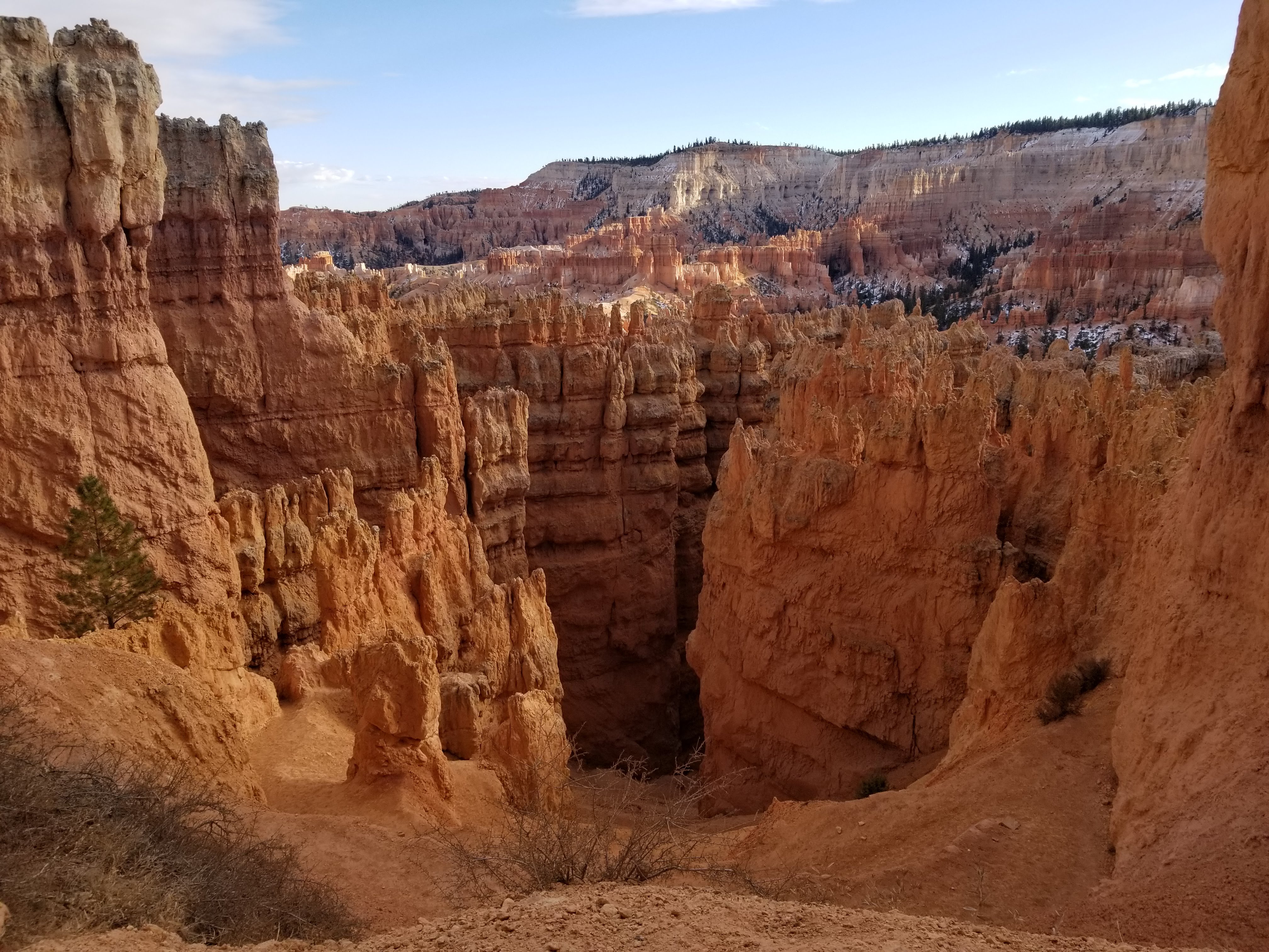
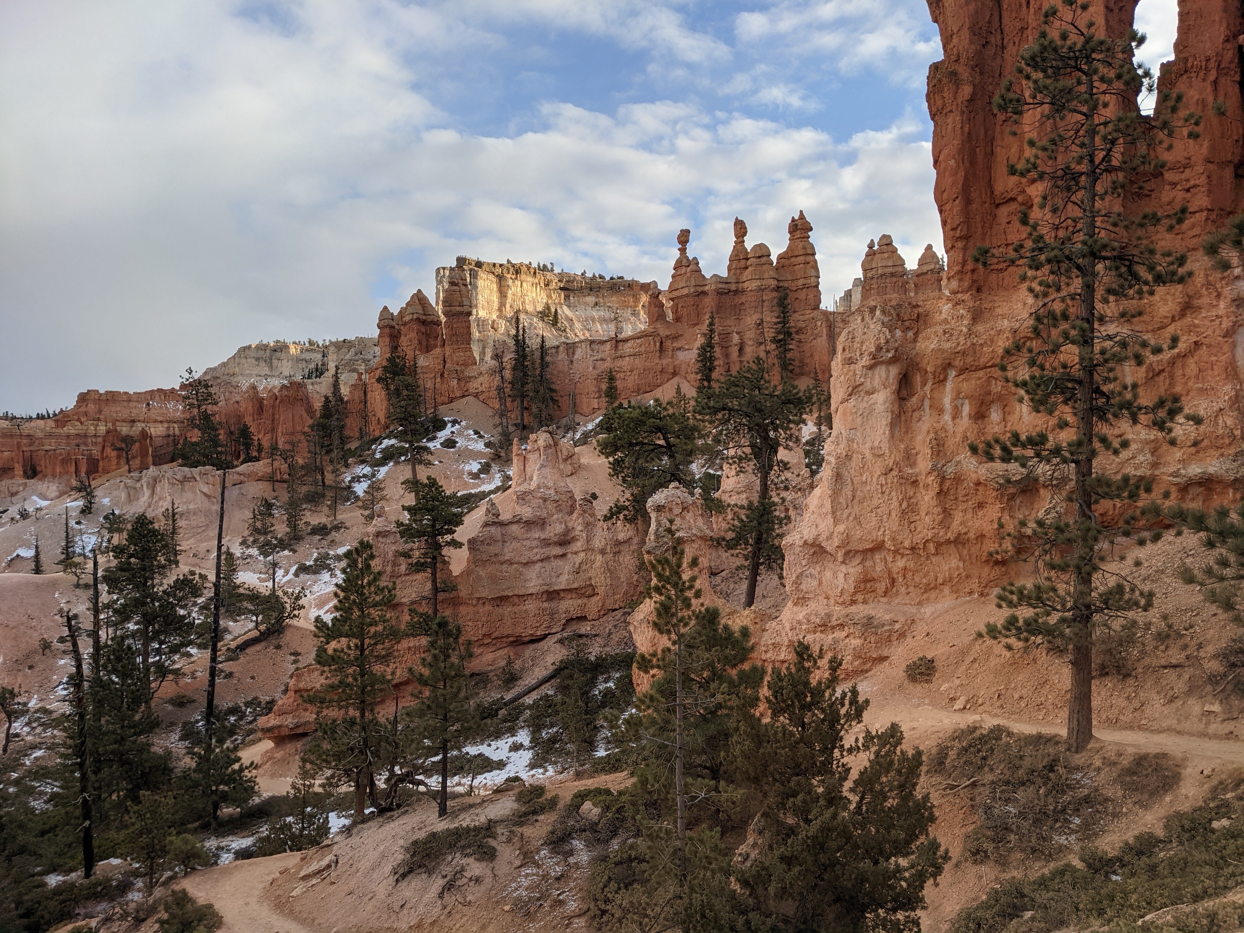
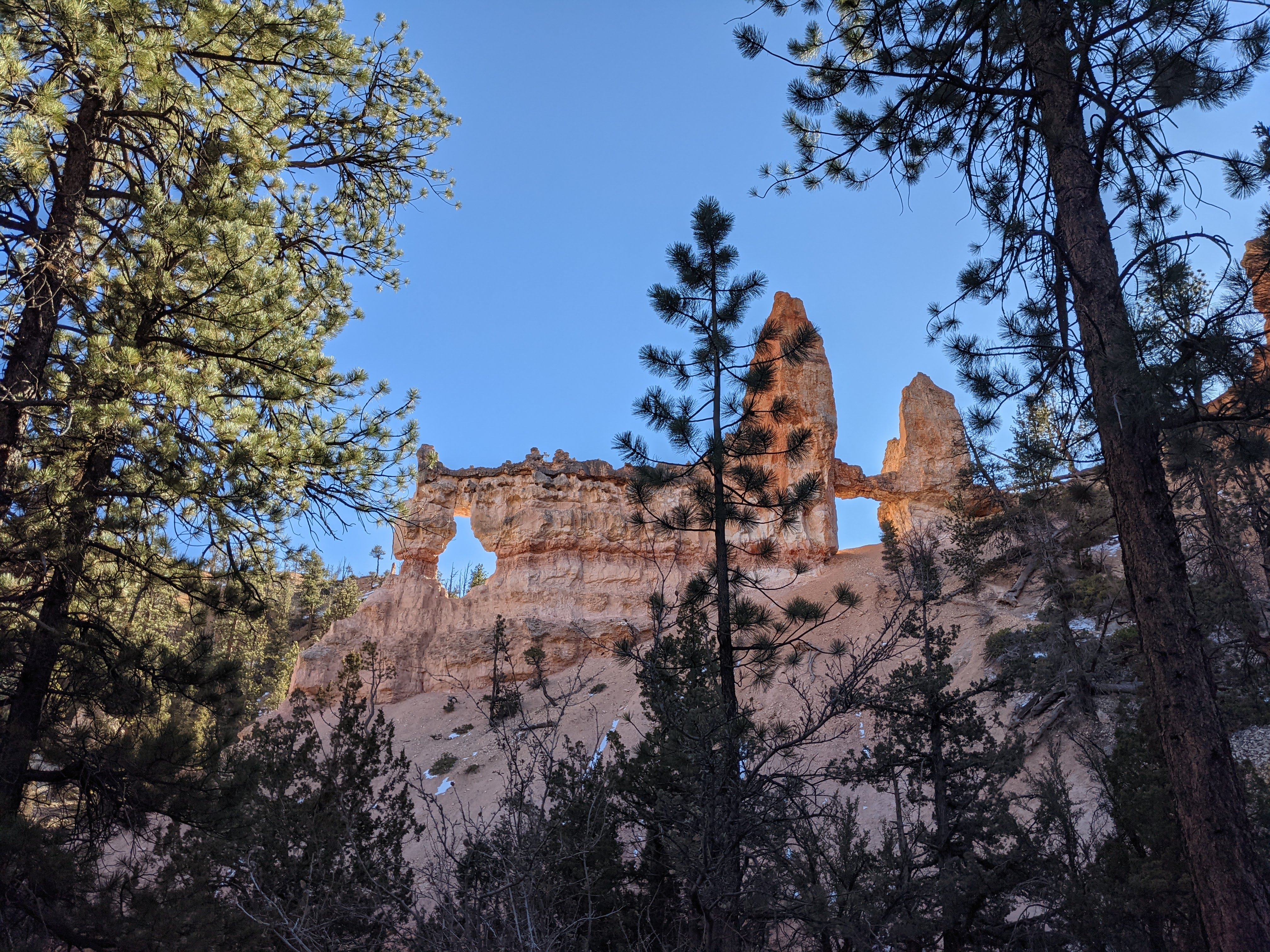
Bryce Canyon National Park, Peek-a-Boo Loop and Fairyland Loop Trails
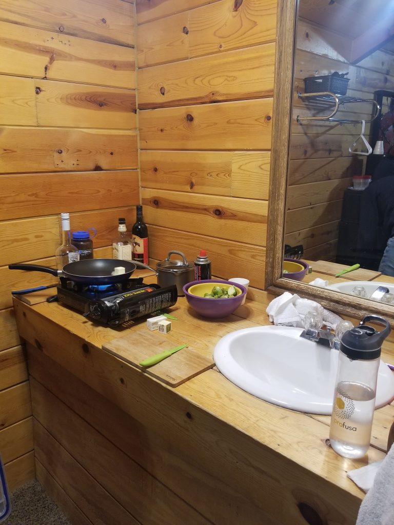
For Thanksgiving break we decided to drive a bit further to Bryce Canyon. I hadn’t been back here since I was a kid and didn’t remember much so I was excited to return. We booked a small cabin near the park entrance with only a bed and bathroom, no kitchen.
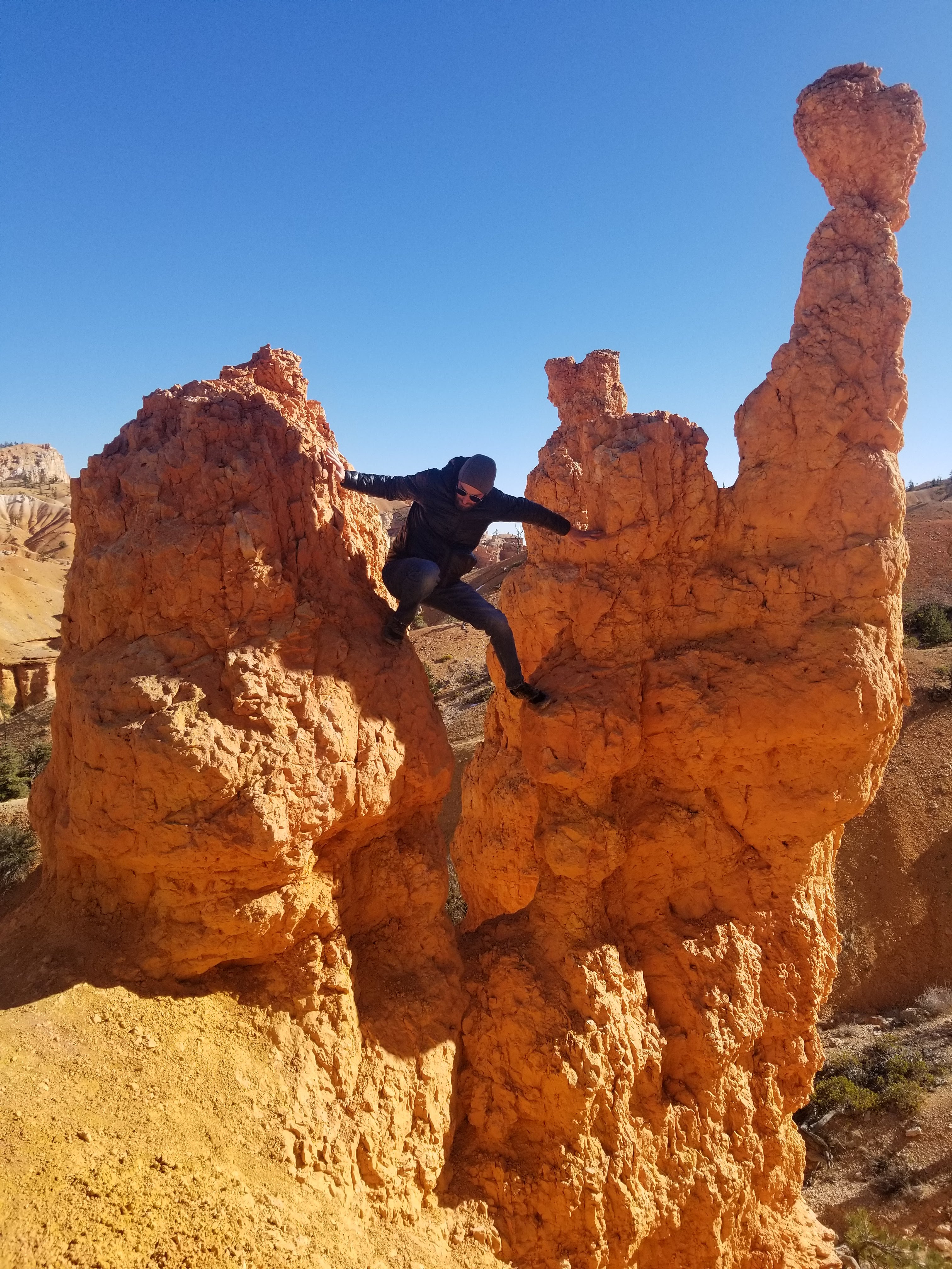
The first day we did the 5-mile Peek-a-Boo loop trail. For this trail you start at the rim and go down before gradually making your way back up. The hoodoos here were much bigger and a different type of rock than in Goblin Valley, more orange and white as opposed to solid red rock. It’s a very windy trail and every time you turn a corner there’s a new hoodoo or structure or view to take in.

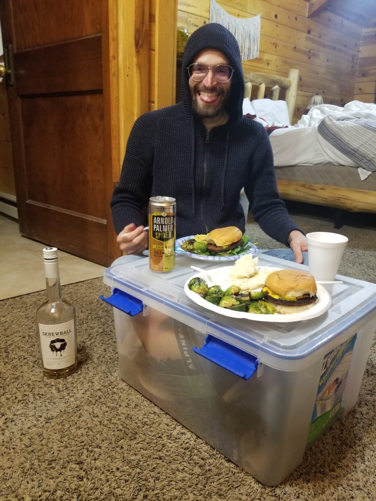
This also happened to be the day of Thanksgiving. Because we didn’t have a kitchen, we brought the JetBoil and stove and made veggie burgers, brussel sprouts and instant mashed potatoes for our Thanksgiving dinner. We also didn’t have a table to eat at, so we improvised with a plastic bin and sitting on the floor. It was a Thanksgiving that made me reflect on what was really important to me.
The next day we returned to Bryce to hike the 8-mile Fairyland Loop. This is just slightly outside the main entrance of the park, but still gets pretty crowded. We lucked out finding a parking spot and started down the trail. Similar to Peek-a-Boo, the trail starts at the rim, you go down and circumnavigate various mesas, again weaving in-and-out and up-and-down, eventually heading back up and walking along the rim for the last mile or so.

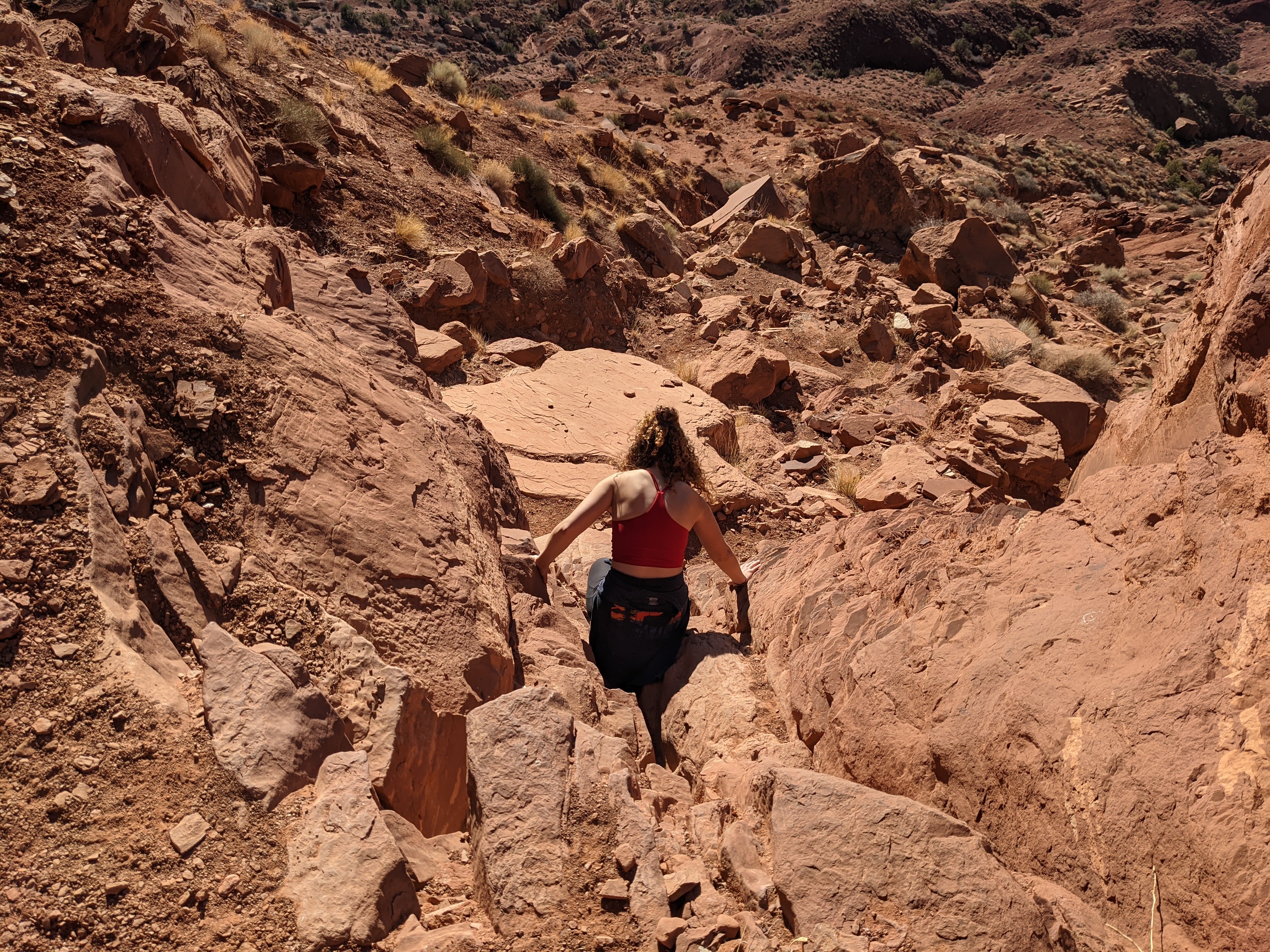
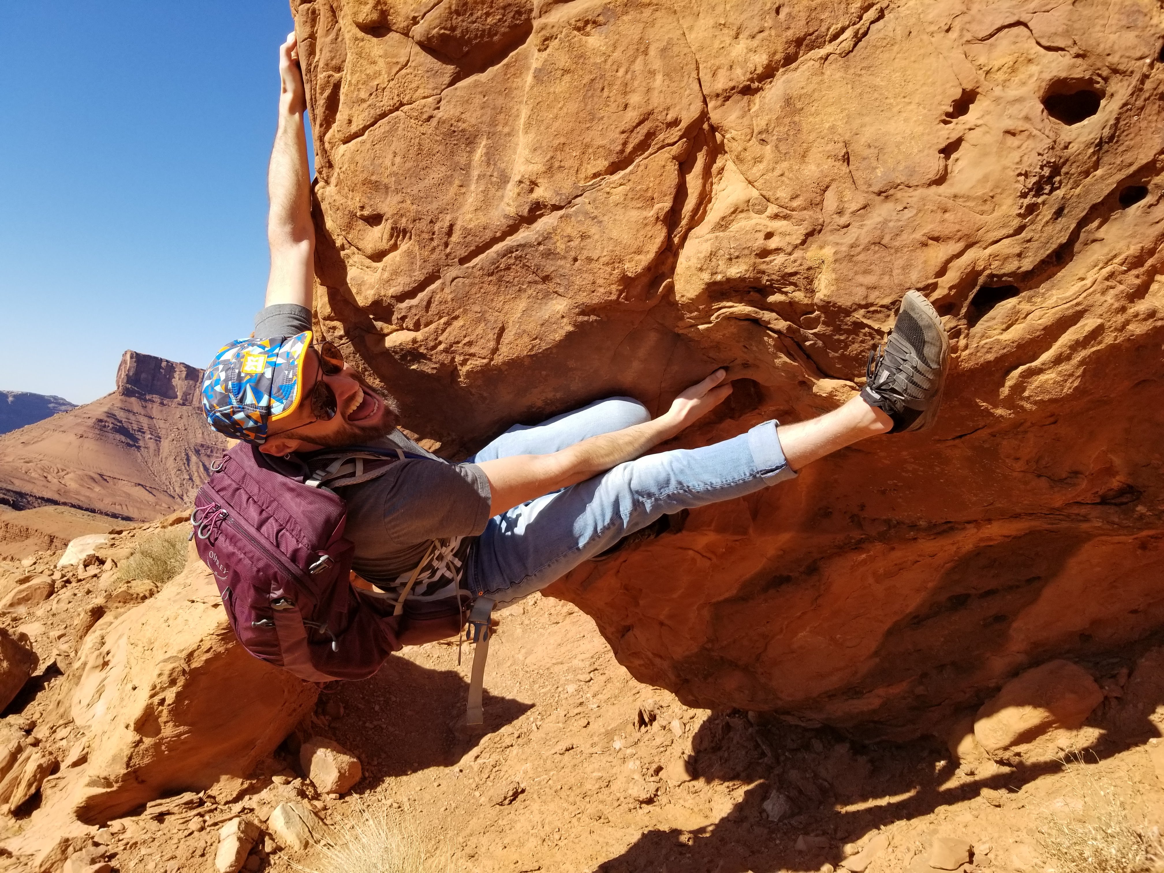
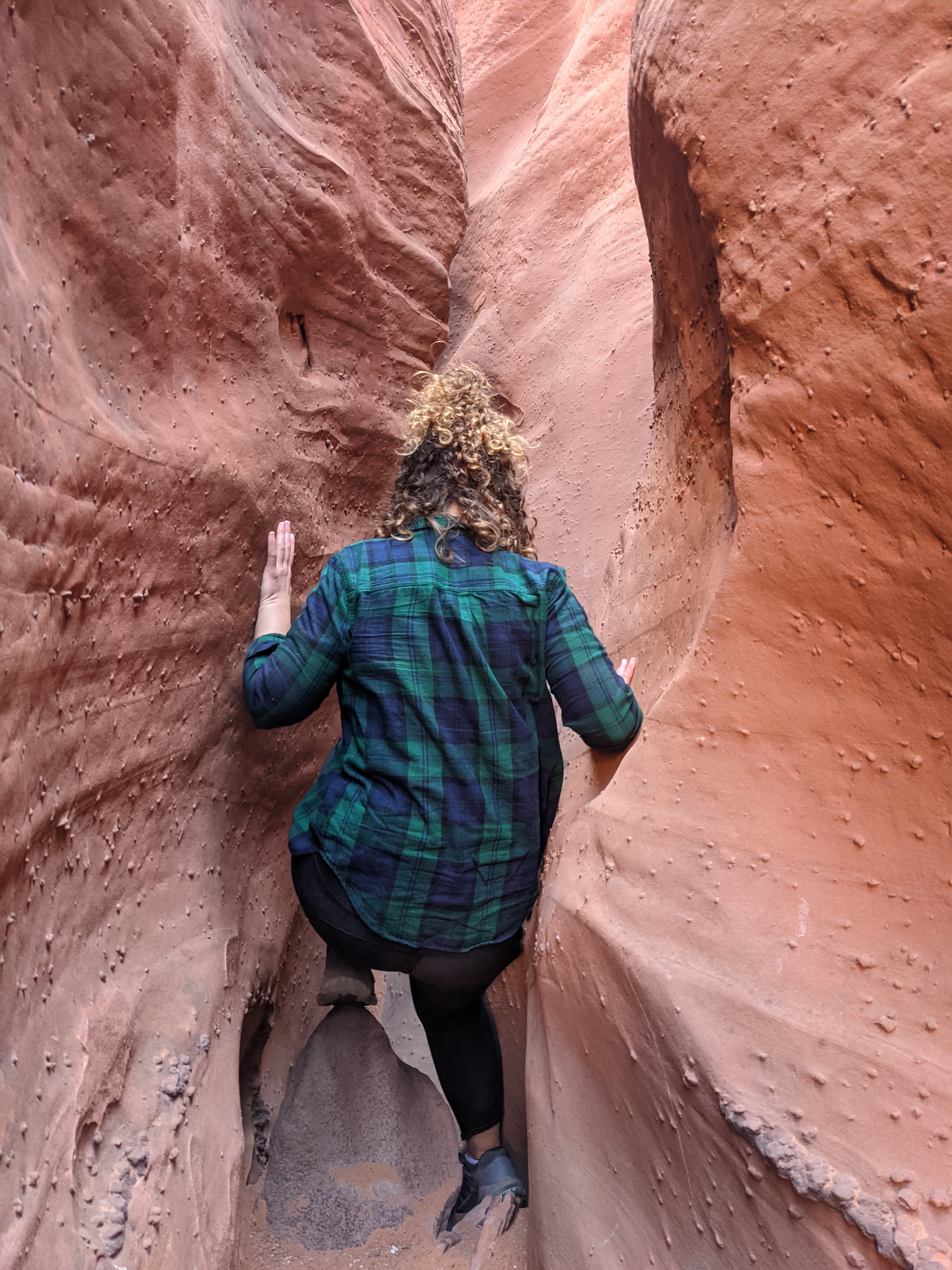
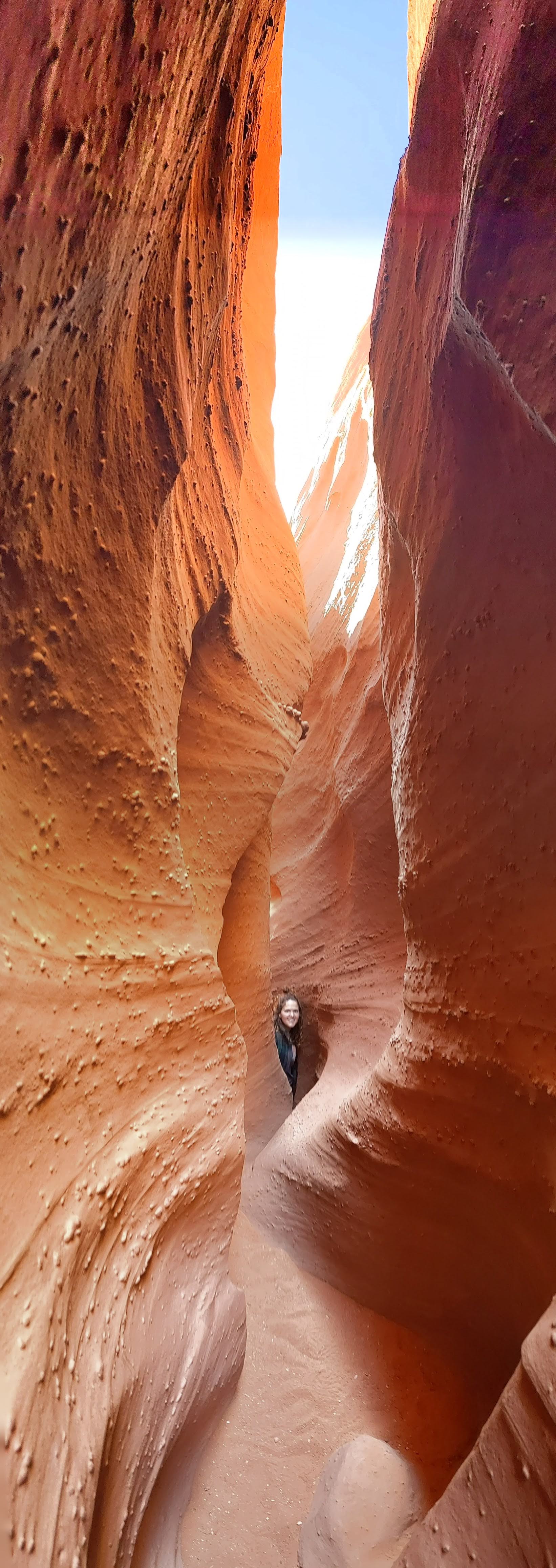
Grand Staircase-Escalante National Monument, Peek-a-Boo & Spooky Slot Canyons
On Saturday, we drove south to Grand Staircase-Escalante National Monument. To get to the trail, we drove 25 miles on a bumpy dirt road, taking almost an hour each way. The trail starts pretty flat with no indication of where the slot canyons will be. I had read how narrow and challenging parts of the canyon could be, so I was surprised when I saw a couple families, some with baby carriers on their backs at the start of the trail.
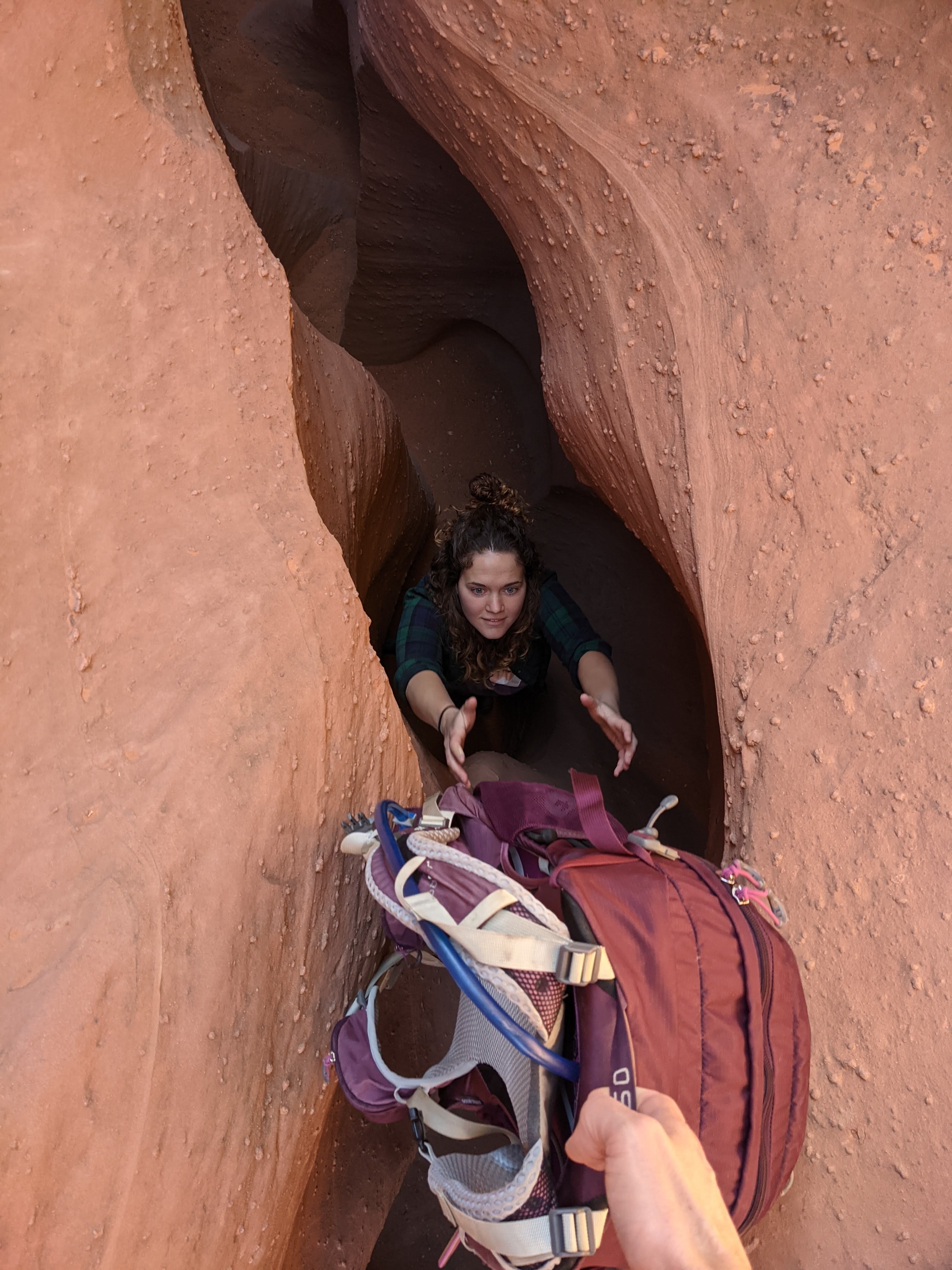
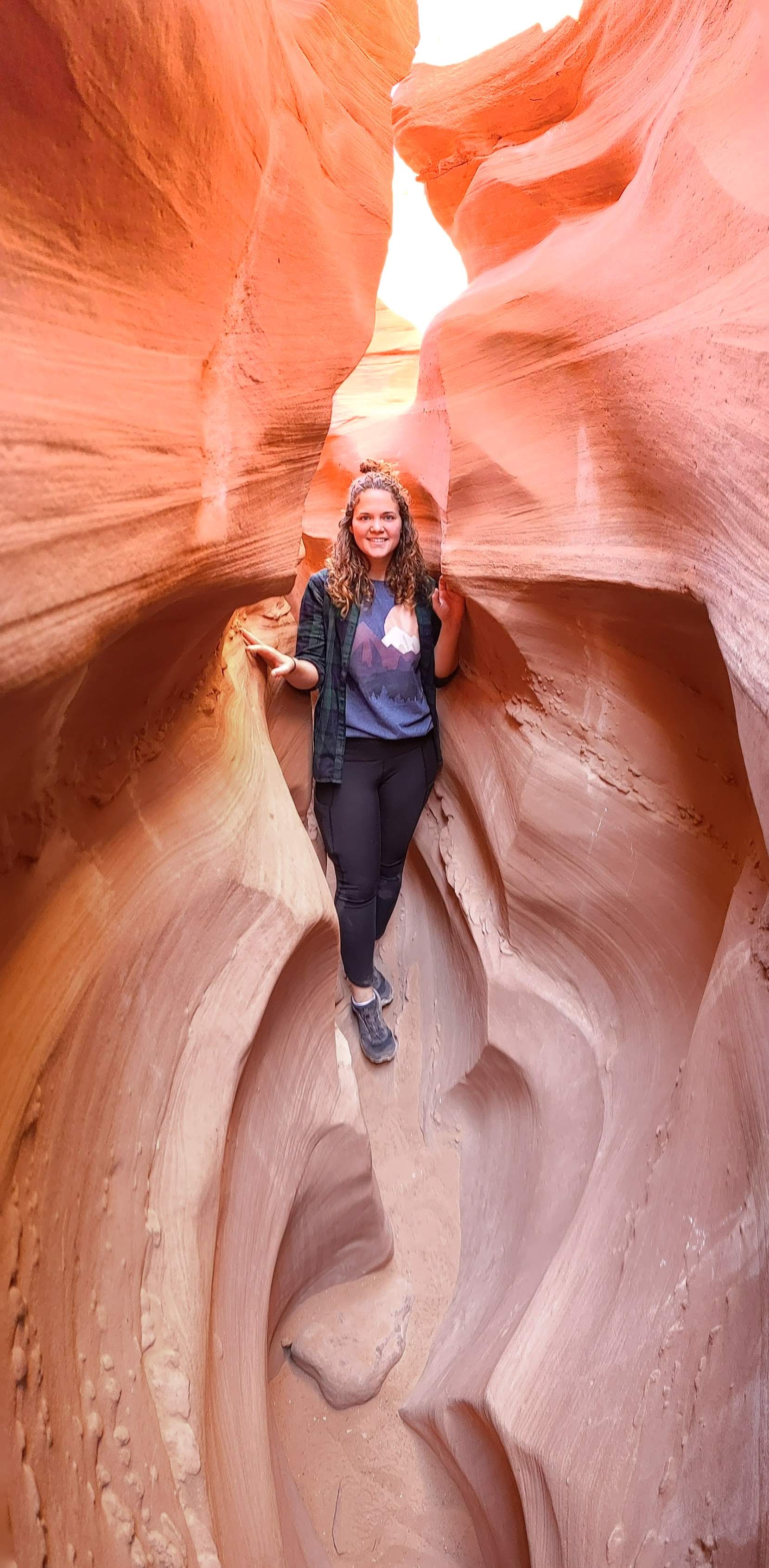
Dale and I charged ahead, excited to see our first slot canyons! We first arrived at Peek-a-Boo slot. This is a 0.7 mile, relatively easy slot canyons. The most difficult part was getting into the slot itself, but once inside it’s fairly flat and comparatively wide. It was a fun introduction to slot canyons.
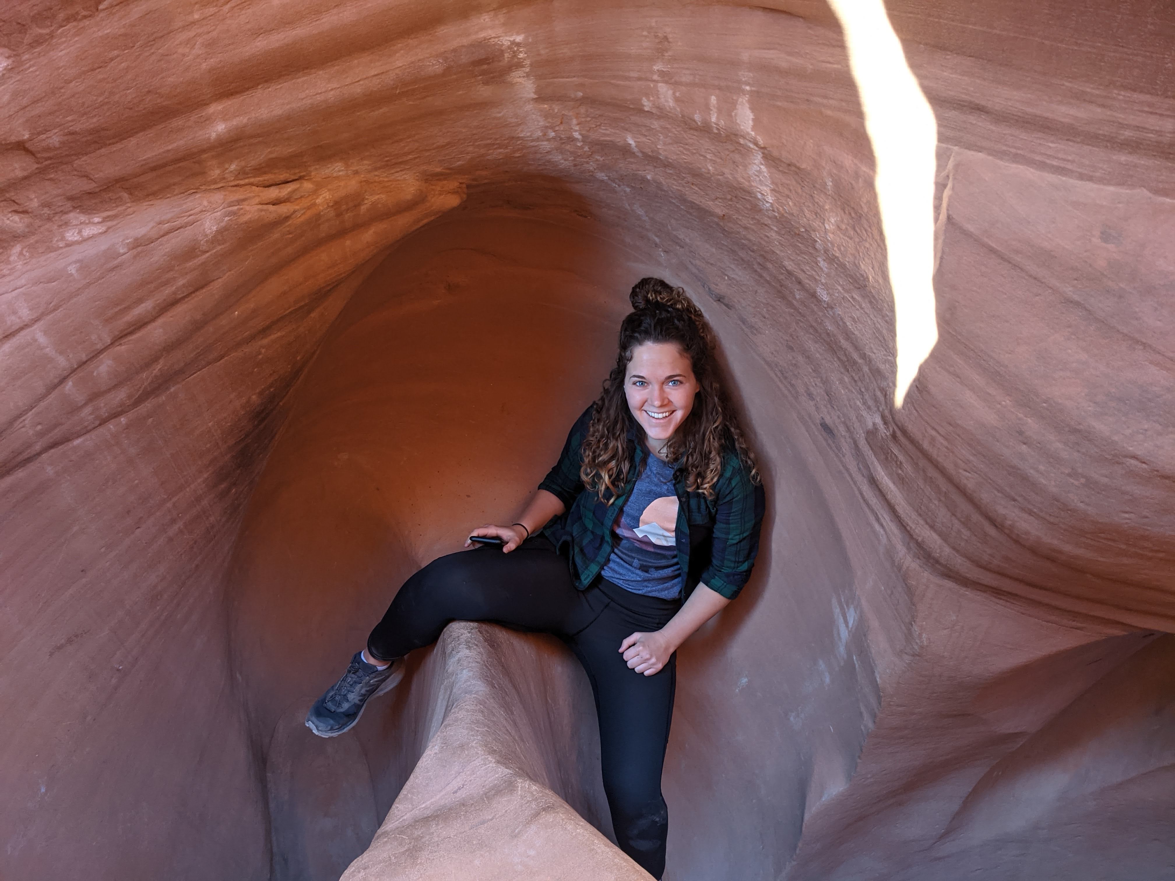
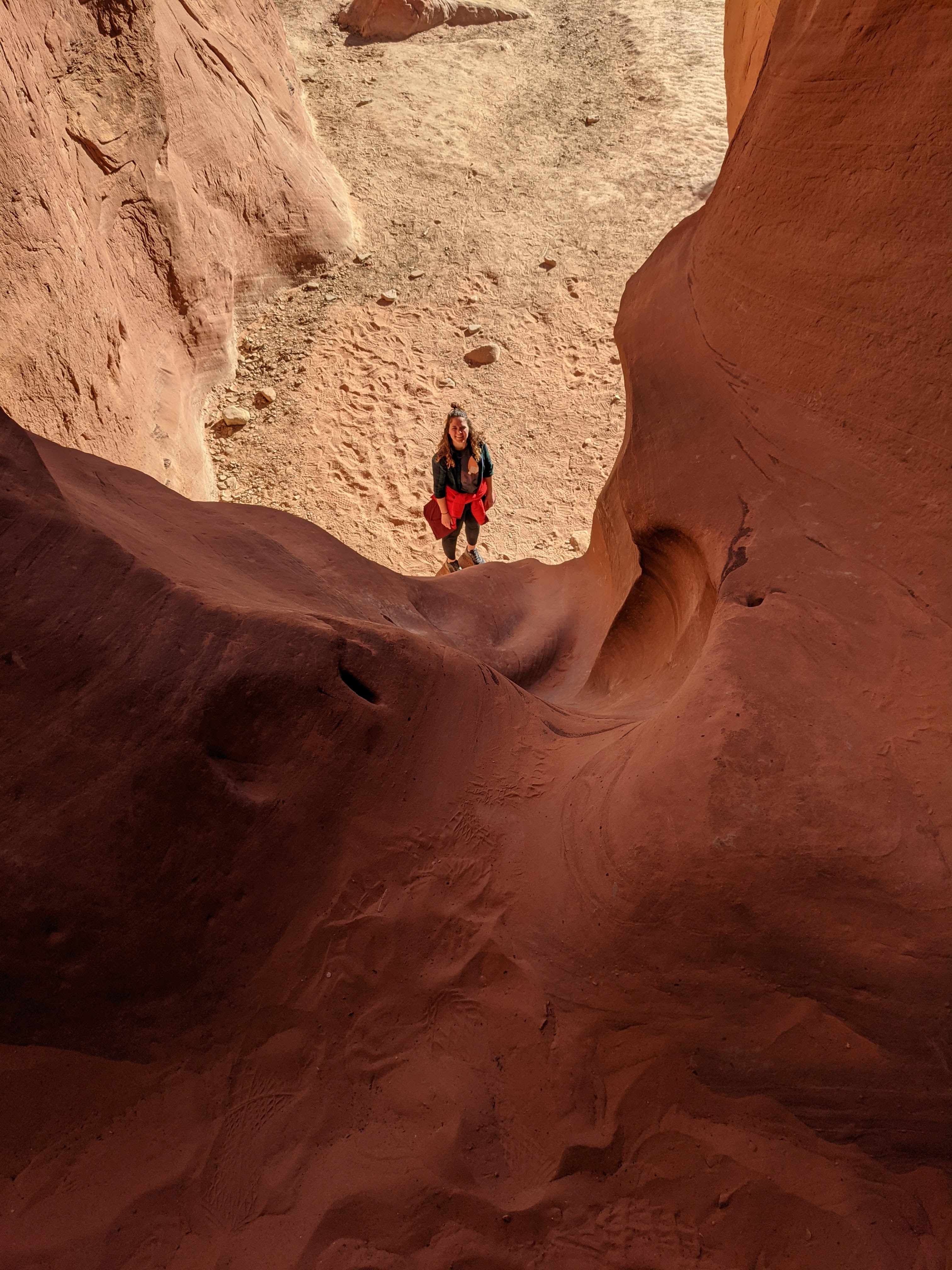
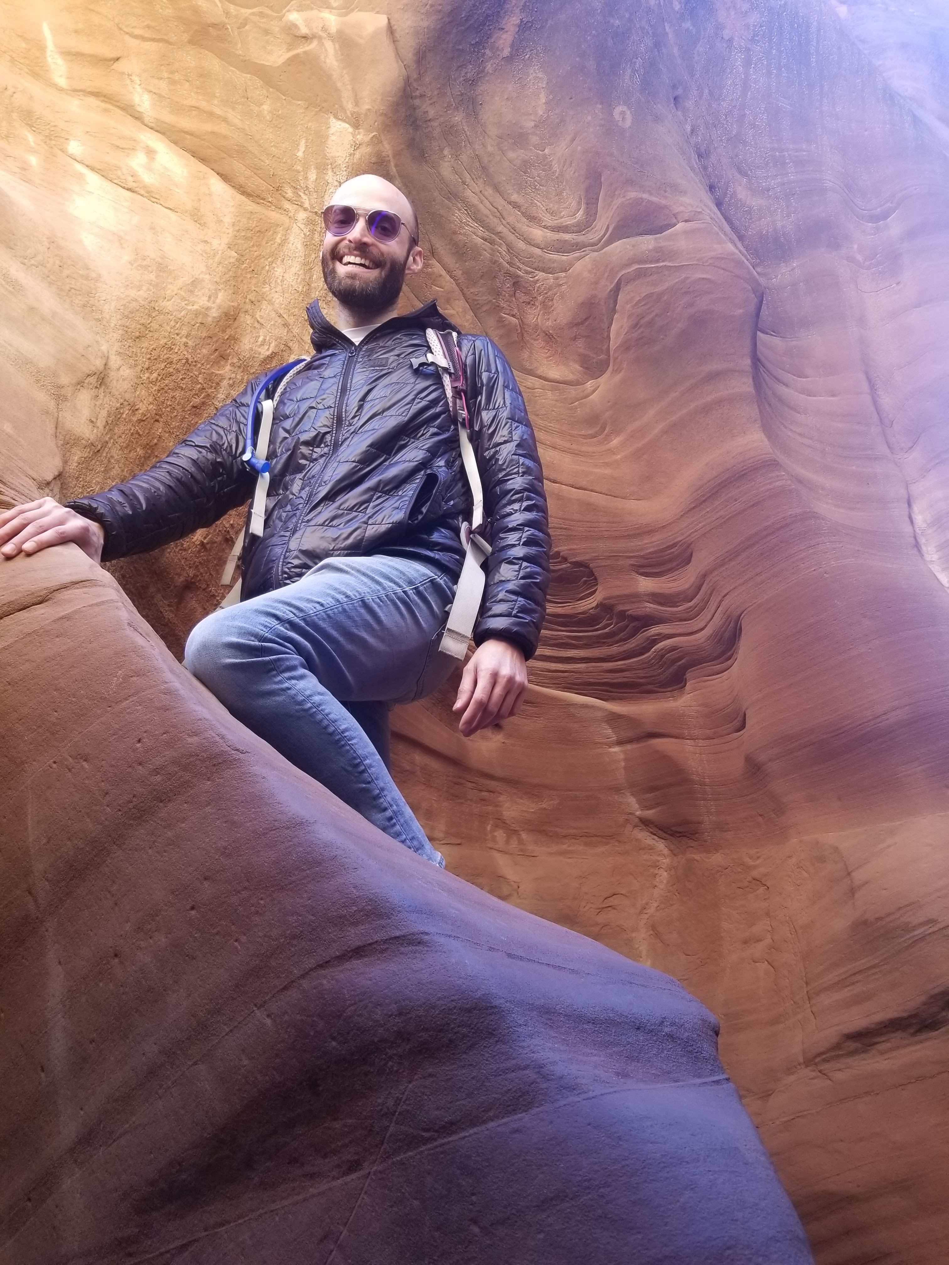
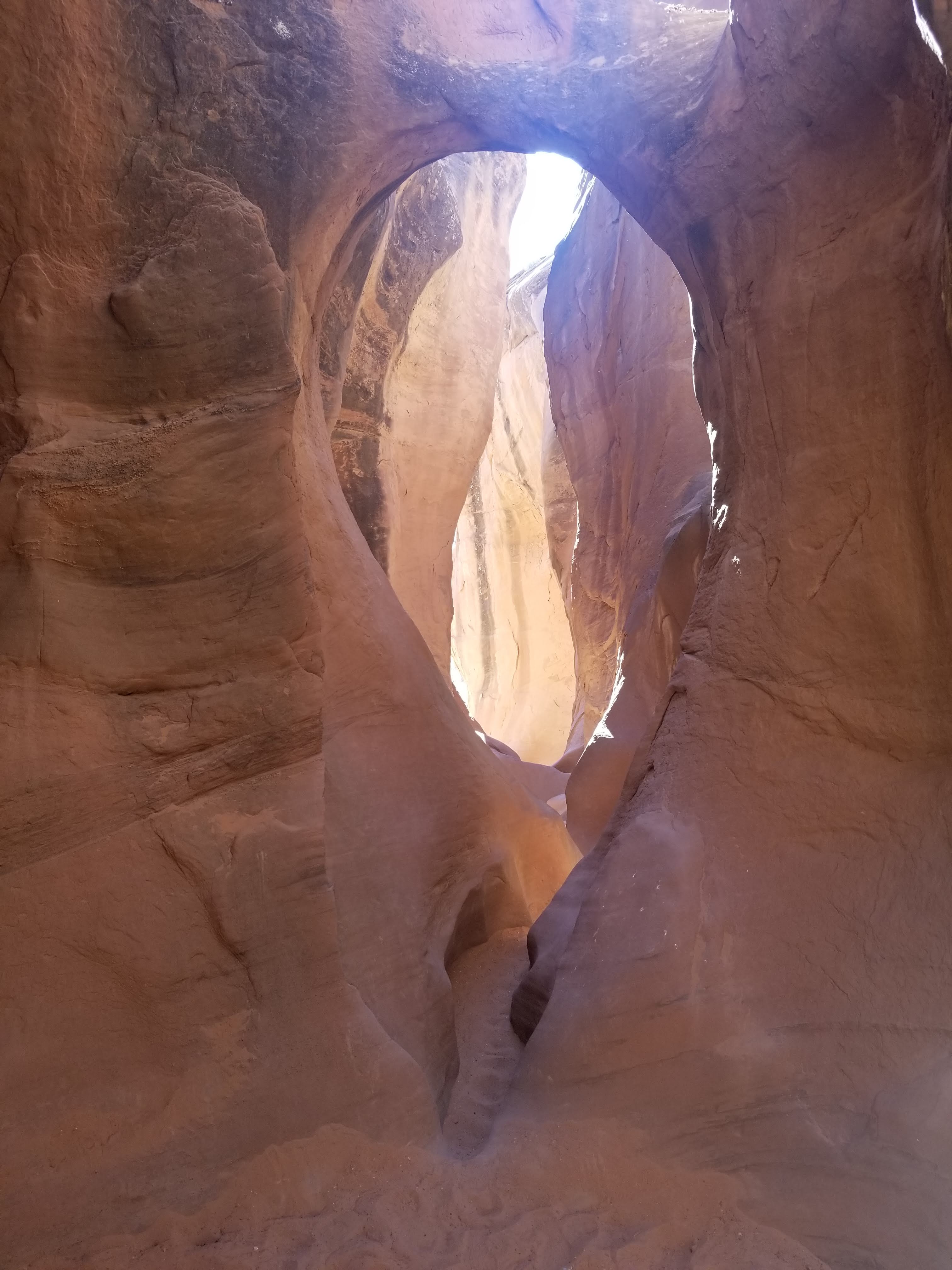
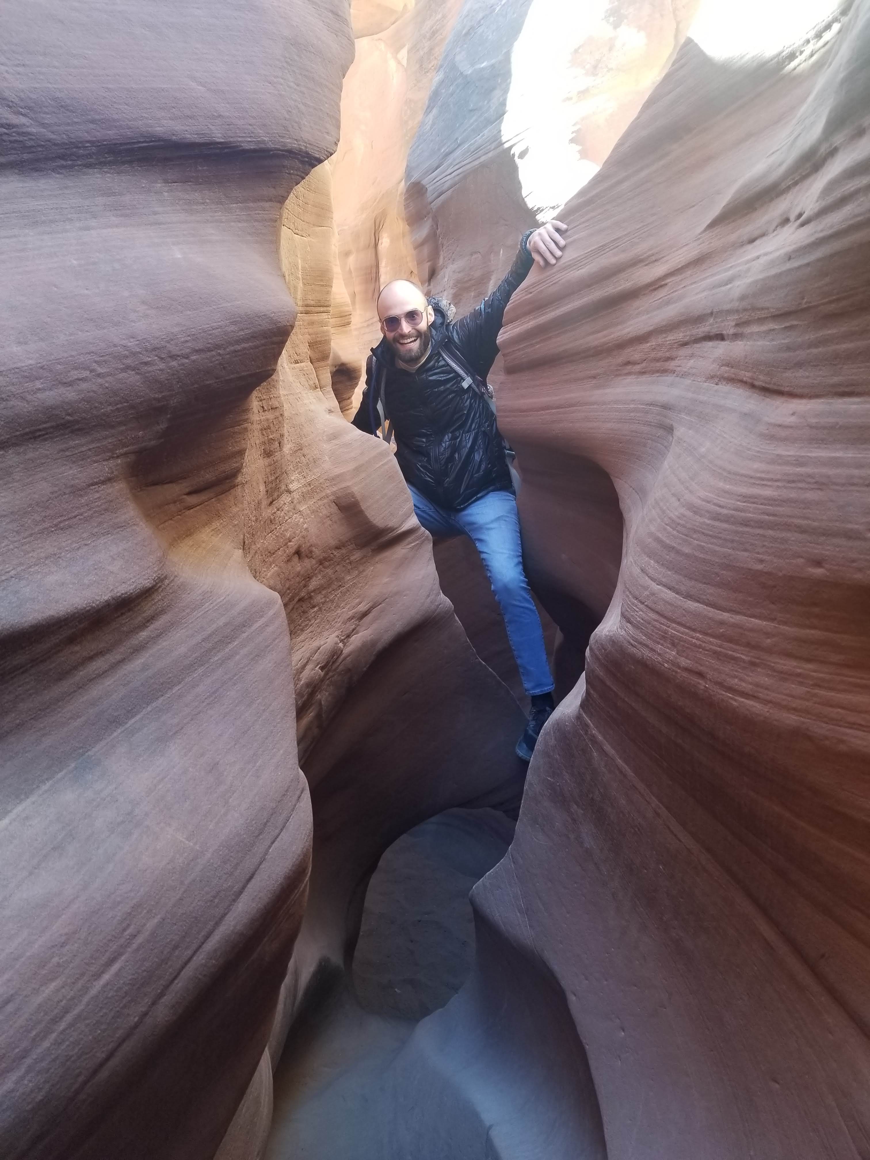
Next, we preceded to Spooky Gulch Slot Canyon which is about 1.2 miles long, much narrower and much more technical. We were climbing on top of rocks, using a rope to lower ourselves down in some areas, and shimmying through some pretty tight sections. It was a little unnerving due to the possibility of getting stuck or the (very small) possibility of a flash flood. But ultimately it was such a cool experience and I would love to experience more slot canyons in the future.
We packed the car back up to drive east on December 4th with a somber mood. I wasn’t ready to leave this desert paradise and was already thinking about the next time I could return.
